Jedlá
Jedlá | |
|---|---|
Municipality | |
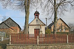 Chapel in the village | |
 Flag 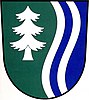 Coat of arms | |
 Jedlá | |
| Coordinates: 49°44′6″N 15°14′0″E / 49.73500°N 15.23333°ECoordinates: 49°44′6″N 15°14′0″E / 49.73500°N 15.23333°E | |
| Country | |
| Region | Vysočina |
| District | Havlíčkův Brod |
| Area | |
| • Total | 6.25 km2 (2.41 sq mi) |
| Elevation | 515 m (1,690 ft) |
| Population (1.1.2014) | |
| • Total | 85 |
| • Density | 14/km2 (35/sq mi) |
| Postal code | 584 01 |

Jedlá is a village and municipality (obec) in Havlíčkův Brod District in the Vysočina Region of the Czech Republic.
The municipality covers an area of 6.25 square kilometres (2.41 sq mi), and has a population of 75 (as at 3 July 2006).
Jedlá lies approximately 29 kilometres (18 mi) north-west of Havlíčkův Brod, 46 km (29 mi) north-west of Jihlava, and 71 km (44 mi) south-east of Prague.
References[]
| Wikimedia Commons has media related to Jedlá. |
| Authority control: National libraries |
|---|
This Vysočina Region location article is a stub. You can help Wikipedia by . |
Categories:
- Villages in Havlíčkův Brod District
- Vysočina Region geography stubs