Dowlingville, South Australia
| Dowlingville South Australia | |||||||||||||||
|---|---|---|---|---|---|---|---|---|---|---|---|---|---|---|---|
 Dowlingville Uniting (formerly Methodist) Church in 2012 | |||||||||||||||
 Dowlingville | |||||||||||||||
| Coordinates | 34°19′37″S 137°55′09″E / 34.327010°S 137.919250°ECoordinates: 34°19′37″S 137°55′09″E / 34.327010°S 137.919250°E | ||||||||||||||
| Population | 490 (shared with adjoining localities in the “State Suburb of Price”) (2011 census)[1] | ||||||||||||||
| Established | 1999[2] | ||||||||||||||
| Postcode(s) | 5555 [3] | ||||||||||||||
| Time zone | ACST (UTC+9:30) | ||||||||||||||
| • Summer (DST) | ACST (UTC+10:30) | ||||||||||||||
| Location | 89 km (55 mi) north-west of Adelaide | ||||||||||||||
| LGA(s) | Yorke Peninsula Council | ||||||||||||||
| Region | Yorke and Mid North[4] | ||||||||||||||
| County | Fergusson[2] | ||||||||||||||
| State electorate(s) | Narungga[5] | ||||||||||||||
| Federal division(s) | Grey[6] | ||||||||||||||
| |||||||||||||||
| |||||||||||||||
| Footnotes | Distances[3] Coordinates[2] Climate[7] Adjoining localities[2] | ||||||||||||||

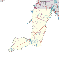
Dowlingville is a locality in the Australian state of South Australia located on the east coast of Yorke Peninsula immediately adjoining Gulf St Vincent about 89 kilometres (55 miles) north-west of the state capital of Adelaide.[3][2] Its boundaries were created in May 1999.[2][8]

The name of the locality is considered to have been derived from a Mr G.P. Dowling Whittaker who was an early resident.[2][9] As of 1904, it was described as follows:[9]
This is essentially a farming district, so that it is not surprising to find only a few houses, a store, a post office conducted by Mr. Whittaker, a State school, in charge of Mrs Lewis and a church. Only a few years ago this country was covered with scrub. Industry and manures have transformed the district considerably...
The locality contains the historic former , which is listed on the South Australian Heritage Register.[10]
As of 2014, the majority land use within the locality is “primary production.”[11]
Dowlingville is located within the federal division of Grey, the state electoral district of Narungga and the local government area of the Yorke Peninsula Council.[2][5][6]
See also[]
References[]
| Wikimedia Commons has media related to Dowlingville, South Australia. |
- ^ Australian Bureau of Statistics (31 October 2012). "Price". 2011 Census QuickStats. Retrieved 25 February 2016.

- ^ a b c d e f g h "Search result for "Dowlingville (Locality Bounded)" (Record no SA0020604) with the following layers selected - "suburbs and localities"". Department of Planning, Transport and Infrastructure. Retrieved 25 February 2016.
- ^ a b c "Dowlingville, South Australia (Postcode)". postcodes-australia.com. Retrieved 25 February 2016.
- ^ "Yorke and Mid North SA Government region" (PDF). The Government of South Australia. Retrieved 17 April 2017.
- ^ a b Narungga (Map). Electoral District Boundaries Commission. 2016. Retrieved 1 March 2018.
- ^ a b "Federal electoral division of Grey" (PDF). Australian Electoral Commission. Retrieved 15 July 2019.
- ^ "Monthly climate statistics: Summary statistics PRICE". Commonwealth of Australia , Bureau of Meteorology. Retrieved 25 February 2016.
- ^ Kentish, P. M. (27 May 1999), "GEOGRAPHICAL NAMES ACT 1991, Notice to Assign Boundaries and Names to Places" (PDF), The South Australian Government Gazette (68): 2696, retrieved 14 September 2017
- ^ a b "Dowlingville". State Library of South Australia. Retrieved 25 February 2016.
- ^ "Dowlingville Post Office". Department of Environment Water and Natural Resources. 16 March 2000. Archived from the original on 5 March 2016. Retrieved 25 February 2016.
- ^ "Development Plan - Yorke Peninsula Council" (PDF). Department of Planning, Transport and Infrastructure. pp. 336–340. Archived from the original (PDF) on 4 June 2015. Retrieved 24 July 2015.
This South Australia geography article is a stub. You can help Wikipedia by . |
- Towns in South Australia
- Yorke Peninsula
- South Australia geography stubs