Minlaton, South Australia
| Minlaton South Australia | |||||||||||||||
|---|---|---|---|---|---|---|---|---|---|---|---|---|---|---|---|
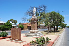 War memorial on Main St. | |||||||||||||||
 Minlaton | |||||||||||||||
| Coordinates | 34°46′17″S 137°35′44″E / 34.77139°S 137.59556°ECoordinates: 34°46′17″S 137°35′44″E / 34.77139°S 137.59556°E | ||||||||||||||
| Population | 800 (2016 census)[1] | ||||||||||||||
| Established | 1876[2] | ||||||||||||||
| Postcode(s) | 5575 | ||||||||||||||
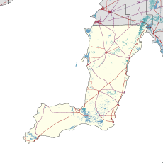
| Location | |||||||||||||||
| LGA(s) | Yorke Peninsula Council | ||||||||||||||
| Region | Yorke and Mid North[3] | ||||||||||||||
| County | Fergusson[2] | ||||||||||||||
| State electorate(s) | Narungga[4] | ||||||||||||||
| Federal Division(s) | Grey[5] | ||||||||||||||
| |||||||||||||||
| Footnotes | Adjoining localities[2] | ||||||||||||||

Minlaton is a town in central Yorke Peninsula, South Australia. At the 2016 census, Minlaton had a population of 800.[1] It is known as the "Barley capital of the world", due to the rich Barley production in the region.
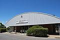
Minlaton was the hometown of Harry Butler, a World War I flying ace. His Bristol M1C monoplane has been restored and is preserved in pride of place in a building the centre of the town. When he flew an air mail run from Adelaide across Gulf St Vincent to Minlaton in 1919, it was the first over-water flight in the Southern Hemisphere.
Minlaton is in the District Council of Yorke Peninsula, the federal Division of Grey[6] and the state electoral district of Narungga.[4]
Thirteen miles to the west is Brown Point, commonly known as "The Bluff" or "Bluff Beach", where the boat winching system is a tourist attraction.[citation needed]
Climate[]
Minlaton, like most of the Yorke Peninsula, has a dry Mediterranean Climate bordering on Semi-Arid. Annual rainfall is around 360mm, most of which falls in the winter months.
| hideClimate data for Minlaton | |||||||||||||
|---|---|---|---|---|---|---|---|---|---|---|---|---|---|
| Month | Jan | Feb | Mar | Apr | May | Jun | Jul | Aug | Sep | Oct | Nov | Dec | Year |
| Record high °C (°F) | 45.6 (114.1) |
44.1 (111.4) |
41.0 (105.8) |
37.4 (99.3) |
30.9 (87.6) |
25.9 (78.6) |
23.0 (73.4) |
29.3 (84.7) |
33.0 (91.4) |
38.7 (101.7) |
44.3 (111.7) |
45.9 (114.6) |
45.6 (114.1) |
| Average high °C (°F) | 29.6 (85.3) |
28.6 (83.5) |
26.7 (80.1) |
23.4 (74.1) |
19.5 (67.1) |
16.3 (61.3) |
15.3 (59.5) |
16.4 (61.5) |
19.1 (66.4) |
22.6 (72.7) |
26.0 (78.8) |
27.6 (81.7) |
22.6 (72.7) |
| Average low °C (°F) | 15.4 (59.7) |
15.3 (59.5) |
14.1 (57.4) |
11.9 (53.4) |
10.0 (50.0) |
7.8 (46.0) |
7.0 (44.6) |
6.8 (44.2) |
7.9 (46.2) |
9.3 (48.7) |
12.0 (53.6) |
13.5 (56.3) |
10.9 (51.6) |
| Record low °C (°F) | 6.4 (43.5) |
8.0 (46.4) |
6.0 (42.8) |
5.0 (41.0) |
3.0 (37.4) |
0.0 (32.0) |
−0.3 (31.5) |
0.5 (32.9) |
0.2 (32.4) |
0.8 (33.4) |
2.1 (35.8) |
3.7 (38.7) |
−0.3 (31.5) |
| Average precipitation mm (inches) | 14.5 (0.57) |
18.1 (0.71) |
16.1 (0.63) |
24.5 (0.96) |
39.5 (1.56) |
52.5 (2.07) |
50.0 (1.97) |
46.1 (1.81) |
35.4 (1.39) |
22.8 (0.90) |
21.8 (0.86) |
19.6 (0.77) |
360.3 (14.19) |
| Average precipitation days (≥ 0.2 mm) | 4.6 | 3.4 | 5.2 | 8.6 | 13.1 | 17.6 | 18.5 | 18.6 | 14.6 | 8.3 | 6.9 | 6.9 | 126.3 |
| Average afternoon relative humidity (%) | 36 | 39 | 40 | 47 | 49 | 67 | 70 | 63 | 58 | 47 | 39 | 39 | 50 |
| Source: [7] | |||||||||||||
Gallery[]

Harry Butler's Red Devil is on display in Minlaton
Harry Butler memorial

Main street
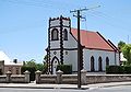
St Benedict's Anglican church, built in 1886


See also[]
References[]
- ^ Jump up to: a b Australian Bureau of Statistics (27 June 2017). "Minlaton (L) (Urban Centre/Locality)". 2016 Census QuickStats. Retrieved 11 February 2018.

- ^ Jump up to: a b c "Search result(s) for Minlaton (LOCB) with the following layers being selected - "Suburbs and Localities", "Counties", "Hundreds", "Place names (gazetteer)" and "Road labels"". Property Location Browser. Government of South Australia. 17 October 2013. SA0045172. Retrieved 7 September 2017.
- ^ "Yorke and Mid North SA Government region" (PDF). The Government of South Australia. Retrieved 28 April 2017.
- ^ Jump up to: a b Narungga (Map). Electoral District Boundaries Commission. 2016. Retrieved 1 March 2018.
- ^ "Federal electoral division of Grey" (PDF). Australian Electoral Commission. Retrieved 24 July 2015.
- ^ "Localities". Australian Electoral Commission. Archived from the original on 6 July 2011. Retrieved 13 July 2010.
- ^ "Climate statistics for Minlaton". Australian Bureau of Meteorology.
External links[]
| Wikimedia Commons has media related to Minlaton, South Australia. |
- Yorke Peninsula: Minlaton
- Harvest Corner website Yorke Peninsula Visitor Information Centre at Minlaton
- Towns in South Australia
- Yorke Peninsula