Kainton, South Australia
| Kainton South Australia | |||||||||||||||
|---|---|---|---|---|---|---|---|---|---|---|---|---|---|---|---|
 Kainton | |||||||||||||||
| Coordinates | 34°7′S 137°54′E / 34.117°S 137.900°ECoordinates: 34°7′S 137°54′E / 34.117°S 137.900°E | ||||||||||||||
| Population | 366 (shared with other localities in the ‘State Suburb of Clinton (SA)’) (2011 census).[1][2][a] | ||||||||||||||
| Postcode(s) | 5552 | ||||||||||||||
| Time zone | ACST (UTC+9:30) | ||||||||||||||
| • Summer (DST) | ACDT (UTC+10:30) | ||||||||||||||
| LGA(s) | Yorke Peninsula Council | ||||||||||||||
| Region | Yorke and Mid North[3] | ||||||||||||||
| County | Daly[2] | ||||||||||||||
| State electorate(s) | Narungga[4] | ||||||||||||||
| Federal division(s) | Grey[5] | ||||||||||||||
| |||||||||||||||
| Footnotes | Adjoining localities[2] | ||||||||||||||

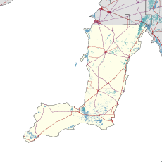
Kainton is a small town in the Australian state of South Australia situated about 10 km south of Paskeville in the upper Yorke Peninsula.
The Kainton school closed in 1907, but the "Hundred of Clinton School" was renamed "Kainton School" in 1915.[6]
Kainton is located within the federal Division of Grey, the state electoral district of Narungga and the local government area known as the Yorke Peninsula Council.[2][5][4]
See also[]
Notes and references[]
- Notes
- ^ For the 2011 census, the ‘State Suburb of Clinton (SA)’ consisted of the localities of Clinton, Clinton Centre, Kainton and Port Arthur
- Citations
- ^ Australian Bureau of Statistics (31 October 2012). "Clinton (SA)". 2011 Census QuickStats. Retrieved 28 April 2017.

- ^ a b c d "Search result(s) for Kainton (LOCB) (Record No. SA0033456) with the following layers being selected - "Suburbs and Localities", "Counties", "Hundreds", "Place names (gazetteer)" and "Road labels"". Property Location Browser. Government of South Australia. Archived from the original on 12 October 2016. Retrieved 28 April 2017.
- ^ "Yorke and Mid North SA Government region" (PDF). The Government of South Australia. Retrieved 17 April 2017.
- ^ a b Narungga (Map). Electoral District Boundaries Commission. 2016. Retrieved 1 March 2018.
- ^ a b "Federal electoral division of Grey" (PDF). Australian Electoral Commission. Retrieved 24 July 2015.
- ^ "Manning index of South Australia". State Library of South Australia. Retrieved 9 October 2015.
This South Australia geography article is a stub. You can help Wikipedia by . |
Categories:
- Towns in South Australia
- Yorke Peninsula
- South Australia geography stubs