Drusenheim
Drusenheim | |
|---|---|
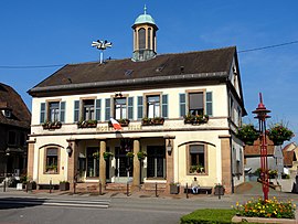 The town hall in Drusenheim | |
 Coat of arms | |
show Location of Drusenheim | |
 Drusenheim | |
| Coordinates: 48°45′46″N 7°57′09″E / 48.7628°N 7.9525°ECoordinates: 48°45′46″N 7°57′09″E / 48.7628°N 7.9525°E | |
| Country | France |
| Region | Grand Est |
| Department | Bas-Rhin |
| Arrondissement | Haguenau-Wissembourg |
| Canton | Bischwiller |
| Government | |
| • Mayor (2020–2026) | Jacky Keller[1] |
| Area 1 | 15.73 km2 (6.07 sq mi) |
| Population (Jan. 2018)[2] | 5,211 |
| • Density | 330/km2 (860/sq mi) |
| Time zone | UTC+01:00 (CET) |
| • Summer (DST) | UTC+02:00 (CEST) |
| INSEE/Postal code | 67106 /67410 |
| Elevation | 119–128 m (390–420 ft) |
| 1 French Land Register data, which excludes lakes, ponds, glaciers > 1 km2 (0.386 sq mi or 247 acres) and river estuaries. | |


Drusenheim is a commune in the Bas-Rhin département in Grand Est in north-eastern France, situated on the bank of the Rhine.
History[]
Drusenheim was fortified by the military architect, militaire Jean Maximilien Welsch in 1705.
Notable people[]
- Roland Wagner (born 1955), former football international
See also[]
References[]
- ^ "Répertoire national des élus: les maires". data.gouv.fr, Plateforme ouverte des données publiques françaises (in French). 2 December 2020.
- ^ "Populations légales 2018". INSEE. 28 December 2020.
| Wikimedia Commons has media related to Drusenheim. |
| show Authority control |
|---|
This Bas-Rhin geographical article is a stub. You can help Wikipedia by . |
Categories:
- Communes of Bas-Rhin
- Bas-Rhin geography stubs