Dumbarton Parish, New Brunswick
Dumbarton | |
|---|---|
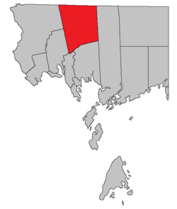 Location within Charlotte County. | |
| Country | |
| Province | |
| County | Charlotte County |
| Erected | 1856 |
| Area | |
| • Land | 374.43 km2 (144.57 sq mi) |
| Population (2016)[1] | |
| • Total | 335 |
| • Density | 0.9/km2 (2/sq mi) |
| • Change 2011-2016 | |
| • Dwellings | 195 |
| Time zone | UTC-4 (AST) |
| • Summer (DST) | UTC-3 (ADT) |
Dumbarton is a civil parish in Charlotte County, New Brunswick, Canada,[2] located inland north of St. George and south of Harvey. It comprises a single local service district (LSD), which is a member of the Southwest New Brunswick Service Commission (SNBSC).[3]
The Census subdivision of the same name shares the parish's boundaries.[1]
Origin of name[]
The parish may have been named for the town of Dumbarton, Scotland,[4] although William Francis Ganong considered this uncertain.
History[]
Dumbarton was erected from northern Saint Patrick Parish in 1856.[5]
It included a small triangle of Saint Croix Parish southwest of the junction of Wilson Road and Route 127 until 1958.[6]
Boundaries[]
Dumbarton Parish is bounded:[2][7][8]
- on the north by the York County line;
- on the east by the prolongation of the eastern line of a shoreline grant to John McDougall west of Sherard Beach;
- on the south by the southern line of a grant beginning at the mouth of Milligan Brook on the Magaguadavic River, then running westerly along the grant line and its prolongation to the rear line of grants along the Digdeguash River, then southwesterly along the southeastern line of a grant to John Campbell the crosses Route 770 until it strikes the Digdeguash, then upstream about 300 metres to the southeastern line of a grant to John Gillman, then southwesterly along the Gillman grant, crossing Wilson Road, to the rear line of grants along Cathcart Road, then northwesterly about 150 metres, then southwesterly along the southeastern line of a grant to John McFarlane to a point near Route 127;
- on the west by a line beginning near Route 127, then running northwesterly along the southwestern line of grants to John McFarlane and John McKenney to a point about 150 metres south of the old railway, on the eastern line of the Cape Ann Association grant, the easternmost grants of which front on the eastern side of Board Road, then northerly along the Cape Ann grant and its prolongation to the York County line.
Local service district[]
The local service district of the parish of Dumbarton comprises the entire parish.[9]
The LSD was established in 1969 to assess for community services,[10] in this case to provide ambulance service after local funeral homes ceased doing so.[11] Fire protection was added in 1970.[12]
Today the LSD assesses for only the basic LSD services of fire protection, police services, land use planning, emergency measures, and dog control.[13] The taxing authority is 510.00 Dumbarton.
Communities[]
Communities at least partly within the parish.[7][8][14]
- Berrys Falls
- Clarence Ridge
- Dumbarton
- Flume Ridge
- Greenock
- Hewitt
- Pleasant Ridge
- Rollingdam
- Sorrel Ridge
- Tryon Settlement
- Whittier Ridge
Bodies of water[]
Bodies of water[a] at least partly within the parish.[7][8][14]
- Digdeguash River
- Magaguadavic River
- Clarence Stream
- Kedron Stream
- Big Kedron Lake
- Craig Lake
Islands[]
Parks, historic sites, and other noteworthy places at least partly within the parish.[7][8][14]
- Flume Islands
Demographics[]
Population[]
| Canada census – Dumbarton Parish, New Brunswick community profile | |||
|---|---|---|---|
| 2016 | 2011 | 2006 | |
| Population: | 335 (-9.0% from 2011) | 368 (+3.4% from 2006) | 356 (-17.2% from 2001) |
| Land area: | 374.43 km2 (144.57 sq mi) | 375.08 km2 (144.82 sq mi) | 375.06 km2 (144.81 sq mi) |
| Population density: | 0.9/km2 (2.3/sq mi) | 1.0/km2 (2.6/sq mi) | 0.9/km2 (2.3/sq mi) |
| Median age: | 51.3 (M: 49.0, F: 52.1) | 48.4 (M: 47.8, F: 48.6) | 43.7 (M: 45.1, F: 43.5) |
| Total private dwellings: | 195 | 204 | 187 |
| Median household income: | $46,784 | $.N/A | $27,336 |
| Notes: 2011 income data for this area has been suppressed for data quality or confidentiality reasons. – References: 2016[15] 2011[16] 2006[17] earlier[18] | |||
|
|
| |||||||||||||||||||||||||||
| [19][1] | |||||||||||||||||||||||||||||
Language[]
| Canada Census Mother Tongue - Dumbarton Parish, New Brunswick[19] | ||||||||||||||||||
|---|---|---|---|---|---|---|---|---|---|---|---|---|---|---|---|---|---|---|
| Census | Total | English
|
French
|
English & French
|
Other
| |||||||||||||
| Year | Responses | Count | Trend | Pop % | Count | Trend | Pop % | Count | Trend | Pop % | Count | Trend | Pop % | |||||
2011
|
375
|
360 | 96.00% | 15 | 4.00% | 0 | 0.00% | 0 | 0.00% | |||||||||
2006
|
355
|
345 | 97.18% | 0 | 0.00% | 0 | 0.00% | 10 | 2.82% | |||||||||
2001
|
430
|
430 | 100.00% | 0 | 0.00% | 0 | 0.00% | 0 | 0.00% | |||||||||
1996
|
445
|
445 | n/a | 100.00% | 0 | n/a | 0.00% | 0 | n/a | 0.00% | 0 | n/a | 0.00% | |||||
Access Routes[]
Highways and numbered routes that run through the parish, including external routes that start or finish at the parish limits:[20]
See also[]
Notes[]
- ^ Not including brooks, ponds or coves.
References[]
- ^ a b c d "Census Profile, 2016 Census Dumbarton, Parish [Census subdivision], New Brunswick". Statistics Canada. Retrieved 8 September 2019.
- ^ a b "Chapter T-3 Territorial Division Act". Government of New Brunswick. Retrieved 1 August 2020.
- ^ "Communities in each of the 12 Regional Service Commissions (RSC) / Les communautés dans chacune des 12 Commissions de services régionaux (CSR)" (PDF), Government of New Brunswick, July 2017, retrieved 1 February 2021
- ^ Ganong, William F. (1896). A Monograph of the Place-Nomenclature of the Province of New Brunswick. Royal Society of Canada. p. 231. Retrieved 17 March 2021.
- ^ "19 Vic. c. 25 An Act to erect the upper part of the Parish of Saint Patrick, in the County of Charlotte, into a separate Town or Parish.". Acts of the General Assembly of Her Majesty's Province of New Brunswick, Passed in the Months of March, April, and May 1856. Fredericton: Government of New Brunswick. 1856. pp. 42–43. Retrieved 27 March 2021.
- ^ "7 Elizabeth II, 1958, c. 56 An Act to Amend the Territorial Division Act". Acts of the Legislature of New Brunswick Passed During the Session of 1958. Fredericton: Government of New Brunswick. 1958. pp. 117–119.
- ^ a b c d "No. 145". Provincial Archives of New Brunswick. Department of Natural Resources and Energy Development. Retrieved 3 July 2021. Remainder of parish on maps 146, 153, 154, and 161 at same site.
- ^ a b c d "440" (PDF). Transportation and Infrastructure. Government of New Brunswick. Retrieved 3 July 2021. Remainder of parish on mapbooks 441, 455, 456, 468, 469, and 479 at same site.
- ^ "New Brunswick Regulation 84-168 under the Municipalities Act (O.C. 84-582)". Government of New Brunswick. Retrieved 6 February 2021.
- ^ "Regulation 69–17 under the Municipalities Act (O. C. 69–161)". The Royal Gazette. Fredericton. 127: 149. 12 March 1969.
- ^ "St. Stephen – Milltown Ambulance Brigade". The New Brunswick Municipal Monthly. Fredericton, NB: Department of Municipal Affairs. 25 (3): 5. March 1969.
- ^ "Regulation 70–63 under the Municipalities Act (O. C. 70–385)". The Royal Gazette. Fredericton. 128: 343–344. 17 June 1970.
- ^ "2020 Local Government Statistics for New Brunswick" (PDF). Department of Environment and Local Government. p. 55. Retrieved 6 February 2021.
- ^ a b c "Search the Canadian Geographical Names Database (CGNDB)". Government of Canada. Retrieved 4 July 2021.
- ^ "2016 Community Profiles". 2016 Canadian Census. Statistics Canada. 21 February 2017. Retrieved 8 September 2019.
- ^ "2011 Community Profiles". 2011 Canadian Census. Statistics Canada. 5 July 2013. Retrieved 15 March 2014.
- ^ "2006 Community Profiles". 2006 Canadian Census. Statistics Canada. 30 March 2011. Retrieved 15 March 2014.
- ^ "2001 Community Profiles". 2001 Canadian Census. Statistics Canada. 17 February 2012.
- ^ a b Statistics Canada: 1996, 2001, 2006, 2011 census
- ^ Atlantic Canada Back Road Atlas ISBN 978-1-55368-618-7 Pages 4, 12
Places adjacent to Dumbarton Parish, New Brunswick | |
|---|---|
| Subdivisions |
|
|---|---|
| Cities | |
| Counties | |
| |
Coordinates: 45°23′42″N 67°04′26″W / 45.394954°N 67.073765°W

- Parishes of Charlotte County, New Brunswick
- Local service districts of Charlotte County, New Brunswick