Easterville, Manitoba
Easterville | |
|---|---|
Unincorporated community | |
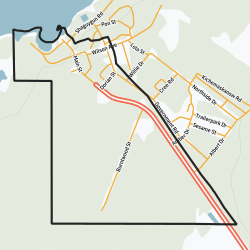 Community boundaries | |
 Easterville Location in Manitoba | |
| Coordinates: 53°06′27″N 99°48′46″W / 53.10750°N 99.81278°WCoordinates: 53°06′27″N 99°48′46″W / 53.10750°N 99.81278°W | |
| Country | Canada |
| Province | Manitoba |
| Established | 1962 |
| Government | |
| • Type | Mayor–council |
| • Chief | Clarence Easter |
| • Councillors |
|
| Area | |
| • Land | 3.31 km2 (1.28 sq mi) |
| Population (2016) | |
| • Total | 44 |
| • Density | 13.3/km2 (34/sq mi) |
| • Summer (DST) | UTC-4 |

Easterville is an unincorporated community, designated as a northern community, in the Canadian province of Manitoba.[1]
It is situated 200 kilometres southeast of The Pas and 100 kilometres (40 km by air) west of Grand Rapids, on the south shore of Cedar Lake. Its elevation above sea level is 265 metres (869 ft). The Chemawawin Cree Nation community is adjacent to the community on Cedar Lake.
The current community of Easterville was established in 1962, when nearby native populations were being displaced by the building of the Grand Rapids Dam, which flooded their prior community of Chemawawin.[2]
History[]
The community of Easterville as it exists today was established in 1962, when it, along with nearby Indigenous populations, were relocated to the south shore of Cedar Lake. The relocation happened as result of displacement by Manitoba Hydro, who flooded the original location within Chemawawin on the lake as a part of a hydroelectric development project for the construction of the Grand Rapids Dam.[2][3][4][5]
Demographics[]
In the 2011 Census, the Easterville designated place had a population of 71 living in 17 of its 26 total private dwellings.[6] The population of Easterville as of 2006 was 80 persons, with 23 private dwellings, a land area of 13.7 km2, and a population density of 5.9 people per square kilometre.[citation needed]
Economy[]
The main sources of economic base, or natural resources of Easterville, are fishing and trapping. The community offers recreational facilities such as the Skating Rink and community centre, public services including a fire hall and school, and local businesses like Easterville Fisherman's Association, a coffee shop, Griffin's Lucky Dollar Foods, and the U&S Department Store.
Notable people[]
- Shelly Chartier, Known for catfishing NBA player Chris Andersen[7][8]
Infrastructure[]
Transportation[]
Easterville is located at the northern terminus of Manitoba Provincial Road 327. It is approximately 20 km north of Provincial Highway 60, the major roadway in the area which connects Highway 6 (to Thompson) and Highway 10 (to Flin Flon). The community is also serviced by Easterville Airport, located just to the east of the town.
Media[]
Radio[]
- 93.5 (VF2337) (NCI)
- 95.5 CBWE-FM (CBC Radio One)
References[]
- ^ Government of Canada, Statistics Canada (2017-02-08). "Population and Dwelling Count Highlight Tables, 2016 Census". www12.statcan.gc.ca. Retrieved 2021-08-13.
- ^ Jump up to: a b (31 July 2010). Paradise Lost, Winnipeg Free Press
- ^ Miller, David L. et al. (eds.) The First ones: Readings in Indian/Native studies (1992) ("The new community of Easterville to which the people were relocated, described as a "pre-planned" community by Manitoba Hydro, was built some 40 miles from Chemawawin along the shore of Cedar Lake.")
- ^ Waldrum, James B. As long as the rivers run: hydroelectric development and native communities in Western Canada, p.81-105 (1988)
- ^ https://www.gov.mb.ca/inr/publications/community_profiles/pubs/easterville-2016.pdf
- ^ "Corrections and updates: Population and dwelling count amendments, 2011 Census". Statistics Canada. February 14, 2013. Retrieved February 16, 2013.
- ^ "How this woman catfished an NBA star and an aspiring model". ABC News. 17 April 2017. Retrieved 1 February 2019.
- ^ October 26, CBC Radio ·. "The untold story of Shelly Chartier: the rural Manitoba woman who catfished the stars | CBC Radio". CBC. Retrieved 1 February 2019.
External links[]
| show Places adjacent to Easterville, Manitoba |
|---|
- Designated places in Manitoba