Enrile, Cagayan
Enrile | |
|---|---|
| Municipality of Enrile | |
 Municipal Hall of Enrile | |
 Seal | |
| Nickname(s): Peanut Capital of the Philippines[1] | |
| Motto(s): Awan Na Matalan, Awan Nga Kalippanan | |
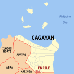 Map of Cagayan with Enrile highlighted | |
OpenStreetMap  | |
 Enrile Location within the Philippines | |
| Coordinates: 17°33′N 121°42′E / 17.55°N 121.7°ECoordinates: 17°33′N 121°42′E / 17.55°N 121.7°E | |
| Country | Philippines |
| Region | Cagayan Valley |
| Province | Cagayan |
| District | 3rd district |
| Named for | Pasqual Enrile y Alcedo |
| Barangays | 22 (see Barangays) |
| Government | |
| • Type | Sangguniang Bayan |
| • Mayor | Miguel B. Decena Jr. |
| • Vice Mayor | Expedito C. Taguibao |
| • Representative | Joseph "Jojo" L. Lara |
| • Sangguniang Panlalawigan | List |
| • Electorate | 21,510 voters (2019) |
| Area | |
| • Total | 184.50 km2 (71.24 sq mi) |
| Elevation | 56 m (184 ft) |
| Highest elevation | 188 m (617 ft) |
| Lowest elevation | 13 m (43 ft) |
| Population (2020 census) [4] | |
| • Total | 36,705 |
| • Density | 200/km2 (520/sq mi) |
| • Households | 7,537 |
| Economy | |
| • Income class | 3rd municipal income class |
| • Poverty incidence | 12.60% (2015)[5] |
| • Revenue | |
| • Assets | |
| • Govt Equity | |
| • Appropriations | |
| • Expenditure | |
| • Obligations | |
| • Liabilities | |
| Service provider | |
| • Electricity | Cagayan 1 Electric Cooperative (CAGELCO 1) |
| Time zone | UTC+8 (PST) |
| ZIP code | 3501 |
| PSGC | |
| IDD : area code | +63 (0)78 |
| Native languages | Ibanag Ilocano Tagalog |
| Lent Culture | Padafung |
| Major religions | Roman Catholic |
| Catholic diocese | Diocese of Tuguegarao |
| Patron saint | San Jose |
| Festival | Peanut Festival (Mappalabbet) |

Enrile (Ibanag: Ili nat Enrile; Ilocano: Ili ti Enrile; Tagalog: Bayan ng Enrile), officially the Municipality of Enrile, is a 3rd class municipality in the province of Cagayan, Philippines. According to the 2020 census, it has a population of 36,705 people. [4]
The municipality was named after Spanish Governor-General Pasqual Enrile y Alcedo.
Cabug was the original name of Enrile when it was a barrio of Tuguegarao. It was established as a separate town in September 1849 and named in honor of the Spanish Governor General Pascual Enrile during the Spanish regime.
Enrile lies on the southernmost part of Cagayan, bounded by Sta. Maria, Isabela to the south, by the mighty Cagayan River to the east, by Solana and Tuguegarao to the north, Kalinga to the west.
Enrile is predominantly an agricultural town where the majority of its population derive their income from farming. It has a land area of 18,450 hectares unevenly distributed to the 22-barangays of the municipality. Its main products are rice, corn, peanut, tobacco and vegetables.
Enrile has a total population of 35,834 inhabitants. Its citizens are called Itawit because they speak the Itawit dialect. Ilocanos and Tagalogs have settled at the western barangays and have blended very well in the mainstream of Itawit life.
Geography[]
Enrile lies on the southernmost part of Cagayan, bounded by Sta. Maria, Isabela to the south, by the mighty Cagayan River to the east, by Solana and Tuguegarao City to the north and by the province of Kalinga to the west.
Topography[]
Enrile is bounded by hills and mountains on both North and West. Area with low elevation is about 20 meters above sea level at the Eastern part which lies close to the river boundaries. The highest elevation is found Northwest which is approximately 800 meters above sea level.
Land Area[]
Enrile has a land area of 18,450 hectares unevenly distributed to the 22 barangays of the municipality and predominantly agricultural where the majority of its inhabitants derive their income from farming.
Climate[]
| Climate data for Enrile, Cagayan | |||||||||||||
|---|---|---|---|---|---|---|---|---|---|---|---|---|---|
| Month | Jan | Feb | Mar | Apr | May | Jun | Jul | Aug | Sep | Oct | Nov | Dec | Year |
| Average high °C (°F) | 25 (77) |
26 (79) |
28 (82) |
31 (88) |
32 (90) |
31 (88) |
31 (88) |
30 (86) |
30 (86) |
28 (82) |
27 (81) |
25 (77) |
29 (84) |
| Average low °C (°F) | 21 (70) |
21 (70) |
22 (72) |
23 (73) |
24 (75) |
25 (77) |
24 (75) |
25 (77) |
24 (75) |
23 (73) |
23 (73) |
22 (72) |
23 (74) |
| Average precipitation mm (inches) | 155 (6.1) |
113 (4.4) |
89 (3.5) |
58 (2.3) |
127 (5.0) |
131 (5.2) |
154 (6.1) |
184 (7.2) |
151 (5.9) |
247 (9.7) |
221 (8.7) |
292 (11.5) |
1,922 (75.6) |
| Average rainy days | 19.6 | 14.8 | 13.4 | 12 | 19.4 | 19.8 | 23 | 25 | 23 | 19.4 | 19.1 | 21.6 | 230.1 |
| Source: Meteoblue [12] | |||||||||||||
Barangays[]
Enrile is politically subdivided into 22 barangays.
- Alibago
- Barangay II
- Barangay IV
- Batu
- Divisoria
- Inga
- Lanna
- Lemu Norte
- Lemu Sur
- Liwan Norte
- Liwan Sur
- Maddarulug Norte
- Maddarulug Sur
- Magalalag East
- Magalalag West (San Nicolas)
- Marracuru
- Roma Norte
- Roma Sur
- San Antonio
- San Jose (Barangay III-A)
- San Roque (Barangay III-B)
- Villa Maria (Barangay I)
Demographics[]
|
| |||||||||||||||||||||||||||||||||||||||||||||||||||
| Source: Philippine Statistics Authority [13] [14] [15][16] | ||||||||||||||||||||||||||||||||||||||||||||||||||||
In the 2020 census, the population of Enrile, Cagayan, was 36,705 people, [4] with a density of 200 inhabitants per square kilometre or 520 inhabitants per square mile.
History[]
The History of Enrile dates as early as 1690. According to Father Juan Paguere, it was just a wide and long stretch of virgin land located at the southernmost end of the province of Cagayan. In 1718, the Govierno Superior ordered the place to become one of the barrios of Tuguegarao. It was named "Cabugag" or in short Cabug, the dialect term for hunchback for the first settler was a man with this deformity. So the place was named after him. The name "Cabug" is engraved on the town's first church bell which is still found in the steeple.
In 1724, The Dominican Friars have thought of giving the barrios their Patron Saint. Cabug was given "Nuestra Señora de las Caldas". The old prominent residents of the barrio had chosen the sixth day of August as her feast day. As year went by, the land area and population of the barrio increased with surprising rapidly. The Cagayan River which flowed close to the barrio site gradually changed its course and moved further towards Cataggaman as flood plains were formed. The non Christian inhabitants called Kalingas gradually deserted the barrio and moved westward to the Mountain Province. As a result, more agricultural lands were cleared and cultivated. Tobacco and corn are the chief crops of the people.
In September 1849, the Govierno Superior ordered the separation of Cabug from the municipality of Tuguegarao to become a town by itself. The new town was named Enrile in honor of Governor Pascual Enrile who was responsible for building roads in the northern part of Luzon during those days. The separation of Enrile from Tuguegarao led to a change of its patron saint. The population unanimously adopted "Nuestra Señora de las Nieves" as its patron Saint. The fifth day of August was selected as her feast day. Since then the feast day had always been celebrated pompously.
According to Father Julian Malumbres in his Historia de Cagayan, the name "Cabug" was first recorded in the official documents of the Dominican Fathers on January 20, 1849. However the town was known as "Cabug" even up 1863 when the name Enrile was officially written and road in the official documents of the Dominican Fathers. Cabug was the original name of Enrile when it was a barrio of Tuguegarao. It was established as a separate town in September 1849 and named in honor of the Spanish Governor General Pascual Enrile during the Spanish regime.
Enrile lies on the southernmost part of Cagayan, bounded by Sta. Maria, Isabela to the south, by the mighty Cagayan River to the east, by Solana, Cagayan and Tuguegarao to the north, Kalinga (province) to the west.
Enrile is predominantly an agricultural town where the majority of its population derive their income from farming. It has a land area of 18,450 hectares unevenly distributed to the 22-barangays of the municipality. Its main products are rice, corn, peanut, tobacco and vegetables.
Enrile has a total population of 29,719 inhabitants. Its citizens are called Itawit because they speak the Itawit dialect. Ilocanos and Tagalogs have settled at the western barangays and have blended very well in the mainstream of Itawit life.
In 1690, the town of Enrile was a virgin forest on the southernmost portion of the province of Cagayan.
In 1724 or thereabouts, it was named Cabug, a barrio of Tuguegarao City and it now celebrates its feast day on August 6, later changed to August 5, in honor of its Patron Saint Nuestra Senoŕa de las Caldas.
In the chronicle of Fray Julian Manumbres, Cabug as a geographical unit was officially recorded on January 20, 1849. And although the name Enrile was officially written and read in the records of the Dominicans up to 1863, the town of Enrile was still known as "Cabug".
Kalingas, the early settlers, were later joined by neighbor inhabitants in the cleaning and cultivating its rich soil. They plowed and planted the fields with staple products and tobacco.
With the increasing production and number of educated elders, the Gobierno Superior proclaimed "Cabug" separated from Tuguegarao City in 1849, with a new patroness named Nuestra Senoŕa de las Nieves.
This proclaimed "Cabug" as "Enrile" in honor of Gobernardo General Pascual Enrile, who was responsible for the construction of Luzon's highways.
Sinupac, a hinterland of Enrile, was the hiding place of Emilio Aguinaldo and his revolutionary forces when they retreated from pursuing American forces.
Local chief executives[]
Gobernadorcillos[]
A. Spanish Regime – 1849 to 1896
- Don Vicente Bunagan
- Don Marcelo Guzman
- Don Martin Fortunato
- Don Lorenzo de los Reyes
- Don Pio Cepeda
- Don Mariano Guzman
- Don Carlos Argonza
- Don Agapito Lappay
- Don Pedro Bunagan
- Don Vicente Carag
- Don Patricio Gacutan
- Don Cayatano Fortunato
Municipal Captain[]
1. Don Cornelio Bunagan – 1896 – 1898
Municipal Mayors[]
- Vicente Babaran 1900-1902
- Tomas Carag 1902-1903
- Matias Bunagan 1903-1904
- Agapito Guzman 1904-1906
- Cipriano Pagulayan 1906-1909
- Vicente Babaran 1909-1913
- Nicolas Pauig 1913-1917
- Generoso Palattao 1917-1920
- Pedro Camigad 1920-1924
- Jacinto Camacam 1924-1926
- Francisco Turingan 1926-1931
- Joaquin Accad 1931-1935
- Felix Babaran 1935-1943
- Rufino Luyun 1943-1945(Japanese Regime)
- Agustin Palattao March 1945 to June 30, 1945 (Military)
- Anastacio Luyun 1945-1946 (Appointed)
- Jose Babaran 1947-1951
- Gorgenio Manauis January 1, 1952 to March 27, 1952
- Benigno Carag Serving the rest of the term of Mayor Manauis (deceased), he being the elected Vice Mayor.
Elected Government Official 2019-2022[]
Mayor:
- Miguel B. Decena Jr.
Vice Mayor:
- Expedito C. Taguibao
Sangguniang Bayan Member:
- Christina Magbitang
- Maria Rosabell Herrera
- Romeo Battung
- Juan Carag
- Sergio Turingan
- Joseph Amistad
- Jacinto Tuddao
- Mercuria Gaffud
- Macario Mabazza (LnB)
- Alfonso Sarmiento (SK Federation)
Economy[]
| Poverty Incidence of Enrile | |
| Source: Philippine Statistics Authority[17][18][19][20][21][22] | |
Peanut Production[]
The Department of Agriculture (DA) has declared the town of Enrile in Cagayan as the "peanut capital of the Philippines" for its "noteworthy contribution" to the development of the local peanut industry.
Agriculture Secretary Proceso Alcala declared it so following the presentation of evidence of the significant contributions of the town to the peanut industry in the country. DA Assistant Secretary for Agribusiness Leandro Gazmin, who went to Enrile to represent Alcala during the peanut harvest ceremony, said the soil suitability of the town – sandy to sandy-loam – and its unique ability to produce peanut year-round are the "primary reasons why it will be known as an important source of peanut henceforth."
Gazmin said the Secretary lauds them for their collective effort but that the DA chief requests that they "commit themselves to improve and develop even further not just the peanut industry but the entire agricultural sector as well."
He said the Secretary is also happy to know that farmers have been receptive to new technologies hence, they are able to increase productivity from 1.5 to 1.8 tons per hectare.
During the peanut harvest, the DA regional office turned over to the local government of Enrile over P4-million worth of farm machineries and equipment, including one unit four-wheel drive tractor, four units of mill for corngrits, 10 heads of carabao, 2,500 kilos of peanut seeds for planting and 300 bags of open-pollinated corn variety.
Though peanut is considered a high value crop by DA, not just in Enrile but in neighboring towns of Peñablanca and Tuguegarao (Cagayan) and Sta. Maria and Cabagan in Isabela, the former was chosen as "number one" for having the "highest production share of 1,800 metric tons per year or 8 to10 percent of the national supply."
Also, Enrile is the only municipality that can cultivate peanuts during the dry and wet season cropping, the DA said.
DA Region II Executive Director Lucrecio Alviar said that per cropping, the town of Enrile is able to produce a big chunk of the national production, making it the major source of raw materials for various peanut-based products processed and sold in Metro Manila.
Enrile is home to 800 peanut farmers cultivating 700 hectares of farmlands with a potential expansion area of another 800 hectares. "With improved production and yield, Enrile may be able to fill up a portion, if not all, of the import requirement for peanut of 15,060 metric tons," Alviar added.
With the use of technology from DA and the Department of Science and Technology (DOST) – particularly the use of improved varieties and fertilizers like Boron and Gypsum – the DA is optimistic that "peanut production could reach an all-time high of 3.25 tons per hectare," or an increase of 200 percent over its current average. The DA said it hopes the farmers can sustain their productivity.
Gazmin also encouraged peanut farmers to bring their harvest to the Isabela Agri-Pinoy Trading Center, where they can directly sell their produce. The Isabela APTC is part of the government's effort to empower farmers to become traders to enhance their incomes, stabilize food prices and encourage them to produce more. "Let us utilize the center as a venue for cooperativism" and enabling each other to produce and earn more, he said.
Local Business[]
- Agro - Trade Fair located at the side of Municipal Hall.
- Kimikarlai - Turingan Sports Center and Airconditioned Cockpit Arena (Bunagan St.)
- Kimikarlai Construction Supply and Services (Santiago - Tuguegarao Road)
- Kimikarlai Gamefarm (Bunagan St.)
- Kimikarlai Hardware and Construction Services (Brgy. Villa Maria)
- Lai Gasoline Station (Brgy. Villa Maria)
- Lai Gasoline Station (Santiago - Tuguegarao Road)
- Lai Grains and Palay Gasoline Station (Bunagan St.)
- M.B. Decena Jr. Livestock
Transportation[]
Passenger jeepneys, tricycles and other private transportation vehicles service all routes within and outside Enrile. Kalesa is also driven within the Poblacion and barangays only.
References[]
- ^ "Area of Coverage". ATI in Cagayan Valley. Retrieved December 23, 2021.
- ^ Municipality of Enrile | (DILG)
- ^ "2015 Census of Population, Report No. 3 – Population, Land Area, and Population Density" (PDF). Philippine Statistics Authority. Quezon City, Philippines. August 2016. ISSN 0117-1453. Archived (PDF) from the original on May 25, 2021. Retrieved July 16, 2021.
- ^ a b c Census of Population (2020). "Region II (Cagayan Valley)". Total Population by Province, City, Municipality and Barangay. PSA. Retrieved 8 July 2021.
- ^ https://psa.gov.ph/sites/default/files/City%20and%20Municipal-level%20Small%20Area%20Poverty%20Estimates_%202009%2C%202012%20and%202015_0.xlsx; publication date: 10 July 2019; publisher: Philippine Statistics Authority.
- ^ "Commission on Audit Report - Cagayan". coa.gov.ph. Commission on Audit. Retrieved 24 May 2021.
- ^ "Commission on Audit Report - Cagayan (Enrile)". coa.gov.ph. Commission on Audit. Retrieved 24 May 2021.
- ^ "Commission on Audit Report - Cagayan (Enrile)". Commission on Audit. Retrieved 24 May 2021.
- ^ "COA Report - Enrile, Cagayan". coa.gov.ph. Commission on Audit. Retrieved 24 May 2021.
- ^ "COA Report - Enrile, Cagayan". Retrieved 24 May 2021.
- ^ "COA Report - Enrile, Cagayan". Retrieved 24 May 2021.
- ^ "Enrile, Cagayan: Average Temperatures and Rainfall". Meteoblue. Retrieved 3 November 2018.
- ^ Census of Population (2015). "Region II (Cagayan Valley)". Total Population by Province, City, Municipality and Barangay. PSA. Retrieved 20 June 2016.
- ^ Census of Population and Housing (2010). "Region II (Cagayan Valley)". Total Population by Province, City, Municipality and Barangay. NSO. Retrieved 29 June 2016.
- ^ Censuses of Population (1903–2007). "Region II (Cagayan Valley)". Table 1. Population Enumerated in Various Censuses by Province/Highly Urbanized City: 1903 to 2007. NSO.
- ^ "Province of Cagayan". Municipality Population Data. Local Water Utilities Administration Research Division. Retrieved 17 December 2016.
- ^ "Poverty incidence (PI):". Philippine Statistics Authority. Retrieved 28 December 2020.
- ^ https://psa.gov.ph/sites/default/files/NSCB_LocalPovertyPhilippines_0.pdf; publication date: 29 November 2005; publisher: Philippine Statistics Authority.
- ^ https://psa.gov.ph/sites/default/files/2003%20SAE%20of%20poverty%20%28Full%20Report%29_1.pdf; publication date: 23 March 2009; publisher: Philippine Statistics Authority.
- ^ https://psa.gov.ph/sites/default/files/2006%20and%202009%20City%20and%20Municipal%20Level%20Poverty%20Estimates_0_1.pdf; publication date: 3 August 2012; publisher: Philippine Statistics Authority.
- ^ https://psa.gov.ph/sites/default/files/2012%20Municipal%20and%20City%20Level%20Poverty%20Estima7tes%20Publication%20%281%29.pdf; publication date: 31 May 2016; publisher: Philippine Statistics Authority.
- ^ https://psa.gov.ph/sites/default/files/City%20and%20Municipal-level%20Small%20Area%20Poverty%20Estimates_%202009%2C%202012%20and%202015_0.xlsx; publication date: 10 July 2019; publisher: Philippine Statistics Authority.
External links[]
Places adjacent to Enrile, Cagayan | |
|---|---|
Tuguegarao (capital) | |
| Municipalities | |
| Component city | |
| Barangays | |
- Municipalities of Cagayan
- Populated places on the Rio Grande de Cagayan