Santa Ana, Cagayan
This article needs additional citations for verification. (January 2014) |
Santa Ana | |
|---|---|
| Municipality of Santa Ana | |
 View of Santa Ana coast from Mount Cagua | |
 Flag  Seal | |
| Nickname(s): Game Fishing Center of the Philippines | |
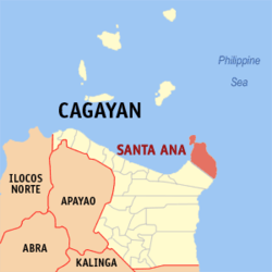 Map of Cagayan with Santa Ana highlighted | |
OpenStreetMap  | |
 Santa Ana Location within the Philippines | |
| Coordinates: 18°28′N 122°09′E / 18.47°N 122.15°ECoordinates: 18°28′N 122°09′E / 18.47°N 122.15°E | |
| Country | Philippines |
| Region | Cagayan Valley |
| Province | Cagayan |
| District | 1st district |
| Founded | October 21, 1949 |
| Named for | Saint Anne |
| Barangays | 16 (see Barangays) |
| Government | |
| • Type | Sangguniang Bayan |
| • Mayor | Nelson P. Robinion |
| • Vice Mayor | Gaylord Robinson B. Ibus |
| • Representative | Ramon C. Nolasco Jr. |
| • Electorate | 21,093 voters (2019) |
| Area | |
| • Total | 441.30 km2 (170.39 sq mi) |
| Elevation | 64 m (210 ft) |
| Highest elevation | 1,142 m (3,747 ft) |
| Lowest elevation | 0 m (0 ft) |
| Population (2020 census) [3] | |
| • Total | 35,688 |
| • Density | 81/km2 (210/sq mi) |
| • Households | 7,723 |
| Economy | |
| • Income class | 2nd municipal income class |
| • Poverty incidence | 12.54% (2015)[4] |
| • Revenue | ₱209,146,177.07 (2020) |
| • Assets | ₱571,171,880.47 (2020) |
| • Expenditure | ₱181,379,723.87 (2020) |
| • Liabilities | ₱159,304,524.27 (2020) |
| Service provider | |
| • Electricity | Cagayan 2 Electric Cooperative (CAGELCO 2) |
| Time zone | UTC+8 (PST) |
| ZIP code | 3514 |
| PSGC | |
| IDD : area code | +63 (0)78 |
| Native languages | Ibanag Ilocano Dupaningan Agta Tagalog |

Santa Ana, officially the Municipality of Santa Ana (Ibanag: Ili nat Santa Ana; Ilocano: Ili ti Santa Ana; Tagalog: Bayan ng Santa Ana), is a 2nd class municipality in the province of Cagayan, Philippines. According to the 2020 census, it has a population of 35,688 people. [3]
The municipality is on the north-easternmost point of Luzon and includes Palaui Island as well. It is the home of the Cagayan Special Economic Zone and the (Naval Operating Base San Vicente) in Barangay San Vicente.
Barangays[]
Santa Ana is politically subdivided into 16 barangays. [5]
Climate[]
| Climate data for Santa Ana, Cagayan | |||||||||||||
|---|---|---|---|---|---|---|---|---|---|---|---|---|---|
| Month | Jan | Feb | Mar | Apr | May | Jun | Jul | Aug | Sep | Oct | Nov | Dec | Year |
| Average high °C (°F) | 24 (75) |
26 (79) |
28 (82) |
31 (88) |
31 (88) |
31 (88) |
30 (86) |
30 (86) |
29 (84) |
28 (82) |
26 (79) |
25 (77) |
28 (83) |
| Average low °C (°F) | 21 (70) |
21 (70) |
21 (70) |
23 (73) |
24 (75) |
24 (75) |
24 (75) |
24 (75) |
24 (75) |
23 (73) |
23 (73) |
22 (72) |
23 (73) |
| Average precipitation mm (inches) | 150 (5.9) |
106 (4.2) |
84 (3.3) |
48 (1.9) |
103 (4.1) |
115 (4.5) |
134 (5.3) |
156 (6.1) |
136 (5.4) |
240 (9.4) |
246 (9.7) |
300 (11.8) |
1,818 (71.6) |
| Average rainy days | 19 | 14.3 | 12.8 | 10.8 | 17.7 | 18.9 | 21.5 | 23.3 | 22.1 | 20.4 | 20.3 | 22.2 | 223.3 |
| Source: Meteoblue [6] | |||||||||||||
History[]
The first inhabitants were the Negritos and hacheros (woodcutters) under (Capitan Vasco 1854-1901[7]) of Aparri. Some fishermen from Minanga (a barrio of Gonzaga) came and settled in Palawig. In 1891, Felipe Agarpao with some settlers organized a gimong (society) called Inanama. The purpose of the organisation was to acquire and occupy lands around the place. That same year, Briccio Campañano of Lapog, Ilocos Sur together with some others from Ilocos came to Palawig to apply for homesteads in the sitio of Marede. These settlers organized another gimong called Dagupan.
In 1900, the woodcutters from Aparri led by Don Julian Astigarraga arrived by the first boat. Thus, began the clearing of settlements.
From 1919 to 1935 several group of settlers from the Ilocos Region came to claim lands aboard virays (light seagoing boats). The once-forested areas were accessible only via rivers and the sea. Before reaching the settlements in the northern and eastern portions, they had to navigate through Palawig River.
The name Palawig was coined from the local term pasawig, meaning mouth of the river.
In 1935, the gimongs Inanama and Dagupan fused into one called Da Inanama. Headed by Navarro, they began to work for the separation of Palawig as a municipality independent from Gonzaga. Their application was held in abeyance because their population did not meet the needed number required by law. The move was suspended in 1941 and when World War II broke out the move was not carried out.
Barrio Palawig and its neighbouring barrios were separated from Gonzaga and the town was created by President Elpidio Quirino via Executive Order No. 289 (21 October 1949). Contrary to the usual assumption, it is not named for Saint Anne but is an acronym of the surnames of the then-three provincial officials: Governor Nicasio Arranz; and Provincial Board members Federico Navarro; and Roberto Avena. The association to the saint was a back-formation in keeping with traditional Hispanicised toponyms.
Demographics[]
|
| |||||||||||||||||||||||||||||||||||||||
| Source: Philippine Statistics Authority [8] [9] [10][11] | ||||||||||||||||||||||||||||||||||||||||
In the 2020 census, the population of Santa Ana, Cagayan, was 35,688 people, [3] with a density of 81 inhabitants per square kilometre or 210 inhabitants per square mile.
Economy[]
| Poverty Incidence of Santa Ana | |
| Source: Philippine Statistics Authority[12][13][14][15][16][17] | |
Santa Ana is a mix of agricultural and commercial economy. Most of the commercial and industrial activities are at Port Irene as the Cagayan Special Economic Zone in Barangay Casambalangan.
Some of its agricultural and aquatic products are rice, corn, peanut, fish, lumber, shells, etc. Among its natural resources are limestone deposits at Bawac Mountain, coal at Carbon Mountain, Santa Clara and guano deposit at Kapannikian Cave.
Tourism[]

Aside from the Cagayan Special Economic Zone which host casinos and other gaming facilities, scenic spots and historical landmarks are present in this town. These include:
- Cape Engaño Lighthouse/Cove (USA Survivor 27 and 28 filming area)
- Siwangag Cove (USA Survivor 27 and 28 filming area)
- White beaches like Anguib Beach, Mapurao Beach, Nangaramoan Beach, and Puzo Robo Beach
- Gotan mangrove forest and waterfalls
- Suncity Casino in Barangay Tangatan
- Buwacag Falls at Santa Clara (Open for public), Padlas Falls at Casambalangan, Lamesa Falls at Casagan (not yet ready for public)
- Sinago Cove (Close for Public)
- Magawigaw Beach (Close for Public)
- Dumasag River at Rapuli
- Pananacpan white Beach (soon to open) by PETA -Pananacpan Eco-Tourism Association
- Riding Takuli (a traditional kayak) and firefly watching at Barangay Casagan
- Tangatan Little Baguio (soon to Open)
- Belt Fishing Activity at Diora-Zinungan
Santa Ana is the game fishing hub of the Philippines. It has hosted international decathlons, where athletes run through the rugged terrain of Punta Verde to Cape Engaño, then dipped in the crystal clear water of the Philippine Sea.
Sports[]
Santa Ana is also known as one of the sites for Kiteboarding and Windsurfing. In 2015, the Philippine Windsurfing Association and the Philippine Kiteboarding Association organized a Kiteboarding and Windsurfing competition in Anguib Beach, known as the paradise for kiteboarders and windsurfers.[18]
In 2016, Beach Volleyball Republic hosts the third leg of the Nationwide On Tour,[19] also in Anguib Beach. Beach volleybelles Charo Soriano, who is a native from Tuguegarao, and Filipino-American Alexa Micek won the third leg of the BVR On Tour.
Festivities[]
Every May 26 to May 30 of the year, the town plays host to the Viray Festival, organized by the local government with the support of the regional tourism office and the private sector. Launched in June 2005, the Viray Festival was conceptualized to dramatize the significance of the viray, which played a key role in the lives and history of the town.
A viray is a large wooden flat boat which, before the use of gasoline-fed engines in the early 1950s, was propelled by sails. Comerciantes (traders) used large virays measuring 18 metres (59 ft) long, 5 metres (16 ft) wide and 3.5 metres (11 ft) high. Fishermen, on the other hand, used smaller ones, usually 11 metres (36 ft) long, 5 metres (16 ft) wide and 2.5 metres (8 ft 2 in) high. Equipped with oars to reach nearby fishing grounds, these types sailed for longer distances.
Due to its capacity to carry great quantities of cargo, the viray was the only means of transport used by the first settlers of Santa Ana.
Leaders and well-off families derived income from the services of the viray ranging from fishing operation, commerce and trade to means of transport during the years when Santa Ana was at its prime. Used for daklis (trawl net), sapiao (net) and sirut (ring net) fishing, viray could carry the fishing gears, provisions, supplies, and manpower. It is assisted by small bancas during the fishing operation.
An annual fluvial parade of colorful boats is held during the first day.
The second day of the festival features a grand carabao parade where each of the 16 barangays composing the municipality has their turn to show off their artistic talents.
On the third day, local folks and visitors alike line up along the main street to watch colorful bodies participating in the street dancing competition.
References[]
- ^ Municipality of Santa Ana | (DILG)
- ^ "2015 Census of Population, Report No. 3 – Population, Land Area, and Population Density" (PDF). Philippine Statistics Authority. Quezon City, Philippines. August 2016. ISSN 0117-1453. Archived (PDF) from the original on May 25, 2021. Retrieved July 16, 2021.
- ^ a b c Census of Population (2020). "Region II (Cagayan Valley)". Total Population by Province, City, Municipality and Barangay. PSA. Retrieved 8 July 2021.
- ^ https://psa.gov.ph/sites/default/files/City%20and%20Municipal-level%20Small%20Area%20Poverty%20Estimates_%202009%2C%202012%20and%202015_0.xlsx; publication date: 10 July 2019; publisher: Philippine Statistics Authority.
- ^ "Province: Cagayan". PSGC Interactive. Quezon City, Philippines: Philippine Statistics Authority. Retrieved 12 November 2016.
- ^ "Santa Ana, Cagayan: Average Temperatures and Rainfall". Meteoblue. Retrieved 27 December 2018.
- ^ Family archives
- ^ Census of Population (2015). "Region II (Cagayan Valley)". Total Population by Province, City, Municipality and Barangay. PSA. Retrieved 20 June 2016.
- ^ Census of Population and Housing (2010). "Region II (Cagayan Valley)". Total Population by Province, City, Municipality and Barangay. NSO. Retrieved 29 June 2016.
- ^ Censuses of Population (1903–2007). "Region II (Cagayan Valley)". Table 1. Population Enumerated in Various Censuses by Province/Highly Urbanized City: 1903 to 2007. NSO.
- ^ "Province of Cagayan". Municipality Population Data. Local Water Utilities Administration Research Division. Retrieved 17 December 2016.
- ^ "Poverty incidence (PI):". Philippine Statistics Authority. Retrieved 28 December 2020.
- ^ https://psa.gov.ph/sites/default/files/NSCB_LocalPovertyPhilippines_0.pdf; publication date: 29 November 2005; publisher: Philippine Statistics Authority.
- ^ https://psa.gov.ph/sites/default/files/2003%20SAE%20of%20poverty%20%28Full%20Report%29_1.pdf; publication date: 23 March 2009; publisher: Philippine Statistics Authority.
- ^ https://psa.gov.ph/sites/default/files/2006%20and%202009%20City%20and%20Municipal%20Level%20Poverty%20Estimates_0_1.pdf; publication date: 3 August 2012; publisher: Philippine Statistics Authority.
- ^ https://psa.gov.ph/sites/default/files/2012%20Municipal%20and%20City%20Level%20Poverty%20Estima7tes%20Publication%20%281%29.pdf; publication date: 31 May 2016; publisher: Philippine Statistics Authority.
- ^ https://psa.gov.ph/sites/default/files/City%20and%20Municipal-level%20Small%20Area%20Poverty%20Estimates_%202009%2C%202012%20and%202015_0.xlsx; publication date: 10 July 2019; publisher: Philippine Statistics Authority.
- ^ Domingo, Leander (January 10, 2015). "Cagayan hosts surf, kite contests". The Manila Times. Retrieved March 7, 2016.
- ^ "Beach volleyball in Cagayan". The Daily Tribune. February 17, 2016. Retrieved March 7, 2016.
External links[]
| Wikimedia Commons has media related to Santa Ana, Cagayan. |
- Santa Ana Profile at PhilAtlas.com
- Philippine Standard Geographic Code
- Philippine Census Information
- Manidad Island in Santa Ana Cagayan Valley
Places adjacent to Santa Ana, Cagayan | ||||||||||||||||
|---|---|---|---|---|---|---|---|---|---|---|---|---|---|---|---|---|
| ||||||||||||||||
Tuguegarao (capital) | |
| Municipalities | |
| Component city | |
| Barangays | |
- Municipalities of Cagayan
- Port cities and towns in the Philippines
- Beaches of the Philippines