Lasam
Lasam | |
|---|---|
| Municipality of Lasam | |
 Seal | |
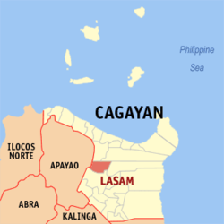 Map of Cagayan with Lasam highlighted | |
OpenStreetMap  | |
 Lasam Location within the Philippines | |
| Coordinates: 18°04′N 121°36′E / 18.07°N 121.6°ECoordinates: 18°04′N 121°36′E / 18.07°N 121.6°E | |
| Country | Philippines |
| Region | Cagayan Valley |
| Province | Cagayan |
| District | 2nd district |
| Founded | June 13, 1950 |
| Barangays | 30 (see Barangays) |
| Government | |
| • Type | Sangguniang Bayan |
| • Mayor | Dante Dexter A. Agatep Jr. |
| • Vice Mayor | Randy C. Cambe |
| • Representative | Samantha Louise V. Alfonso |
| • Electorate | 26,339 voters (2019) |
| Area | |
| • Total | 213.70 km2 (82.51 sq mi) |
| Elevation | 24 m (79 ft) |
| Highest elevation | 179 m (587 ft) |
| Lowest elevation | 1 m (3 ft) |
| Population (2020 census) [3] | |
| • Total | 41,225 |
| • Density | 190/km2 (500/sq mi) |
| • Households | 8,862 |
| Economy | |
| • Income class | 3rd municipal income class |
| • Poverty incidence | 12.16% (2015)[4] |
| • Revenue | ₱171,295,698.00 (2020) |
| • Assets | ₱482,214,753.54 (2020) |
| • Expenditure | ₱126,867,173.50 (2020) |
| • Liabilities | ₱72,181,102.09 (2020) |
| Service provider | |
| • Electricity | Cagayan 2 Electric Cooperative (CAGELCO 2) |
| Time zone | UTC+8 (PST) |
| ZIP code | 3524 |
| PSGC | |
| IDD : area code | +63 (0)78 |
| Native languages | Ibanag Ilocano Tagalog |
| Website | lasam |

Lasam, officially the Municipality of Lasam (Ibanag: Ili nat Lasam; Ilocano: Ili ti Lasam; Tagalog: Bayan ng Lasam), is a 3rd class municipality in the province of Cagayan, Philippines. According to the 2020 census, it has a population of 41,225 people. [3]
The town was once a part of the Municipality of Gattaran, that stretches the width of the province and bisected by the Cagayan River. The barangays west of the river was established as the separate town of Lasam in 1950 by Republic Act No. 507. The new municipality of Lasam became part of the Second Representative District of the Province of Cagayan, while Gattaran is in the First District.[5]
Etymology[]
The Municipality of Lasam was named after the late Cagayan Governor Honorio Lasam.[6]
Barangays[]
Lasam is politically subdivided into 30 barangays.
- Aggunetan
- Alannay
- Battalan
- Cabatacan East (Duldugan)
- Cabatacan West
- Calapangan Norte
- Calapangan Sur
- Callao Norte
- Callao Sur
- Cataliganan
- Centro I (Poblacion)
- Centro II (Poblacion)
- Centro III (Poblacion)
- Finugo Norte
- Gabun
- Ignacio B. Jurado (Finugu Sur)
- Magsaysay
- Malinta
- Minanga Sur
- Minanga Norte
- Nabannagan East
- Nabannagan West
- New Orlins
- Nicolas Agatep
- Peru
- San Pedro
- Sicalao
- Tagao
- Tucalan Passing
- Viga
Climate[]
| Climate data for Lasam, Cagayan | |||||||||||||
|---|---|---|---|---|---|---|---|---|---|---|---|---|---|
| Month | Jan | Feb | Mar | Apr | May | Jun | Jul | Aug | Sep | Oct | Nov | Dec | Year |
| Average high °C (°F) | 25 (77) |
27 (81) |
29 (84) |
32 (90) |
32 (90) |
31 (88) |
31 (88) |
31 (88) |
30 (86) |
29 (84) |
27 (81) |
25 (77) |
29 (85) |
| Average low °C (°F) | 20 (68) |
21 (70) |
22 (72) |
23 (73) |
24 (75) |
25 (77) |
25 (77) |
25 (77) |
24 (75) |
23 (73) |
23 (73) |
21 (70) |
23 (73) |
| Average precipitation mm (inches) | 133 (5.2) |
87 (3.4) |
68 (2.7) |
44 (1.7) |
127 (5.0) |
134 (5.3) |
160 (6.3) |
162 (6.4) |
134 (5.3) |
192 (7.6) |
194 (7.6) |
260 (10.2) |
1,695 (66.7) |
| Average rainy days | 18.1 | 13.3 | 13.3 | 11.8 | 19.7 | 20.9 | 22.8 | 22.8 | 20.3 | 16.6 | 18.4 | 21.7 | 219.7 |
| Source: Meteoblue [7] | |||||||||||||
Demographics[]
|
| |||||||||||||||||||||||||||||||||||||||
| Source: Philippine Statistics Authority [8] [9] [10][11] | ||||||||||||||||||||||||||||||||||||||||
In the 2020 census, the population of Lasam, Cagayan, was 41,225 people, [3] with a density of 190 inhabitants per square kilometre or 490 inhabitants per square mile.
Economy[]
| Poverty Incidence of Lasam | |
| Source: Philippine Statistics Authority[12][13][14][15][16][17] | |
Lasam is primarily an agricultural community and its people derive their income mainly from farming and livestock raising.[6]
History[]
Lasam was once a part of Gattaran separated from the mother town by the wide Cagayan River with no bridges connecting the communities. As the population increased, the residents of the western part of the town asked to be created as a separate municipality.[6]
The town was established on June 13, 1950, by Republic Act No. 507 and signed by President Elpidio Quirino. Barrios (barangays) of Gattaran located west of the Cagayan River were formed into the new and regular Municipality of Lasam, with the old site of the Barrio Macatabang as the seat of the government.[5]
The town was officially inaugurated as independent from Gattaran in January 1951. Ignacio Jurado was appointed as its first mayor whose major task was to build the infrastructure of the new independent town of Lasam.[6]
References[]
- ^ Municipality of Lasam | (DILG)
- ^ "2015 Census of Population, Report No. 3 – Population, Land Area, and Population Density" (PDF). Philippine Statistics Authority. Quezon City, Philippines. August 2016. ISSN 0117-1453. Archived (PDF) from the original on May 25, 2021. Retrieved July 16, 2021.
- ^ a b c Census of Population (2020). "Region II (Cagayan Valley)". Total Population by Province, City, Municipality and Barangay. PSA. Retrieved 8 July 2021.
- ^ https://psa.gov.ph/sites/default/files/City%20and%20Municipal-level%20Small%20Area%20Poverty%20Estimates_%202009%2C%202012%20and%202015_0.xlsx; publication date: 10 July 2019; publisher: Philippine Statistics Authority.
- ^ a b "An act to create the municipality of Lasam in the province of Cagayan". PhiilippineLaw.info. Archived from the original on 2012-07-12. Retrieved 2013-09-04.
- ^ a b c d "Lasam" Archived 2013-09-04 at archive.today. Cagayan Province Official Website. Retrieved on 2013-09-04.
- ^ "Lasam, Cagayan: Average Temperatures and Rainfall". Meteoblue. Retrieved 15 December 2018.
- ^ Census of Population (2015). "Region II (Cagayan Valley)". Total Population by Province, City, Municipality and Barangay. PSA. Retrieved 20 June 2016.
- ^ Census of Population and Housing (2010). "Region II (Cagayan Valley)". Total Population by Province, City, Municipality and Barangay. NSO. Retrieved 29 June 2016.
- ^ Censuses of Population (1903–2007). "Region II (Cagayan Valley)". Table 1. Population Enumerated in Various Censuses by Province/Highly Urbanized City: 1903 to 2007. NSO.
- ^ "Province of Cagayan". Municipality Population Data. Local Water Utilities Administration Research Division. Retrieved 17 December 2016.
- ^ "Poverty incidence (PI):". Philippine Statistics Authority. Retrieved 28 December 2020.
- ^ https://psa.gov.ph/sites/default/files/NSCB_LocalPovertyPhilippines_0.pdf; publication date: 29 November 2005; publisher: Philippine Statistics Authority.
- ^ https://psa.gov.ph/sites/default/files/2003%20SAE%20of%20poverty%20%28Full%20Report%29_1.pdf; publication date: 23 March 2009; publisher: Philippine Statistics Authority.
- ^ https://psa.gov.ph/sites/default/files/2006%20and%202009%20City%20and%20Municipal%20Level%20Poverty%20Estimates_0_1.pdf; publication date: 3 August 2012; publisher: Philippine Statistics Authority.
- ^ https://psa.gov.ph/sites/default/files/2012%20Municipal%20and%20City%20Level%20Poverty%20Estima7tes%20Publication%20%281%29.pdf; publication date: 31 May 2016; publisher: Philippine Statistics Authority.
- ^ https://psa.gov.ph/sites/default/files/City%20and%20Municipal-level%20Small%20Area%20Poverty%20Estimates_%202009%2C%202012%20and%202015_0.xlsx; publication date: 10 July 2019; publisher: Philippine Statistics Authority.
External links[]
Places adjacent to Lasam | ||||||||||||||||
|---|---|---|---|---|---|---|---|---|---|---|---|---|---|---|---|---|
| ||||||||||||||||
Tuguegarao (capital) | |
| Municipalities | |
| Component city | |
| Barangays | |
- Municipalities of Cagayan
- Populated places on the Rio Grande de Cagayan