Fayette County, Tennessee
Fayette County | |
|---|---|
U.S. county | |
 County Courthouse, Town of Somerville, seat of Fayette County | |
 Seal | |
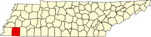 Location within the U.S. state of Tennessee | |
 Tennessee's location within the U.S. | |
| Coordinates: 35°11′N 89°25′W / 35.19°N 89.41°W | |
| Country | |
| State | |
| Founded | September 29, 1824 |
| Named for | Marquis de Lafayette[1] |
| Seat | Somerville |
| Largest town | Oakland |
| Area | |
| • Total | 706 sq mi (1,830 km2) |
| • Land | 705 sq mi (1,830 km2) |
| • Water | 1.5 sq mi (4 km2) 0.2%% |
| Population | |
| • Estimate (2018) | 40,507 |
| • Density | 56.8/sq mi (21.9/km2) |
| Time zone | UTC−6 (Central) |
| • Summer (DST) | UTC−5 (CDT) |
| Congressional district | 8th |
| Website | fayettetn |

Fayette County is a county located in the U.S. state of Tennessee. As of the 2010 census, the population was 38,413.[2] Its county seat is Somerville.[3] The county was named after the Marquis de la Fayette, French hero of the American Revolution.[4] A part of the Memphis, TN-MS-AR Metropolitan Statistical Area, Fayette County is culturally alike to the Mississippi Delta and was a major area of cotton plantations dependent on slave labor in the nineteenth century.
Fayette County has a 19-seat legislative body referred to as the Board of County Commissioners representing 8 districts. All positions are elected every four years.
- District 1 (Somerville)
- Willie German
- Charles Dacus
- District 2 (Laconia)
- Ray Seals
- Tommy Perkins
- District 3 (Gallaway/Braden/Garnett)
- Elizabeth Rice
- Bill Walker
- Jim Norton
- District 4 (Oakland)
- Vacant
- Kevin Powers
- Tim A. Goodroe
- District 5 (Piperton/Rossville)
- Sylvester Logan
- Claude Oglesby, Jr.
- Ben Farley
- District 6 (Moscow/Williston)
- David Lillard, Sr.
- Steve Reeves
- District 7 (Moscow/LaGrange)
- Larry Watkins
- Jimmy Jordan
- District 8 (Hickory Withe/Eads)
- Robert Sills
- Terry Leggett
The County Mayor is currently Rhea "Skip" Taylor.[5]
History[]
Fayette County was established by Tennessee General Assembly in 1824 from the neighboring counties of Shelby and Hardeman.[6] The same year, Somerville was selected as its county seat. The first churches in the county were the First Presbyterian Church in Somerville, established in 1829, and Immanuel Parish, established in 1832.
Following the emancipation of slaves on plantations, many of Fayette County's African-American residents worked as sharecroppers. In the 1960s and 1970s, civil rights activists fought for school integration and voting rights; and created tent cities to house displaced tenant farmers who had tried to register to vote.
In recent years, Fayette County has been transitioning from a rural area to accommodate the suburban sprawl from Memphis.[7]
Geography[]
According to the U.S. Census Bureau, the county has a total area of 706 square miles (1,830 km2), of which 705 square miles (1,830 km2) is land and 1.5 square miles (3.9 km2) (0.2%) is water.[8] It is the third-largest county in Tennessee by area. The county is, roughly, the same size as Marshall County, Mississippi.
Adjacent counties[]
- Haywood County (north)
- Hardeman County (east)
- Benton County, Mississippi (southeast)
- Marshall County, Mississippi (south)
- Shelby County (west)
- Tipton County (northwest)
State protected areas[]
- William B. Clark Conservation Area
- Ghost River State Natural Area
- Piperton Wetland Complex Wildlife Management Area (part)
- Wolf River Wildlife Management Area
- WMA Briggs Tract
- Herb Parsons Lake
Demographics[]
| Historical population | |||
|---|---|---|---|
| Census | Pop. | %± | |
| 1830 | 8,652 | — | |
| 1840 | 21,501 | 148.5% | |
| 1850 | 26,719 | 24.3% | |
| 1860 | 24,327 | −9.0% | |
| 1870 | 26,145 | 7.5% | |
| 1880 | 31,871 | 21.9% | |
| 1890 | 28,878 | −9.4% | |
| 1900 | 29,701 | 2.8% | |
| 1910 | 30,257 | 1.9% | |
| 1920 | 31,499 | 4.1% | |
| 1930 | 28,891 | −8.3% | |
| 1940 | 30,322 | 5.0% | |
| 1950 | 27,535 | −9.2% | |
| 1960 | 24,577 | −10.7% | |
| 1970 | 22,692 | −7.7% | |
| 1980 | 25,305 | 11.5% | |
| 1990 | 25,559 | 1.0% | |
| 2000 | 28,806 | 12.7% | |
| 2010 | 38,413 | 33.4% | |
| 2018 (est.) | 40,507 | [9] | 5.5% |
| U.S. Decennial Census[10] 1790-1960[11] 1900-1990[12] 1990-2000[13] 2010-2014[2] 2017[14] | |||

Since the four-lane expansion of Highway 64 in the early 1990s, western Fayette County has had a population explosion. Although the county seat is still in Somerville, the population of Oakland has far surpassed it because of the influx of people working in Shelby County and seeking more affordable housing.
Although Fayette County is growing on its western side, the county's economy is still based on agriculture. Historically it was a site of cotton plantations as part of the Mississippi Delta. Several of the county's largest farmers, including the Rhea, German, , and Karcher families, control the vast majority of the county's wealth. Some of these families have been farming for generations dating back to plantations before the Civil War. Others are younger farmers who have used their skill, business savvy, and work ethic to develop large farming operations.
Fayette County has become a destination for people of the Memphis metro area. This group is known by Fayette County natives as "Shelby County Spillover" or "White Flight Memphonites". The total value for building permits in June 2007 was close to that of the much larger Memphis suburban area of DeSoto County, Mississippi.
2010 census[]
As of the census of 2010[16] there were 38,413 people, 14,505 households, and 11,029 families residing in the county. The population density was 54.49 persons per square mile and the housing unit density was 20.57 units per square mile. The racial makeup of the county was 69.19% White, 28.07% Black or African American, 0.48% Asian, 0.28% Native American, 0.01% Pacific Islander, 1.08% from other races, and 0.89% from two or more races. Those of Hispanic or Latino origins were 2.23% of the population.
Of the 14,505 households, 32.58% had children under the age of 18 living in them, 58.24% were married couples living together, 4.64% had a male householder with no wife present, 13.15% had a female householder with no husband present, and 23.96% were non-families. 20.77% of all households were made up of individuals, and 7.71% had someone living alone who was 65 years of age or older. The average household size was 2.62 and the average family size was 3.02
Of the 38,413 residents, 23.11% were under the age of 18, 62.01% were between the ages of 18 and 64, and 14.88% were 65 years of age or older. The median age was 41.9 years. 50.42% of the residents were female, and 49.58% were male.
The median household income in the county was $57,919 and the median family income was $68,159. Males had a median income of $50,560 versus $40,412 for females. The per capita income for the county was $30,471. About 9.9% of families and 14.4% of the population were below the poverty line, including 22.1% of those under the age of 18 and 9.8% of those age 65 and over.
2000 census[]
As of the census[17] of 2000, there were 28,806 people, 10,467 households, and 8,017 families residing in the county. The population density was 41 people per square mile (16/km2). There were 11,214 housing units at an average density of 16 per square mile (6/km2). The racial makeup of the county was 62.48% White, 35.95% Black or African American, 0.19% Native American, 0.22% Asian, 0.01% Pacific Islander, 0.39% from other races, and 0.76% from two or more races. 1.03% of the population were Hispanic or Latino of any race.
According to the census of 2000, the largest ancestry groups in Fayette County were English 51.66%, African 35.95%, Scots-Irish 7.1%, and Scottish 1.2%.
In 2000 there were 10,467 households, out of which 31.00% had children under the age of 18 living with them, 58.50% were married couples living together, 14.00% had a female householder with no husband present, and 23.40% were non-families. 20.50% of all households were made up of individuals, and 8.60% had someone living alone who was 65 years of age or older. The average household size was 2.71 and the average family size was 3.14.
In the county, the population was spread out, with 25.70% under the age of 18, 8.20% from 18 to 24, 27.40% from 25 to 44, 25.60% from 45 to 64, and 13.00% who were 65 years of age or older. The median age was 38 years. For every 100 females there were 96.50 males. For every 100 females age 18 and over, there were 92.20 males.
The median income for a household in the county was $40,279, and the median income for a family was $46,283. Males had a median income of $33,603 versus $24,690 for females. The per capita income for the county was $17,969. About 10.90% of families and 14.30% of the population were below the poverty line, including 18.40% of those under age 18 and 18.00% of those age 65 or over.
Education[]
- "Fayette County Schools". Retrieved 2013-05-05.
- Fayette Ware Comprehensive High
- Fayette Academy (PK-12 Independent School)
- Fayette Christian School
- Rossville Christian Academy
- West Jr High
- East Jr High
- Buckley-Carpenter Elementary School
- Southwest Elementary
- Oakland Elementary
- LaGrange-Moscow Elementary
- University of Tennessee at Martin (Somerville Campus)
Fayette County has the 3rd largest school district in the state of Tennessee.[citation needed]
Communities[]
Cities[]
- Gallaway
- Grand Junction‡ (partial)
- Moscow
- Piperton
- Williston
Towns[]
Unincorporated communities[]
Politics[]
Historically, Fayette County was part of the “Solid South” whereby the county's black majority was entirely disenfranchised. From the end of Reconstruction until Harry S. Truman’s civil rights proposals during the 1940s, Democrats won over 85 percent of Fayette County’s vote even in 1920 and 1928 when Warren G. Harding and Herbert Hoover carried the state’s electoral votes. During the Civil Rights era, Fayette County’s politics resembled that of Mississippi more than that of the rest of Tennessee, with Strom Thurmond winning over 83 percent of the county’s limited electorate in 1948 and T. Coleman Andrews carrying the county as a “States’ Rights” candidate in 1956. Once the county's blacks were enfranchised during the 1960s, Democrats would carry the county or only lose narrowly between 1976 and 1996, but in the twenty-first century as the county becomes increasingly white and suburban, its strongly conservative social views have made it strongly Republican. The first county Republican Primary was held in 2018.[19]
See also[]
- National Register of Historic Places listings in Fayette County, Tennessee
- Herb Parsons Lake
- Wolf River (Tennessee)
- Wolf River Conservancy
References[]
- ^ Dorothy R. Morton, "Fayette County," Tennessee Encyclopedia of History and Culture. Retrieved: 27 June 2013.
- ^ Jump up to: a b "State & County QuickFacts". United States Census Bureau. Archived from the original on June 7, 2011. Retrieved November 29, 2013.
- ^ "Find a County". National Association of Counties. Archived from the original on May 3, 2015. Retrieved 2011-06-07.
- ^ Gannett, Henry (1905). The Origin of Certain Place Names in the United States. Govt. Print. Off. pp. 124.
- ^ "County Directory". Fayettetn.us. Archived from the original on 2013-07-25. Retrieved 2013-05-05.
- ^ Summerlin, Cathy; Summerlin, Vernon (1999). Traveling Tennessee. Thomas Nelson. ISBN 1418559687.
- ^ Morton, Dorothy R. (October 8, 2017). "Fayette County". Tennessee Encyclopedia. Archived from the original on November 16, 2018. Retrieved June 29, 2019.
- ^ "2010 Census Gazetteer Files". United States Census Bureau. August 22, 2012. Retrieved April 4, 2015.
- ^ "Population and Housing Unit Estimates". Retrieved July 20, 2018.
- ^ "U.S. Decennial Census". United States Census Bureau. Retrieved April 4, 2015.
- ^ "Historical Census Browser". University of Virginia Library. Retrieved April 4, 2015.
- ^ Forstall, Richard L., ed. (March 27, 1995). "Population of Counties by Decennial Census: 1900 to 1990". United States Census Bureau. Retrieved April 4, 2015.
- ^ "Census 2000 PHC-T-4. Ranking Tables for Counties: 1990 and 2000" (PDF). United States Census Bureau. April 2, 2001. Retrieved April 4, 2015.
- ^ "QuickFacts. Fayette County, Tennessee". United States Census Bureau. Archived from the original on February 2, 2019. Retrieved October 3, 2018.
- ^ Based on 2000 census data
- ^ "U.S. Census website". United States Census Bureau. Retrieved 2020-01-14.
- ^ "U.S. Census website". United States Census Bureau. Retrieved 2011-05-14.
- ^ Leip, David. "Dave Leip's Atlas of U.S. Presidential Elections". uselectionatlas.org. Retrieved 2018-03-10.
- ^ Cohn, Nate; ‘Demographic Shift: Southern Whites’ Loyalty to G.O.P. Nearing That of Blacks to Democrats’, New York Times, April 24, 2014
External links[]
| Wikimedia Commons has media related to Fayette County, Tennessee. |
- Official site
- Fayette County Chamber of Commerce
- Fayette County Schools
- Fayette Academy - PreK - 12 Private School
- Fayette County, TNGenWeb – genealogy resources
- "October 1960: The Untold Story of the Civil Rights Struggle in Fayette County, Tennessee"[permanent dead link], multi-part series in The Jackson Sun by Jimmy Hart
- Fayette County at Curlie
| show Places adjacent to Fayette County, Tennessee |
|---|
| show Municipalities and communities of Fayette County, Tennessee, United States |
|---|
| show City of Memphis and Memphis metropolitan area (counties in TN, MS and AR) |
|---|


Coordinates: 35°11′N 89°25′W / 35.19°N 89.41°W
| show Authority control |
|---|
- Tennessee counties
- Fayette County, Tennessee
- Counties in the Memphis metropolitan area
- 1824 establishments in Tennessee
- Populated places established in 1824
- Second Amendment sanctuaries in Tennessee
- Government