Friesenheim, Bas-Rhin
Friesenheim
Friesene | |
|---|---|
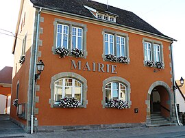 The town hall in Friesenheim | |
 Coat of arms | |
show Location of Friesenheim | |
 Friesenheim | |
| Coordinates: 48°18′37″N 7°40′18″E / 48.3103°N 7.6717°ECoordinates: 48°18′37″N 7°40′18″E / 48.3103°N 7.6717°E | |
| Country | France |
| Region | Grand Est |
| Department | Bas-Rhin |
| Arrondissement | Sélestat-Erstein |
| Canton | Erstein |
| Government | |
| • Mayor (2014–2020) | André Klumb |
| Area 1 | 12.03 km2 (4.64 sq mi) |
| Population (Jan. 2018)[1] | 622 |
| • Density | 52/km2 (130/sq mi) |
| Time zone | UTC+01:00 (CET) |
| • Summer (DST) | UTC+02:00 (CEST) |
| INSEE/Postal code | 67146 /67860 |
| Elevation | 158–163 m (518–535 ft) (avg. 160 m or 520 ft) |
| 1 French Land Register data, which excludes lakes, ponds, glaciers > 1 km2 (0.386 sq mi or 247 acres) and river estuaries. | |


show This article may be expanded with text translated from the corresponding article in French. (December 2008) Click [show] for important translation instructions. |
Friesenheim is a commune in the Bas-Rhin department in Grand Est in north-eastern France.
Economy[]
Friesenheim retains a strongly agricultural economy. The sight of old drying racks for tobacco leaves brings to mind just one of the many crops that flourish in the gently warm climate of the alluvial riverside fields surrounding the village.
See also[]
References[]
- ^ "Populations légales 2018". INSEE. 28 December 2020.
| Wikimedia Commons has media related to Friesenheim (Bas-Rhin). |
| show Authority control |
|---|
This Bas-Rhin geographical article is a stub. You can help Wikipedia by . |
Categories:
- Communes of Bas-Rhin
- Bas-Rhin geography stubs