God's Lake First Nation
God's Lake | |
|---|---|
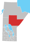
 God's Lake Location of God's Lake in Manitoba | |
| Coordinates: 54°34′14″N 94°27′53″W / 54.57056°N 94.46472°WCoordinates: 54°34′14″N 94°27′53″W / 54.57056°N 94.46472°W | |
| Country | Canada |
| Province | Manitoba |
| Region | Northern |
| Government | |
| • MP (Churchill—Keewatinook Aski) | Niki Ashton (NDP) |
| • MLA (Keewatinook) | Ian Bushie (NDP) |
| Area | |
| • Total | 47.06 km2 (18.17 sq mi) |
| Elevation | 178 m (584 ft) |
| Population (2016[1]) | |
| • Total | 982 |
| • Density | 20.9/km2 (54/sq mi) |
| Time zone | UTC-6 (CST) |
| • Summer (DST) | UTC-5 (CDT) |

God's Lake First Nation is a First Nations band government whose reserve is primarily located at an area known as God's Lake Narrows, about 250 kilometers southeast of Thompson, Manitoba. There are about 2,638 registered members of First Nation #296. They are Swampy Cree, and more specifically, Rocky Cree (Asinīskāwiyiniwak). The First Nation is a member of the Keewatin Tribal Council.
Demographics[]
As of September 2014 the total registered population of God's Lake First Nation was 2,638 with 1,482 members living on reserve or Crown Land and 1,156 members living off reserve.[2]
The 2011 Canada Census reported 1,341 inhabitants in the reserve known as God's Lake 23, the largest of 15 reserves of God's Lake First Nation.[3]
See also[]
References[]
- ^ "God's Lake Census Canada data". Census Canada. Retrieved 2018-06-20.
- ^ "AANDC (God's Lake First Nation)". Archived from the original on 2013-11-22. Retrieved 2014-10-07.
- ^ "2011 Community Profiles". Statistics Canada. Government of Canada. Retrieved 2014-10-07.
External links[]
| show Authority control |
|---|
This First Nations-related article is a stub. You can help Wikipedia by . |
This Manitoba location article is a stub. You can help Wikipedia by . |
- Keewatin Tribal Council
- Cree governments
- First Nations governments in Manitoba
- First Nations stubs
- Manitoba geography stubs
- First Nations in Northern Region, Manitoba