Red Sucker Lake First Nation
| People | Oji-Cree |
|---|---|
| Treaty | Treaty 5 |
| Headquarters | Red Sucker Lake, Manitoba |
| Land | |
| Main reserve | Red Sucker Lake 1976 |
| Government | |
| Chief | Samuel Knott[1] |
| Tribal Council | |
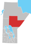
Red Sucker Lake is an Oji-Cree First Nation in Manitoba, Canada, located about 706 km (439 mi) northeast of Winnipeg. As of December 2014, the registered population was 1,067 of which 930 lived on their own reserve.[2]
Its main reserve is Red Sucker Lake 1976, which contains the community of Red Sucker Lake, Manitoba.
Historically, the peoples of Red Sucker Lake were part of the Island Lake Band, which also included nearby First Nations of Garden Hill, St. Theresa Point, and Wasagamack. They are a signatory to the 1909 adhesion to Treaty 5.
History[]
Red Sucker Lake First Nations once belonged to the Island Lake band,[3] who, on 13 August 1909, became a signatory of Treaty 5. In 1969, Island Lake split into four separate communities with their own separate administrations: Garden Hill, Wasagamack, St. Theresa Point First Nations, and Red Sucker Lake.[4] Today, the four communities have a Tribal Council, called ,[5] to collaborate on common interests.[4][6]
Reserves[]
The First Nation has eight reserves:[2]
| Reserve[2] | Coordinates[7] | Total area | Notes |
|---|---|---|---|
| Red Sucker Lake 1976 | 54°9′39″N 93°34′10″W / 54.16083°N 93.56944°W | 252.60 ha (624.2 acres) | Serves as the First Nation's main reserve and contains the community of Red Sucker Lake, Manitoba. It is located 224 km (139 mi) from the city of Thompson |
| Red Sucker Lake 1976 A | 54°9′11″N 93°29′44″W / 54.15306°N 93.49556°W | 1,729.90 ha (4,274.7 acres) | |
| Red Sucker Lake 1976 B | 54°6′27″N 93°31′57″W / 54.10750°N 93.53250°W | 1,069.30 ha (2,642.3 acres) | |
| Red Sucker Lake 1976 C | 54°12′24″N 93°52′13″W / 54.20667°N 93.87028°W | 443.60 ha (1,096.2 acres) | |
| Red Sucker Lake 1976 D | 54°10′20″N 93°47′14″W / 54.17222°N 93.78722°W | 57.90 ha (143.1 acres) | |
| Red Sucker Lake 1976 F | 54°5′58″N 93°43′43″W / 54.09944°N 93.72861°W | 28.40 ha (70.2 acres) | |
| Red Sucker Lake 1976 G | 10.90 ha (26.9 acres) | ||
| Red Sucker Lake 1976 H | 129.90 ha (321.0 acres) |

Governance[]
The First Nation elect their officials through the . Their council consists of a Chief and six councillors.[2]
The First Nation maintains political affiliations with the (ILTC), (MKO), Assembly of Manitoba Chiefs (AMC), and Indian and Northern Affairs Canada (INAC).[2]
Notable people[]
See also[]
References[]
- ^ Laychuk, Riley (December 14, 2020). "Community 'still panicking' as military arrives in Red Sucker Lake First Nation amid COVID-19 outbreak: chief". CBC News. Retrieved August 28, 2021.
- ^ Jump up to: a b c d e Indigenous and Northern Affairs Canada. "Red Sucker Lake | First Nation Detail". AANDC. Retrieved 2021-08-18.
- ^ "About Us". St. Theresa Point First Nations. Retrieved 2021-08-18.
- ^ Jump up to: a b "First Nation History". St. Theresa Point First Nations. Retrieved 2021-08-18.
- ^ "Island Lake Tribal Council Inc". Indigenous and Northern Affairs Canada. 2019-04-09. Retrieved 2021-08-18.
- ^ "AANDC (Registered Population)". Retrieved 2015-01-14.
- ^ "Search Results for Red Sucker Lake". Government of Canada. Retrieved August 28, 2021.
External links[]
Coordinates: 54°09′39″N 93°34′10″W / 54.16083°N 93.56944°W
- First Nations governments in Manitoba
- Island Lake Tribal Council
- First Nations in Northern Region, Manitoba