Opaskwayak Cree Nation
hideThis article has multiple issues. Please help or discuss these issues on the talk page. (Learn how and when to remove these template messages)
|
| People | Swampy Cree |
|---|---|
| Treaty | Treaty 5 |
| Province | |
| Land[1] | |
| Main reserve | OCN 21E |
| Other reserve(s) |
|
| Land area | 177.851 km2 |
| Population (2019)[1] | |
| On reserve | 3357 |
| On other land | 22 |
| Off reserve | 2866 |
| Total population | 6245 |
| Government[1] | |
| Chief | Christian Sinclair |
| Tribal Council[1] | |
| Website | |
| https://opaskwayakcreenation.ca/ | |
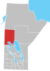
The Opaskwayak Cree Nation (/ˌoʊpəˈskwaɪək/; OCN) is a First Nations band government in Manitoba, Canada. Most of the on-reserve population lives near The Pas on the OCN 21E reserve, but the band also has many other reserves stretching from Goose Lake in the north to Mountain Cabin, Saskatchewan in the south.
The First Nation hosts the Opaskwayak Indian Days annually each August. OCN is accessible by rail, road, water, and air travel.
History[]
The current townsite of Opaskwayak, reserve parcel 21E, was a historical gathering place where people travelled for spiritual healing. The area Cree would meet here every summer to fish, harvest, and cultivate the land. Also during this time it was an opportunity for creating social ties and practising the ceremonial way of life known as the Metewiwin or Grand Medicine Society.
The language of the Opaskwayak people is from the Swampy Cree n-dialect. There was a number of local bands who shared the same defined territory which in turn, composed of a number of interrelated families who came together periodically through the year for various social, cultural activities and ceremonies.
When the Opaskwayak people signed Treaty 5 on in 1876, the federal government agreed to give the band Timber Rights. In 1904, the band opened a sawmill on Mission Island in the Saskatchewan River. Soon after, the band surrendered their land on the south side of the river, and in 1908, they moved their sawmill to the north side. The sawmill operated intermittently until 1930, and provided wood for most of the homes built in the first few decades of the 20th century.[2]
The nation has made many developments, including the Joe. A. Ross, Oscar Lathlin Collegiate, and a Community Hall known as the 'Veteran's Hall' for the events such as bingos, socials and community events, etc. The local hotel, known as Kikiwak Inn, was built and completed in July 1996. The Otineka Shopping Mall was built in the early 1970s and opened in the 1975 which has various retail outlets. The McGillivary Care Home was constructed in 1982 for community elders. The community of Opaskwayak Cree Nation has two churches on the reserve. The Church of Redeemer is situated in Big Eddy, and the Church of Messiah is situated in the townsite area. Both of these churches have been recently constructed to replace the old churches.
According to oral traditions Cree people have occupied the landscape of north-central Manitoba since a time before memory; archaeology supports this. The earliest archeological evidence of the people occupying the area has been carbon dated 2,600–4,000 years ago.
Government[]
The Band is governed by the Chief and eight Councillors, who are elected according to its own election code which was adopted by its members in 2012, for a three-year term. The reserve consists of 24 parcels of land varying in size from 10 to 5200 acres and totaling about 45,000 acres. The most populated settlements are located in and around The Pas. Most of the reserve's borders are with the Rural Municipality of Kelsey and The Pas. The balance is with the unorganized portion of Census Division No. 21.
See also[]
References[]
- ^ "First Nation Detail". Indigenous and Northern Affairs Canada. Government of Canada. Retrieved November 9, 2019.
- ^ Nicholson, Karen (February 2000). "The Lumber Industry in Manitoba" (PDF). Manitoba Culture, Heritage, Tourism and Sport - Historic Resources Branch. Retrieved October 26, 2019.
External links[]
Coordinates: 53°48′58″N 101°15′07″W / 53.816°N 101.252°W

| show Places adjacent to Opaskwayak Cree Nation |
|---|
| show Authority control |
|---|
- First Nations governments in Manitoba
- Swampy Cree Tribal Council
- Cree governments