Grit Fell
| Grit Fell | |
|---|---|
 Looking east from Grit Fell towards Ward's Stone | |
| Highest point | |
| Elevation | 468 m (1,535 ft) |
| Prominence | c. 33 m (108 ft) |
| Coordinates | 54°01′24″N 2°40′40″W / 54.02329°N 2.67768°WCoordinates: 54°01′24″N 2°40′40″W / 54.02329°N 2.67768°W |
| Geography | |
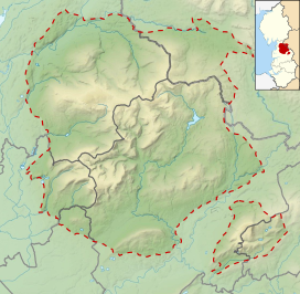 Grit Fell Location in the Forest of Bowland | |
| Location | Forest of Bowland, England |
| OS grid | SD557588 |
| Topo map | OS Landranger 102 |


Grit Fell is a lonely hill between Clougha Pike and Ward's Stone in the Forest of Bowland in Lancashire, England.[1] Covered by heather and large bogs, it is difficult walking country. The path from Jubilee Tower car park in the south is difficult and treacherous, with sheer-sided bogs 6 feet (1.83 m) deep. The path from Clougha Pike in the west is better, but still contains bogs crossed by the odd plank of wood. The path from Ward's Stone is the most treacherous of all. Crossing Cabin Flat, it weaves its way across hidden pools of stagnant water, the presence of which is betrayed by a form of red grass.
The summit is fairly inconspicuous, with only cairns and a wall.
References[]
- ^ "LANCASHIRE RECOMMENDS - 5 best walks" - Lancashire Evening Post, 13 June 2016
This Lancashire location article is a stub. You can help Wikipedia by . |
Categories:
- Hills of the Forest of Bowland
- Mountains and hills of Lancashire
- Geography of the City of Lancaster
- Lancashire geography stubs