Hamilton County, New York
Hamilton County | |
|---|---|
 Hamilton County Courthouse in Lake Pleasant | |
 Flag  Seal | |
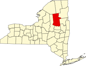 Location within the U.S. state of New York | |
 New York's location within the U.S. | |
| Coordinates: 43°39′N 74°30′W / 43.65°N 74.5°W | |
| Country | |
| State | |
| Founded | 1847 |
| Named for | Alexander Hamilton |
| Seat | Lake Pleasant |
| Largest CDP | Long Lake |
| Area | |
| • Total | 1,808 sq mi (4,680 km2) |
| • Land | 1,717 sq mi (4,450 km2) |
| • Water | 90 sq mi (200 km2) 5.0% |
| Population | |
| • Estimate (2019) | 4,416 |
| • Density | 2.8/sq mi (1.1/km2) |
| Time zone | UTC−5 (Eastern) |
| • Summer (DST) | UTC−4 (EDT) |
| Congressional district | 21st |
| Website | www |

Hamilton County is a county in the U.S. state of New York. As of the 2010 census, the population was 4,836,[1] making it the least populous county in New York. With an area nearly the size of Delaware, but with a population in 2019 of only 4,416,[2] it is the least densely populated county east of the Mississippi River. Its county seat is Lake Pleasant.[3] The county is named after Alexander Hamilton,[4] the only member of the New York State delegation who signed the United States Constitution in 1787 and later the first United States Secretary of the Treasury. The county was created in 1816 and organized in 1847.[5]
Hamilton County is one of only two counties that lie entirely within the Adirondack Park (Essex being the other). Because of its location in the park, any development in the county is restricted by the New York State Constitution, which designates the park as "forever wild." There is no permanent traffic light in the county.
History[]
On April 12, 1816, Hamilton County was created by partitioning 1,800 square miles (4,700 km2) from Montgomery County,[6] but due to low population it remained unorganized and administered from Montgomery County, N.Y. until it was recognized as sufficiently prepared for self-government on January 1, 1838.[7] The organization process was completed by summer 1847.[8]
On April 6, 1860, Fulton County was partitioned, with 10 square miles (26 km2) of land in Sacandaga Park transferred to Hamilton County.[9] On May 24, 1915, land was swapped between Hamilton and Essex counties, with Hamilton ceding Fishing Brook Mountain for Indian Lake. Hamilton gained an additional 20 square miles (52 km2), whereas Essex County lost 30 square miles (78 km2). This left Hamilton with its present size of 1,830 square miles (4,700 km2).[10]
The former town of Gilman was dissolved in 1860. The original county seat was Sageville, now part of Lake Pleasant.
Geography[]

According to the U.S. Census Bureau, the county has a total area of 1,808 square miles (4,680 km2), of which 1,717 square miles (4,450 km2) is land and 90 square miles (230 km2) (5.0%) is water.[11] It is New York's third-largest county by land area and fifth-largest by total area.
Hamilton County is in state's north central part, northwest of Albany. It lies entirely within Adirondack Park and consists mostly of publicly owned parkland.
Adjacent counties[]
- Franklin County - north
- Essex County - northeast
- Warren County - east
- Saratoga County - southeast
- Fulton County - south
- Herkimer County - west
- St. Lawrence County - northwest
Demographics[]
| Historical population | |||
|---|---|---|---|
| Census | Pop. | %± | |
| 1820 | 1,251 | — | |
| 1830 | 1,325 | 5.9% | |
| 1840 | 1,907 | 43.9% | |
| 1850 | 2,188 | 14.7% | |
| 1860 | 3,024 | 38.2% | |
| 1870 | 2,960 | −2.1% | |
| 1880 | 3,923 | 32.5% | |
| 1890 | 4,762 | 21.4% | |
| 1900 | 4,947 | 3.9% | |
| 1910 | 4,373 | −11.6% | |
| 1920 | 3,970 | −9.2% | |
| 1930 | 3,929 | −1.0% | |
| 1940 | 4,188 | 6.6% | |
| 1950 | 4,105 | −2.0% | |
| 1960 | 4,267 | 3.9% | |
| 1970 | 4,714 | 10.5% | |
| 1980 | 5,034 | 6.8% | |
| 1990 | 5,279 | 4.9% | |
| 2000 | 5,379 | 1.9% | |
| 2010 | 4,836 | −10.1% | |
| 2020 | 5,107 | 5.6% | |
| U.S. Decennial Census[12] 1790-1960[13] 1900-1990[14] 1990-2000[15] 2010-2018[1] | |||
As of the census[16] of 2000, there were 5,379 people, 2,362 households, and 1,558 families residing in the county. The population density was 1/km2 (3/sq mi); both the total population and population density rank lowest in the state of New York. There were 7,965 housing units at an average density of 5 per square mile (2/km2). The racial makeup of the county was 97.73% White, 0.45% Black or African American, 0.26% Native American, 0.15% Asian, 0.06% Pacific Islander, 0.67% from other races, and 0.69% from two or more races. 1.06% of the population were Hispanic or Latino of any race. 16.9% were of Irish, 15.7% German, 15.2% English, 10.9% French, 7.3% American and 5.7% Italian ancestry. 97.5% spoke English and 1.7% French as their first language.
There were 2,362 households, out of which 23.60% had children under the age of 18 living with them, 55.70% were married couples living together, 6.70% had a female householder with no husband present, and 34.00% were non-families. 29.60% of all households were made up of individuals, and 13.70% had someone living alone who was 65 years of age or older. The average household size was 2.24 and the average family size was 2.74.
In the county, the population was spread out, with 19.70% under the age of 18, 5.20% from 18 to 24, 24.20% from 25 to 44, 30.90% from 45 to 64, and 20.00% who were 65 years of age or older. The median age was 45 years. For every 100 females there were 100.00 males. For every 100 females age 18 and over, there were 99.40 males.
The median income for a household in the county was $32,287, and the median income for a family was $39,676. Males had a median income of $29,177 versus $21,849 for females. The per capita income for the county was $18,643. About 6.00% of families and 10.40% of the population were below the poverty line, including 10.50% of those under age 18 and 8.70% of those age 65 or over.
Government and politics[]
| Year | Republican | Democratic | Third parties |
|---|---|---|---|
| 2020 | 64.3% 2,225 | 34.1% 1,178 | 1.6% 57 |
| 2016 | 64.0% 2,064 | 29.4% 949 | 6.6% 212 |
| 2012 | 62.1% 1,932 | 36.2% 1,128 | 1.7% 53 |
| 2008 | 62.8% 2,141 | 35.9% 1,225 | 1.3% 45 |
| 2004 | 67.0% 2,475 | 31.0% 1,145 | 2.0% 75 |
| 2000 | 64.9% 2,388 | 30.3% 1,114 | 4.9% 180 |
| 1996 | 51.0% 1,841 | 34.0% 1,228 | 15.0% 543 |
| 1992 | 53.4% 2,038 | 25.2% 963 | 21.4% 816 |
| 1988 | 69.9% 2,320 | 29.4% 976 | 0.6% 21 |
| 1984 | 78.0% 2,637 | 21.8% 737 | 0.2% 8 |
| 1980 | 63.1% 2,038 | 28.6% 925 | 8.3% 267 |
| 1976 | 68.4% 2,306 | 31.2% 1,052 | 0.4% 12 |
| 1972 | 77.9% 2,597 | 21.9% 731 | 0.2% 6 |
| 1968 | 69.5% 2,123 | 25.0% 762 | 5.5% 168 |
| 1964 | 44.2% 1,269 | 55.8% 1,603 | 0.0% 1 |
| 1960 | 73.1% 2,168 | 26.8% 795 | 0.0% 1 |
| 1956 | 84.8% 2,619 | 15.2% 470 | 0.0% 0 |
| 1952 | 82.7% 2,615 | 17.3% 546 | 0.1% 3 |
| 1948 | 71.7% 2,000 | 26.7% 744 | 1.7% 46 |
| 1944 | 68.6% 1,834 | 31.1% 830 | 0.3% 9 |
| 1940 | 70.6% 2,029 | 29.2% 840 | 0.1% 4 |
| 1936 | 64.5% 1,695 | 35.5% 934 | 0.0% 0 |
| 1932 | 58.8% 1,603 | 40.6% 1,107 | 0.7% 18 |
| 1928 | 59.5% 1,399 | 40.5% 952 | 0.0% 0 |
| 1924 | 61.2% 1,063 | 36.4% 631 | 2.4% 42 |
| 1920 | 62.7% 881 | 36.7% 516 | 0.6% 9 |
| 1916 | 49.0% 612 | 49.8% 623 | 1.2% 15 |
| 1912 | 40.0% 454 | 43.4% 493 | 16.6% 188 |
| 1908 | 50.0% 632 | 46.4% 586 | 3.6% 46 |
| 1904 | 50.7% 688 | 48.3% 655 | 1.0% 13 |
| 1900 | 55.0% 651 | 43.0% 509 | 2.0% 24 |
| 1892 | 44.6% 454 | 47.1% 480 | 8.3% 85 |
Hamilton County has long been one of the most consistently Republican counties in New York. Since Woodrow Wilson carried the county in 1916,[18] the Republican candidate has lost only once, when Barry Goldwater in 1964 failed to win a single county in the state. The county was Goldwater's third strongest in the state however.[19] In the 2008 U.S. presidential election, John McCain carried Hamilton County by a 26.9% margin over Barack Obama, with Obama winning statewide by a virtually equal margin over McCain; Republican nominee Mitt Romney won the county over President Obama in the 2012 election, too.[20] Hamilton gave McCain the highest margin of victory in the state.[21]
It was the only county won by Howard Mills over incumbent Chuck Schumer in the 2004 U.S. Senate election. It also voted for John Faso over Eliot Spitzer for governor in 2006, and for John Spencer 55.5%-42.1% over incumbent Hillary Clinton for the U.S. Senate in 2006, despite Faso and Spencer both losing in landslides statewide. It was one of only a handful of counties outside Western New York to have voted for Carl Paladino over eventual winner Andrew Cuomo for Governor in 2010.
Democrat Kirsten Gillibrand, however, won the county in her bid to be elected for a full term to the U.S. Senate in 2012.[22]
Transportation[]
Airports[]
The following public use airports are located in the county:[23]
- Piseco Airport (K09) – Piseco
- Long Lake Helms Seaplane Base (NY9) – Long Lake
- Long Lake Sagamore Seaplane Base (K03) – Long Lake
Ground[]
Communities[]
Larger Settlements[]
| # | Location | Population | Type |
|---|---|---|---|
| 1 | Long Lake | 547 | CDP |
| 2 | Speculator | 324 | Village |
| - | Wells | N/A | CDP |
Towns[]
Other hamlets[]
- Arietta
- Benson
- Blue Mountain Lake
- Higgins Bay
- Hoffmeister
- Hope
- Hope Falls
- Indian Lake
- Inlet
- Lake Pleasant (county seat)
- Piseco
- Raquette Lake
- Upper Benson
Former hamlet[]
- Sabattis (formerly Long Lake West)
See also[]
- List of counties in New York
- National Register of Historic Places listings in Hamilton County, New York
References[]
- ^ Jump up to: a b "State & County QuickFacts". United States Census Bureau. Archived from the original on June 7, 2011. Retrieved October 11, 2013.
- ^ "U.S. Census Bureau QuickFacts: Hamilton County, New York". www.census.gov. Retrieved 2020-03-28.
- ^ "Find a County". National Association of Counties. Retrieved June 7, 2011.
- ^ Gannett, Henry (1905). The Origin of Certain Place Names in the United States. Govt. Print. Off. pp. 147.
- ^ "New York: Individual County Chronologies". New York Atlas of Historical County Boundaries. The Newberry Library. 2008. Archived from the original on April 10, 2015. Retrieved January 9, 2015.
- ^ New York. Laws of New York;1816; 39th Session; Chapter 120; Section 1; Page 16.
- ^ New York. Laws of New York;1837; 60th Session; Chapter 238; Section 1; Page 227.
- ^ Aber, Ted, and King, Stella (1965). History of Hamilton County. Lake Pleasant, New York: . p. 51.
- ^ New York. Laws of New York;1860; 83rd Session; Chapter 178; Page 298.
- ^ New York. Laws of New York;1915; 138th Session; Chapter 718; Section 1; Page 2364.
- ^ "2010 Census Gazetteer Files". United States Census Bureau. August 22, 2012. Archived from the original on May 19, 2014. Retrieved January 5, 2015.
- ^ "U.S. Decennial Census". United States Census Bureau. Retrieved January 5, 2015.
- ^ "Historical Census Browser". University of Virginia Library. Retrieved January 5, 2015.
- ^ "Population of Counties by Decennial Census: 1900 to 1990". United States Census Bureau. Retrieved January 5, 2015.
- ^ "Census 2000 PHC-T-4. Ranking Tables for Counties: 1990 and 2000" (PDF). United States Census Bureau. Retrieved January 5, 2015.
- ^ "U.S. Census website". United States Census Bureau. Retrieved January 31, 2008.
- ^ Leip, David. "Dave Leip's Atlas of U.S. Presidential Elections". uselectionatlas.org. Retrieved 2018-10-22.
- ^ The Political Graveyard; Hamilton County, New York
- ^ "Dave Leip's Atlas of U.S. Presidential Elections - Data Graphs".
- ^ "Dave Leip's Atlas of U.S. Presidential Elections". uselectionatlas.org.
- ^ "County Results - Election Center 2008". www.cnn.com.
- ^ "The county backs Gillibrand". Archived from the original on March 6, 2016.
- ^ Hamilton County Public and Private Airports, New York. Retrieved June 13, 2013.
External links[]
- Hamilton County Information
- More county data
- Hamilton County at Curlie
- Speculator Region Chamber of Commerce
- Brief history
| show Places adjacent to Hamilton County, New York |
|---|
| show Municipalities and communities of Hamilton County, New York, United States |
|---|


Coordinates: 43°40′N 74°30′W / 43.66°N 74.50°W
| show Authority control |
|---|
- New York (state) counties
- Hamilton County, New York
- Adirondacks
- 1847 establishments in New York (state)
- Populated places established in 1847
- Adirondack Park