Hartsel, Colorado
Hartsel, Colorado | |
|---|---|
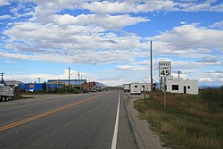 U.S. Highway 24 in Hartsel. | |
 Hartsel Location of the Hartsel CDP in the State of Colorado. | |
| Coordinates: 39°01′19″N 105°47′53″W / 39.0220753°N 105.7981746°WCoordinates: 39°01′19″N 105°47′53″W / 39.0220753°N 105.7981746°W[1] | |
| Country | |
| State | |
| County | Park County |
| Founded | 1880 |
| Government | |
| • Type | unincorporated town |
| Area | |
| • Total | 0.192 sq mi (0.498 km2) |
| • Land | 0.188 sq mi (0.486 km2) |
| • Water | 0.005 sq mi (0.012 km2) |
| Elevation | 8,904 ft (2,714 m) |
| Time zone | UTC-7 (MST) |
| • Summer (DST) | UTC-6 (MDT) |
| ZIP Code[3] | 80449 |
| Area code(s) | 719 |
| GNIS feature[2] | Hartsel CDP |

Hartsel is an unincorporated town, a post office, and a census-designated place (CDP) located in and governed by Park County, Colorado, United States. The Hartsel post office has the ZIP Code 80449.[3] At the United States Census 2010, the population of the 80449 ZIP Code Tabulation Area was 909 including adjacent areas.[4] The CDP is a part of the Denver–Aurora–Lakewood, CO Metropolitan Statistical Area.
History[]
Founded in 1880, Hartsel is close to the geographic center of the state, and is often referred to as "The Heart of Colorado". The namesake of the community is Samuel Hartsel,[5] a local cattle rancher who came to Park County in 1860 and left in 1908. He also raised pigs and sheep and grew oats, wheat, barley, rye, and hay on fifteen thousand acres. He developed the Hartsel hot springs and built a sawmill, blacksmith shop, and a trading post to lay the groundwork for the town.[6]

Geography[]
The Hartsel CDP has an area of 123 acres (0.498 km2), including 3.0 acres (0.012 km2) of water.[1]
Climate[]
According to the Köppen climate classification system, Hartsel has a Cold Semi-arid climate (BSk). According to the United States Department of Agriculture, the Plant Hardiness zone is 3b with an average annual extreme minimum temperature of −30.7 °F (−34.8 °C).[7]
Summers are warm with chilly nights in the 30s and 40s (°F) and some thunderstorm activity during the months of July and August. Winters are cold and dry with lows below zero.[8][9] A climate writeup consisting of interpolated data is below.
| hideClimate data for Hartsel, Park County, CO. Elevation 8901 ft. | |||||||||||||
|---|---|---|---|---|---|---|---|---|---|---|---|---|---|
| Month | Jan | Feb | Mar | Apr | May | Jun | Jul | Aug | Sep | Oct | Nov | Dec | Year |
| Average high °F (°C) | 35.1 (1.7) |
37.1 (2.8) |
42.6 (5.9) |
49.9 (9.9) |
60.1 (15.6) |
70.6 (21.4) |
76.3 (24.6) |
73.5 (23.1) |
67.2 (19.6) |
56.0 (13.3) |
43.5 (6.4) |
35.1 (1.7) |
54.0 (12.2) |
| Average low °F (°C) | 2.2 (−16.6) |
4.5 (−15.3) |
13.6 (−10.2) |
20.2 (−6.6) |
28.7 (−1.8) |
35.8 (2.1) |
41.2 (5.1) |
40.3 (4.6) |
32.0 (0.0) |
21.7 (−5.7) |
12.5 (−10.8) |
2.9 (−16.2) |
21.4 (−5.9) |
| Average precipitation inches (mm) | 0.35 (8.9) |
0.25 (6.4) |
0.84 (21) |
0.81 (21) |
1.09 (28) |
1.19 (30) |
2.05 (52) |
2.56 (65) |
1.05 (27) |
0.90 (23) |
0.37 (9.4) |
0.40 (10) |
11.86 (301) |
| Average relative humidity (%) | 56.0 | 52.2 | 51.0 | 46.4 | 44.3 | 40.5 | 45.5 | 52.5 | 47.0 | 44.0 | 48.4 | 53.1 | 48.4 |
| Average dew point °F (°C) | 5.5 (−14.7) |
6.0 (−14.4) |
12.2 (−11.0) |
16.5 (−8.6) |
24.0 (−4.4) |
29.8 (−1.2) |
37.8 (3.2) |
39.7 (4.3) |
30.2 (−1.0) |
18.8 (−7.3) |
11.0 (−11.7) |
4.7 (−15.2) |
19.8 (−6.8) |
| Source: PRISM Climate Group[10] | |||||||||||||

Ecology[]
According to the A. W. Kuchler U.S. Potential natural vegetation Types, Hartsel would have a Wheatgrass / Needlegrass (66) vegetation type and a North Mixed grass prairie (7) vegetation form.[11]
See also[]
- Outline of Colorado
- State of Colorado
- Colorado cities and towns
- Colorado census designated places
- Colorado counties
- Colorado cities and towns
References[]
- ^ Jump up to: a b c "State of Colorado Census Designated Places - BAS20 - Data as of January 1, 2020". United States Census Bureau. Retrieved December 26, 2020.
- ^ Jump up to: a b c "U.S. Board on Geographic Names: Domestic Names". United States Geological Survey. Retrieved December 26, 2020.
- ^ Jump up to: a b "Look Up a ZIP Code". United States Postal Service. Retrieved December 26, 2020.
- ^ "2010: DEC Summary File 1". United States Census Bureau. Retrieved December 26, 2020.
- ^ Dawson, John Frank. Place names in Colorado: why 700 communities were so named, 150 of Spanish or Indian origin. Denver, CO: The J. Frank Dawson Publishing Co. p. 26.
- ^ Laura King Van Dusen, "Samuel Hartsel: 1860s Pioneer Rancher, One of Colorado's First Cattlemen. Founded Town of Hartsel", Historic Tales from Park County: Parked in the Past (Charleston, South Carolina: The History Press, 2013), ISBN 978-1-62619-161-7, pp. 21-27.[need quotation to verify]
- ^ "USDA Interactive Plant Hardiness Map". United States Department of Agriculture. Retrieved 2019-07-11.
- ^ Team, National Weather Service Corporate Image Web. "National Weather Service Climate". w2.weather.gov. Retrieved 2020-05-29.
- ^ "HARTSEL, COLORADO - Climate Summary". wrcc.dri.edu. Retrieved 2020-05-29.
- ^ "PRISM Climate Group, Oregon State University". www.prism.oregonstate.edu. Retrieved July 10, 2019.
- ^ "U.S. Potential Natural Vegetation, Original Kuchler Types, v2.0 (Spatially Adjusted to Correct Geometric Distortions)". . Retrieved 2019-07-11.
External links[]
 Definitions from Wiktionary
 Media from Wikimedia Commons
 News from Wikinews
 Quotations from Wikiquote
 Texts from Wikisource
 Textbooks from Wikibooks
 Resources from Wikiversity
- Hartsel @ Colorado.com
- Hartsel @ UncoverColorado.com
- Hartsel @ Sangres.com
- Hartsel @ GhostTowns.com
- Hartsel Area Historic Sites
- Park County website
| show Municipalities and communities of Park County, Colorado, United States |
|---|

- Unincorporated communities in Park County, Colorado
- Unincorporated communities in Colorado