Highway 66 (Israel)
 | ||||
|---|---|---|---|---|
| כביש 66 | ||||
 | ||||
| Route information | ||||
| Length | 17 km (11 mi) | |||
| Existed | 1929–present | |||
| Highway system | ||||
| Roads in Israel Highways
| ||||
Highway 66 is a north-south highway in the Jezreel Valley in northern Israel. It extends along the eastern lowlands below the Menashe Heights and the Carmel. It is 17 kilometres (11 mi) long. In the past the road continued south to Jenin, but today it ends at checkpoint.
The northern section of the highway was constructed in 1929 to allow access to Tel Megiddo archaeological site for the anticipated visit of John D. Rockefeller Jr. The southern section was constructed in the 1930s, and the highway opened to general traffic between Haifa and Jenin in 1936 as a bypass road avoiding Nazareth.
Interchanges & Junctions (South to North)[]
This article contains a bulleted list or table of intersections which should be presented in a properly formatted junction table. (November 2021) |
| Kilometers | Name | type | Location | Intersecting routes | |
|---|---|---|---|---|---|
| Green Line | |||||
| Salem Security Checkpoint[1] | |||||
| 0 | checkpoint | Salem, Zububa |
|||
| 1 | Givat Oz Junction | Giv'at Oz | entrance road | ||
| 3 | Megiddo junction | Megiddo | |||
| 4.8 | Megiddo | local road | |||
| 5.5 | HaYogev Junction | HaYogev | local road | ||
| 7.4 | Midrakh Oz Junction | Midrakh Oz | local road | ||
| 10 | Mishmar Ha'Emek Junction | Mishmar Ha'Emek | |||
| 14 | HaZore'a Junction | HaZore'a | local road | ||
| 17 | HaTishbi Junction | Yokneam | |||
| 18 | Tel Kashish Interchange | Yokneam | |||
Places of interest on Highway 66[]
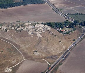
- Tel Megiddo National Park[2]
See also[]
- List of highways in Israel
References[]
- ^ "Checkpoints in the West Bank and Gaza". B’Tselem. 2019-09-25. Retrieved 2020-08-18.
- ^ "Tel Megiddo National Park". The Israel Nature and Parks Authority. Retrieved 2020-08-18.
| Roads |
| ||||
|---|---|---|---|---|---|
| Bus operators | |||||
| Rail transport |
| ||||
| Cycle infrastructure | |||||
| Sea ports | |||||
| Aviation |
| ||||
| Cable cars |
| ||||
| By city | |||||
| Smart cards | |||||
Coordinates: 32°37′14″N 35°08′13″E / 32.62056°N 35.13694°E

Categories:
- Roads in Israel