Highway 4 (Israel)
This article needs additional citations for verification. (June 2010) |
  | ||||
|---|---|---|---|---|
| כביש 4 | ||||
| Hebrew: כביש נהריה - אשקלון, romanized: Kvish Nahariyya–Ashqelon Hebrew: כביש גהה, romanized: Kvish Geha Hebrew: כביש חיפה - תל אביב הישן, romanized: Kvish Haifa–Tel Aviv HaYashan | ||||
 | ||||
| Route information | ||||
| Part of (Ratified by Palestine but not by Israel) | ||||
| Length | 205 km (127 mi) | |||
| Major junctions | ||||
| South end | Erez Border Crossing with Gaza (Hevel Azzah Junction) | |||
| ||||
| North end | Rosh HaNikra Border Crossing with Lebanon | |||
| Location | ||||
| Major cities | Ashkelon, Ashdod, Yavne, Rishon LeZion, Holon, Tel Aviv, Ramat Gan, Giv'atayim, Bnei Brak, Petah Tikva, Ramat Hasharon, Hod HaSharon, Kfar Saba, Ra'anana, Netanya, Hadera, Pardes Hanna-Karkur, Zikhron Ya'akov, Tirat Carmel, Haifa, The Kerayot, Acre, Nahariya | |||
| Highway system | ||||
| ||||
| ||||
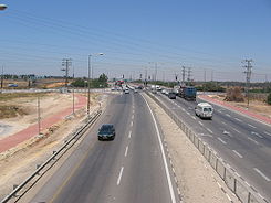
Highway 4 (Hebrew: כּֽבִישׁ אַרְבַּע, Kvish Arba' ) is an Israeli highway that runs along Israel's entire coastal plain of the Mediterranean Sea, from the Rosh HaNikra border crossing with Lebanon in the North to the Erez Border Crossing with the Gaza Strip in the South. The highway follows in part the route of the ancient Via Maris.
Until the 1990s and the withdrawal of Israel Defense Forces from most of the Gaza Strip due to the Oslo Accords, Highway 4 continued all the way until Rafah and the Egyptian border. The part of the remaining highway in the Gaza Strip is called Salah al-Din Road.
Although the highway is continuous, it is generally considered to be divided into five sections, each with its own nickname and characteristics such as a differing number of lanes and speed limits:
- Northern Coastal Highway (Rosh Hanikra–Haifa). This section passes through the Krayot, Acre and Nahariya in Northern Israel. The southern third of the highway bisects the densely populated Krayot area and frequently experienced heavy traffic congestion until a bypass freeway, Highway 22, was constructed in the early 2010s several kilometers to the east of Highway 4.
- Haifa–Tel Aviv Highway (Haifa–Ra'anana). Commonly referred to in Israel as The Old Highway (Hebrew: הכביש הישן; כביש חיפה - תל אביב עם רמזורים) while Highway 2 is sometimes called The New Highway. The construction of this section started in the early 1930s, and by 1936, it had reached Khirbat Bayt Lid. During the 1936–39 Arab revolt in Palestine, the construction speed greatly increased in order to allow Jewish traffic from Tel Aviv and Petah Tikva to Haifa to bypass the Arab towns of Qalqilyah, Tulkarm and Jenin. The highway opened to traffic on 30 September 1937, reducing the travel distance between Tel Aviv and Haifa from 140 to 106 km.[1] The distance was further reduced to 96 km by 1942, when a direct road opened between Hadera and Binyamina bypassing Pardes Hanna.[2]
- Geha Highway, or First President Road (Ra'anana–Azor). This functions as an important arterial road in the eastern portion of the Tel Aviv Metropolitan Area. Designed as a shortcut to replace the southern section of the Old Haifa–Tel Aviv Highway, the construction of Geha Highway started in 1951, and was completed in 1968. The replaced section of the Old Highway was then re-designated as the northern section of Highway 40, and later in 2002, as .
- Tel Aviv–Ashdod Highway (Azor–Ashdod), constructed in the early 1970s to relieve congestion on Highway 42, caused by the freight traffic to the Port of Ashdod which opened in 1965.
- Southern Coastal Highway (Ashdod–Erez Crossing) is the oldest section of the highway: a road along this route had existed since before the World War I.
The Tel Aviv–Ashdod and Geha sections are freeways. The rest of the highway consists of multiple lanes in each direction except between Erez Crossing and Yad Mordechai, Rosh HaNikra and Nahariya, and between Tirat Carmel just south of Haifa and Fureidis, which have a single lane of traffic in each direction. While there have been multiple proposals to widen the Haifa–Fureidis section, these have so far been blocked due to opposition from nearby residents who would like the highway in the area to retain its current rural character.
Current and planned construction[]
| External video | |
|---|---|
As of 2016, Netivei Yisrael is planning a multi-billion Shekel project to convert the Sharon section of the highway (between the Dror Interchange and Highway 65 north of Hadera) to a freeway.[3] The project includes a massive interchange at the junction with Highway 57 and a long cut-and-cover tunnel with a road and intersections above it at the entrance to Hadera to separate local and intercity traffic.
Junctions and interchanges[]
This article contains a bulleted list or table of intersections which should be presented in a properly formatted junction table. (November 2021) |

| External video | |
|---|---|
| km | Name | Type | Meaning | Location | Road(s) crossed |
|---|---|---|---|---|---|
| Southern Coastal Highway | |||||
| 0 | צומת חבל עזה (Hevel 'Azza Junction) |
Gaza Strip | Erez border crossing | local road | |
| 1 | צומת נתיב העשרה (Netiv HaAsara Junction) |
Named after location | Netiv HaAsara | ||
| 4 | צומת יד מרדכי (Yad Mordechai Junction) |
Named after location | Yad Mordechai | ||
| 6 | צומת זיקים (Zikim Junction) |
Named after location | Zikim | ||
| 8 | צומת מבקיעים (Mavki'im Junction) |
Named after location | Mavki'im | local road | |
| 9 | צומת אשקלון דרום (Ashkelon Darom Junction) |
Ashkelon South | Ashkelon | Bar-Lev Blvd. | |
| 11 | צומת בת הדר (Bat Hadar Junction) |
Named after location | Bat Hadar | local road | |
| 12 | צומת בית שיקמה (Beit Shikma Junction) |
Named after nearby Beit Shiqma |
Beit Shikma | ||
| 13 | צומת אשקלון (Ashkelon Junction) |
Named after location | Ashkelon | Ben Gurion Blvd. | |
| 14 | צומת ברכיה (Berekhya Junction) |
Named after location | Berekhya | ||
| 15 | צומת אבא הלל (Abba Hillel Junction) |
Named after Abba Hillel Silver |
Kfar Silver | ||
| 15.5 | Ashkelon (North) | Menachem Begin Blvd. | |||
| 21 | צומת אשכולות (Eshkolot Junction) |
Named after nearby Eshkolot Farm |
Nitzanim | ||
| 22 | צומת ניצנים (Nitzanim Junction) |
Named after location | Nitzan | ||
| 24 | צומת בית עזרא (Beit Ezra Junction) |
Named after location | Beit Ezra | HaEla St. | |
| 25 | צומת אמונים (Emunim Junction) |
Named after nearby Emunim | Ezer | ||
| 27 | צומת שדה עוזיהו (Sede uziyahu junction) |
Named after location | Sde Uziyahu | ||
| 27 | צומת עד הלום (Ad Halom Junction) |
Named after location | Ashdod (Ad Halom Industrial Area) |
local road | |
| 29 | מחלף עד הלום (Ad Halom Interchange) |
Ashdod South | Ashdod | Menachem Begin Blvd. | |
| 30 | צומת גן יבנה (Gan Yavne Junction) |
Named after location | Gan Yavne | Menachem Begin Blvd. | |
| Tel Aviv–Ashdod Highway (Ashdod interchange - Morasha interchange freeway) | |||||
| 36 | מחלף אשדוד () |
Named after location | Port of Ashdod | local road | |
| 44 | מחלף יבנה (Yavne Interchange) |
Named after location | Yavne | ||
| 51 | מחלף חולות (Holot Interchange) |
Sand Dunes | Rishon LeZion only from/to south |
||
| 53 | מחלף ראשון דרום (Rishon Darom Interchange) |
South Rishon LeZion | Rishon LeZion | ||
| 55 | מחלף גן רווה (Gan Rave Interchange) |
Named after nearby Gan Raveh Regional Council |
Rishon LeZion | ||
| 57 | מחלף ראשון לציון (Rishon LeZion Interchange) |
Named after location | Rishon LeZion | ||
| 60 | מחלף חולון מזרח (Holon Mizrah Interchange) |
East Holon | Holon, Rishon LeZion |
Jerusalem Blvd. | |
| 61 | מחלף השבעה (HaShiv'a Interchange) |
Named after location | Mishmar HaShiv'a | ||
| 62 | מחלף גנות (Ganot Interchange) |
Named after location | Ganot | ||
| 63 | מחלף מסובים (Mesubim Interchange) |
Named after , a past ma'abara at the location[4] |
Ramat Ef'al | ||
| 65 | מחלף אלוף שדה () |
Named after Aluf Yitzhak Sadeh |
Ramat Gan | Aluf Sadeh St. | |
| 66 | מחלף בר-אילן (Bar Ilan Interchange) |
Named after nearby Bar-Ilan University |
Ramat Gan | ||
| 67 | מחלף גבעת שמואל (Giv'at Shmuel Interchange) |
Named after location | Giv'at Shmuel, Bnei Brak |
Mivtza Kadesh St. | |
| 69 | מחלף גהה (Geha Interchange) |
Named after Geha Hospital torn down to build interchange |
Petah Tikva | (Jabotinski Road) | |
| 70 | מחלף אם המושבות (Em HaMoshavot Interchange) |
Named after intersecting street | Petah Tikva, Bnei Brak |
(Em HaMoshavot Rd.) | |
| 73 | מחלף מורשה (Morasha Interchange) |
Named after location | Ramat Hasharon | ||
| Haifa–Tel Aviv Highway | |||||
| 78 | מחלף רעננה-כפר סבא דרום (Ra'anana Darom Interchange) |
South Ra'anana | Ra'anana, Kfar Saba |
(Tchernichovsky St.) to | |
| 78 | צומת רעננ�� (Ra'anana Junction) |
Named after location | Ra'anana, Kfar Saba |
(Ahuza St.) (HaShalom Rd.) | |
| 80 | מחלף רעננה-כפר סבא צפון (Ra'anana-Kfar Saba Tzafon Interchange) |
Named after location | Ra'anana, Kfar Saba |
Begin Blvd. Weizmann St. | |
| 83 | מחלף בצרה (Batzra Interchange) |
Named after location | Batzra | Kibbutz Galuyot St. | |
| 84 | צומת בני ציון (Bnei Zion Junction) |
Named after location | Bnei Zion | ||
| 86 | מחלף הדרים (Hadarim Interchange) |
Citrus fruit | Tel Mond | ||
| 88 | מחלף דרור (Dror Interchange) |
Named after location | Bnei Dror, Even Yehuda |
||
| 91 | צומת הדסים (Hadasim Junction) |
Named after location | Tzoran-Kadima, Hadassim Youth Village, Even Yehuda |
Herzl St. | |
| 94 | צומת פרדסיה (Pardesiya Junction) |
Named after location | Pardesiya | (HaNassi Blvd.) | |
| 96 | צומת השרון (HaSharon Junction) |
Named after Sharon Plain | Nordiya | ||
| 98 | צומת רופין (Rupin Junction) |
Named after location | Ruppin Academic Center, Kfar Monash |
||
| 99 | צומת העוגן (Ha'Ogen Junction) |
Named after location | HaOgen, Ma'abarot |
||
| 102 | צומת חפר (Hefer Junction) |
Named after | Kfar Vitkin | ||
| 104 | צומת הרואה (Haroeh Junction) |
Named after location | Kfar Haroeh | ||
| 106 | צומת יער חדרה (Ya'ar Hadera Junction) |
Hadera Forest | Hefer Valley | ||
| 109 | צומת חדרה (Hadera Junction) |
Named after location | Hadera | Shimoni St, Herbert Samuel St. | |
| 111 | צומת חרושת (Haroshet Junction) |
Factory | Hadera | HaShalom St. | |
| 113 | צומת נחל חדרה (Nahal Hadera Junction) |
Hadera River | Hadera | ||
| 115 | צומת פל ים (Pal-Yam Junction) |
Named after location | Caesarea | ||
| 117 | צומת אור עקיבא (Or Akiva Junction) |
Named after location | Or Akiva | Weizman Blvd. | |
| 119 | צומת בנימינה (Binyamina Junction) |
Named after location | Binyamina, Or Akiva |
||
| 121 | צומת בית חנניה (Beit Hananya Junction) |
Named after location | Beit Hananya | ||
| 124 | מחלף מעגן מיכאל (Ma'agan Michael Interchange) |
Named after location | Ma'agan Michael | local road | |
| 125 | צומת זכרון יעקב (Zikhron Ya'akov Junction) |
Named after location | Zikhron Ya'akov | Nili Blvd. | |
| 128 | צומת פוריידיס (Fureidis Junction) |
Named after location | Fureidis, Zikhron Ya'akov |
||
| 129 | צומת נחשולים (Nahsholim Junction) |
Named after location | Nahsholim | ||
| 132 | צומת עין איילה (Ein Ayala Junction) |
Named after location | Ein Ayala | HaRimon St. | |
| 133 | צומת עופר (Ofer Junction) |
Named after location | Ofer, Kerem Maharal |
||
| 134 | צומת צרופה (Tzrufa Junction) |
Named after location | Tzrufa | local road | |
| 136 | צומת גבע כרמל (Geva Carmel Junction) |
Named after location | Geva Carmel | local road | |
| 137 | צומת עין כרמל (Ein Carmel Junction) |
Named after location | Ein Carmel | local road | |
| 140 | צומת עין הוד (Ein Hod Junction) |
Named after location | Ein Hod | ||
| 142 | צומת אורן (Oren Junction) |
Named after nearby kibbutz Beit Oren |
Atlit | ||
| 143 | צומת מגדים (Megadim Junction) |
Named after location | Megadim | local road | |
| 145 | צומת החותרים (HaHoterim Junction) |
Named after location | HaHoterim | local road | |
| 147 | צומת טירת כרמל (Tirat Carmel Junction) |
Named after location | Tirat Carmel | Jabotinski St. | |
| 147 | צומת כפר גלים (Kfar Galim Junction) |
Named after location | Kfar Galim | local road | |
| 151 | מחלף חיפה דרום (Haifa Darom Interchange) |
South Haifa | Haifa MATA"M Industrial Park |
||
| Northern Coastal Highway | |||||
| 153 | צומת דרך הים (Dereh HaYam Junction) |
Road of the Sea (Via Maris) |
Haifa |
||
| 156 | מחלף אלנבי (Allenby Interchange) |
Named after intersecting street |
Haifa German Colony, Wadi Nisnas |
Allenby Road | |
| 160 | מחלף חירם (Hiram Interchange) |
King Hiram I | Haifa Hadar HaCarmel only from/to southbound |
(Kishon Road) | |
| 162 | מחלף גשר פז (Gesher Paz Interchange) |
Paz Bridge | Haifa , Neve Sha'anan |
HaHashmal St. | |
| 162 | מחלף גדוד 21 (Gedud 21 Interchange) |
21st Battalion | Haifa to Technion |
HaHashmal St. | |
| 163 | מחלף הקריות / צ'קפוסט (HaKerayot Interchange/ Checkpost) |
HaKerayot (British) Checkpost |
Haifa, Nesher |
||
| 164 | מחלף קישון (Kishon Interchange) |
Kishon River | Haifa | ||
| 167 | צומת וולקן (Vulcan Junction) |
Haifa Airport | Moshe Dayan Road | ||
| 168 | מחלף מוטה גור (Motta Gur Interchange) |
Named after Motta Gur |
Kiryat Haim, Kiryat Ata |
Halutzei HaTa'asiya St., HaDshanim St., Haifa Road | |
| 169 | צומת קרית חיים (Kiryat Haim Junction) |
Named after location | Kiryat Haim, Kiryat Ata |
Ahi Eilat Blvd., HaAmakim St. to (Bialik St.) | |
| 170 | צומת השופטים (HaShoftim Junction) |
Book of Judges | Kiryat Bialik, Kiryat Motzkin |
Jerusalem Blvd., Goshen Blvd. | |
| 171 | צומת העשור (HaAsor Junction) |
Decade | Kiryat Bialik, Kiryat Motzkin |
Ben-Gurion Blvd., Weizman Blvd. | |
| 173 | צומת אפק (Afek Junction) |
Tel Afek | Kiryat Bialik | ||
| 173 | צומת עין אפק (Ein Afek Junction) |
Ein Afek | Kiryat Bialik | ||
| 173.7 | Kiryat Bialik | Giora St. Gush Halav St. | |||
| 174 | צומת צור שלום (Tzur Shalom Junction) |
Named after location | Kiryat Bialik | Jerusalem Blvd. | |
| 174.3 | Kiryat Bialik, Kiryat Bialik Industrial Zone |
Hen Blvd. | |||
| 175.7 | Kiryat Bialik, Kiryat Bialik Industrial Zone |
Yosef Levi Blvd. | |||
| 176 | מחלף כרי נעמן (Karei Na'aman Interchange) |
Named after Karei Na'aman Nature Reserve |
Kiryat Bialik, Kfar Masaryk |
(Krayot Bypass) | |
| 177 | צומת כפר מסריק (Kfar Masaryk Junction) |
Named after location | Kfar Masaryk | local road | |
| 179 | צומת עין המפרץ (Ein HaMifratz Junction) |
Named after location | Ein HaMifratz, Akko |
David Remez St. | |
| 181 | צומת עכו מזרח (Akko Mizrah Junction) |
East Akko | Akko | ||
| 184 | צומת שומרת (Shomrat Junction) |
Named after location | Akko | ||
| 186 | צומת לוחמי הגטאות (Lohamey HaGeta'ot Junction) |
Named after location | Lohamey HaGeta'ot | local road | |
| 188 | צומת רגבה (Regba Junction) |
Named after location | Regba Shavei Tzion |
(HaIrus St.) | |
| 188.4 | Mazra'a | local road | |||
| 189 | צומת עברון (Evron Junction) |
Named after location | Nahariya | Zalman Shazar St. | |
| 189.8 | Nahariya, Evron | Isi laMolino Street | |||
| 190.8 | Nahariya, Evron | Irit Street | |||
| 191 | צומת נהריה (Nahariya Junction) |
Named after location | Nahariya | ||
| 191.2 | northbound only | Nahariya | Derech Yechi'am | ||
| 191.3 | Nahariya | HaMiyasdim Street | |||
| 192 | Nahariya | Har Tabor Street | |||
| 193.3 | Nahariya | Masryk Street | |||
| 192.6 | Nahariya | Trumpeldor Street | |||
| 193.1 | Nahariya | Har Meron Street | |||
| 193.4 | Nahariya | David Ben Gaon Street | |||
| 193.5 | צומת סער (Sa'ar Junction) |
Sa'ar | local road | ||
| 194.3 | Nehariya North Industrial Zone |
HaYotzrim Street | |||
| 195.2 | Nehariya North Industrial Zone |
local road | |||
| 197.7 | צומת גשר הזיו (Gesher HaZiv Junction) |
Named after location | Gesher Haziv | local road | |
| 198.1 | Achziv Beach National Park |
local road | |||
| 200.3 | צומת לימן (Liman Junction) |
Named after location | Liman | HaTamar St. | |
| 200.7 | local road | ||||
| 201.7 | צומת בצת (Betzet Junction) |
Named after location | Betzet | ||
| 203.7 | צומת ראש הנקרה (Rosh HaNikra Junction) |
Named after location | Rosh HaNikra | local road | |
| 205.2 | מעבר הגבול ראש הנקרה (Rosh HaNikra Border Crossing) |
Named after location | Rosh HaNikra grottoes | ||
References[]
- ^ "מתל־אביב לחיפה דרו מגידו ויקנעם | דבר | 18 מרץ 1936 | אוסף העיתונות | הספרייה הלאומית".
- ^ File:14-20-Hadera-1942.jpg
- ^ Gazit, Amitai (July 28, 2016). "כביש 4 מתרחב, אך לא הודיעו לבעלי הקרקע" [Road 4 Being Expanded, but Landowners Not Being Notified]. Calcalist (in Hebrew). Retrieved December 15, 2019.
- ^ File:Ayalon River.jpg
| Roads |
| ||||
|---|---|---|---|---|---|
| Bus operators | |||||
| Rail transport |
| ||||
| Cycle infrastructure | |||||
| Sea ports | |||||
| Aviation |
| ||||
| Cable cars |
| ||||
| By city | |||||
| Smart cards | |||||
| |||||
- Limited-access roads in Israel
- Roads in Israel