Route 436 (Israel–Palestine)
 | |
|---|---|
| כביש 436 | |
 | |
| Route information | |
| Length | 13.2 km (8.2 mi) |
| Major junctions | |
| South end |
|
| |
| North end |
|
| Location | |
| Major cities |
|
| Highway system | |
| |


Route 436 is a regional arterial road in Israel and the West Bank between Jerusalem and Givat Ze'ev. The southern portion begins as a major urban artery in Jerusalem's predominantly Hareidi neighborhoods leading to Highway 50 (Begin Boulevard), to Highway 1 and to the northern neighborhood of Ramot. Further north, the road runs alongside portions of Israel's West Bank Barrier as it approaches Givat Ze'ev. It crosses Route 443 to the Tel Aviv area and Highway 45 to Atarot and ends at the Beitunia section of the security barrier. The speed limit begins at 50 km/h along its urban section becoming 70 km/h as it passes through Ramot and then becoming 90 km/h as it leaves the Jerusalem municipality northwards. The road officially ends at the Beitunya cargo transfer terminal.
Route[]
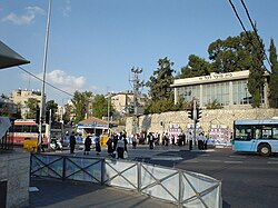
The road begins at the heavily congested intersection of Route 417 (Bar-Ilan Street/Hativat HarEl Boulevard) and Shmuel HaNavi Street.[1] The first 0.3 km is called Shmuel HaNavi Street, a continuation of the street south of the intersection. At its beginning, 436 is a major transfer point for intra- and inter-city buses. It is six lanes wide with two lanes in each direction on either side for private vehicles and two public transportation lanes along its median. The bus lanes along the center of the road are envisioned to become part of the "Blue Line" of the Jerusalem Light Rail.[2]
Just before Givat Moshe Junction, at 770 meters above sea level, the name of the road becomes Golda Meir Boulevard. It passes Jerusalem's largest high tech park, Har Hotzvim, while descending into Emek HaArazim (Valley of The Cedars) at 630 meters. At Golda Meir Interchange, entrances in both directions provide access to Highway 50 (southbound). The road widens to eight lanes crossing the Sorek Stream and the Green Line at Yigael Yadin Interchange providing access to Highway 1 and Highway 50 (northbound). It then becomes six lanes and begins a steep ascent as the central artery through Ramot.
Leaving Ramot and the Jerusalem Municipality, the road becomes four lanes wide, passing the entrance to Nebi Samuel and reaching an altitude of 840 meters. It then begins another descent to 725 meters in the Plain of Gibeon. Along this section, the road passes alongside the security barrier next to al-Jib. Passing Mahane Giv'on, the road rises to 770 meters as it passes through Givat Ze'ev. Further on, it descends to 740 meters, intersecting with Routes 443 and 45. North of 443/45, the road provides entrances to Mahane Ofer and the Beitunia cargo transfer terminal, officially ending as numbered.
Junctions (south to north)[]
This article contains a bulleted list or table of intersections which should be presented in a properly formatted junction table. (November 2021) |
| km | Name | Type | Meaning | Location | Road(s) Crossed |
|---|---|---|---|---|---|
| ↓Jerusalem Municipality↓ | |||||
| 0 | ככר בית החיים (Beit HaHayyim Square) |
House of Life (name of adjacent municipal Funeral Home) |
Bukharim, Shmuel HaNavi, Mahanayim, Sanhedriya |
(Bar Ilan St.) (Hativat HarEl St.), Shmuel HaNavi St.[3] | |
| 0.05 | Mahanayim, Sanhedriya |
Moshe Blau St. | |||
| 0.3 | צומת גבעת מש��/גוש 80 (Givat Moshe/Gush 80 Junction) |
Moshe's Hill named after Moshe Porush |
Ezrat Torah Sanhedria Murhevet |
HaAdmorim Leiner St., Givat Moshe St. | |
| 0.8 | Kiryat Sanz Har Hotzvim |
A.S. Artom St., Shefa Chayim St. | |||
| 1 | צומת הר חוצבים (Har Hotzvim Junction) |
Stonecutter's Hill | Har Hotzvim | Kiryat Mada St. | |
| 1.2 | צומת NDS (NDS Junction) |
named after NDS Jerusalem headquarters |
Har Hotzvim | Shlomo (Momo) HaLevi St. | |
| 1.7 | מחלף גולדה מאיר (Golda Meir Interchange) |
named after Golda Meir |
Har Hotzvim | (Begin Boulevard) southbound | |
| 2.2 | מחלף ידאל ידין (Yigael Yadin Interchange) |
named after Yigael Yadin |
Ramot | (Begin Boulevard) northbound | |
| 2.4 | Green Line | ||||
| 3.1 | כיכר בנימין כהן (Binyamin Cohen Square) |
named after Benjamin Victor Cohen |
Ramot Neve Orot, Ramot Alon, Ramot Bet |
Harry Truman St., Yigal Alon St. | |
| 3.7 | כיכר ספימת מפקורה (Sfinat Mefkura Square) |
named after sunk refugee boat |
Ramot | Shivat Zion St., Asirei Zion St. | |
| 3.8 | Ramot Mall | public transportation lanes, entrance to parking, deliveries | |||
| 4.2 | כיכר המלחין שוסטקוביץ (HaMalhin Shostakovich Square) |
named after Dmitri Shostakovich |
Ramot Ramot Polin, Ramot Gimel, Ramot Daled |
HaRoeh St, HaKongres HaTzioni St. | |
| 4.7 | כיכר הרב אלעזר (HaRav Elazar Square) |
named after |
Ramot | Avraham Recanati St., Yitzhak Mirsky St. | |
| 5.2 | Ramot | Binyamin Mintz St., HaMeshorer Etzeg St. | |||
| ↑Jerusalem Municipality↑ | |||||
| 5.3 | צומת שמואל (Shmu'el Junction) |
named after nearby Nebi Samu'el |
former location of security checkpoint |
local road | |
| 6.2 | Nebi Samuel | entrance road | |||
| 7.2 | entrance road, ( | ||||
| 8.9 | Mahane Givon (West) | entrance road | |||
| 9.1 | (northbound only) | Mahane Givon (East) | entrance road | ||
| 10.2 | Giv'on HaHadasha, Givat Ze'ev |
entrance road | |||
| 10.4 | צומת גבעונים (Giv'onim Junction) |
named after ancient Gibeonites |
filling station | entrance road, ( & Bir Nabala closed) | |
| 11 | Givat Ze'ev | HaMaccabim St., Kidron St. | |||
| 12.2 | צומת גבעת זאב (Givat Ze'ev Junction) |
Wolf Hill | Giv'at Ze'ev Ofer Prison |
||
| 12.3 | Beitunia Terminal[4][5] | entrance to cargo transfer station | |||
| 12.4 | Ofer Prison | entrance to Ofer Prison | |||
| 13.2 | Beitunia | Security Barrier | |||
References[]
- ^ Street View - Beginning of Route 436 viewed northward from intersection with Route 417 (Bar Ilan/Hativat HarEl) (Map). Google Maps. November 2011. Retrieved 2013-06-14.
- ^ "Jerusalem Light Rail Project – The Blue Line". DEL Group (Engineering, Development & Infrastructure). Retrieved 2013-06-20.(in Hebrew)
- ^ 1 Samuel 1:20
- ^ "Crossing Points West Bank and Gaza Strip". Palestinian Shipper's Council. Archived from the original on 2014-08-26. Retrieved 2018-06-02.
- ^ "Coordination of Government Activity in the Territories - Beitunia Crossing". Israel Defense Forces. Archived from the original on 2014-08-31. Retrieved 2018-06-02.
See also[]
- List of highways in Israel
Coordinates: 31°49′51.80″N 35°11′08.50″E / 31.8310556°N 35.1856944°E

| Roads |
| ||||
|---|---|---|---|---|---|
| Bus operators | |||||
| Rail transport |
| ||||
| Cycle infrastructure | |||||
| Sea ports | |||||
| Aviation |
| ||||
| Cable cars |
| ||||
| By city | |||||
| Smart cards | |||||
- Roads in Israel
- Roads in Israeli-occupied territories
- Streets in Jerusalem