Hoppers Crossing, Victoria
This article needs additional citations for verification. (January 2012) |
| Hoppers Crossing Melbourne, Victoria | |||||||||||||||
|---|---|---|---|---|---|---|---|---|---|---|---|---|---|---|---|
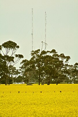 Canola Fields and Radio Towers in Hoppers Crossing | |||||||||||||||
 Hoppers Crossing | |||||||||||||||
| Coordinates | 37°52′08″S 144°41′35″E / 37.869°S 144.693°ECoordinates: 37°52′08″S 144°41′35″E / 37.869°S 144.693°E | ||||||||||||||
| Population | 38,701 (2016 census)[1] | ||||||||||||||
| • Density | 2,174/km2 (5,631/sq mi) | ||||||||||||||
| Postcode(s) | 3029 | ||||||||||||||
| Area | 17.8 km2 (6.9 sq mi) | ||||||||||||||
| Location | |||||||||||||||
| LGA(s) | City of Wyndham | ||||||||||||||
| State electorate(s) | |||||||||||||||
| Federal Division(s) | Lalor | ||||||||||||||
| |||||||||||||||

Hoppers Crossing is a suburb of Melbourne, Victoria, Australia, 23.1 km south-west of Melbourne's Central Business District, located within the City of Wyndham local government area. Hoppers Crossing recorded a population of 38,701 at the 2016 Census.

The suburb is named after the family of Stephen Hopper (1832-1908), who were residents in the area.[2][3] In the late 19th century, Hopper's wife, Elizabeth, was the gatekeeper at the level crossing where Hoppers Lane (Old Melbourne Road) crossed the Geelong-Melbourne railway, adjacent to the present Hoppers Crossing railway station.
History[]
The name Hoppers Crossing was in common usage as early as 1910, named after the Hopper family who lived on a farm near the rail crossing. Stephen Hopper was a railway ganger for 33 years, and his wife Elizabeth Hopper attended the railway gates for many years before boom gates were installed. The original Hoppers Crossing was the spot where the Princes Highway crossed the Melbourne to Geelong railway line. Railway workers on the line knew the area as Hopper’s Hill, due to the steep gradient from Skeleton Creek where goods trains would often have to haul their cargo up in two sections.[4]
Until the early 1960's, the only notable feature of Hoppers Crossing was Frank Kopacka's general store. In 1963, the first subdivision of residential land took place by former shearer Harold Llewellyn Baden Powell. However, basic infrastructure like telephones, sewerage and even kerb-side post boxes were only built over 5 years later, after lobbying from the Hoppers Crossing Ratepayers Association.[5]
Hoppers Crossing grew rapidly from the 1970s. The suburb's first primary school, Mossfiel Primary School, had its initial student intake in 1970, and the railway station opened on 16 November 1970. The first shopping centre, Woodville Park, was built soon after.[6] The Post Office opened on 2 June 1975.[7]
Population[]
In the 2016 Census, there were 38,701 people in Hoppers Crossing. 58.8% of people were born in Australia. The next most common countries of birth were India 5.9%, New Zealand 2.7%, Philippines 2.6%, England 2.2% and Myanmar 1.8%. 60.5% of people spoke only English at home. Other languages spoken at home included Arabic 2.6%, Punjabi 2.0%, Italian 1.9%, Mandarin 1.7% and Hindi 1.6%. The most common responses for religion were Catholic 27.4%, No Religion 22.4% and Anglican 8.1%.[1]
Retail[]
Hoppers Crossing Shopping Centre opened in 1983.[8] It included a Target store (a Baby Target store for a brief period in the mid-nineties), Safeway Supermarket and 10 other stores. Following a $10m major redevelopment in 2016,[9] the centre has expanded to include a range of speciality retail and food outlets, and replaced Target with a Coles Supermarket.
Werribee Plaza opened in 1985, originally categorised as a regional shopping centre. The centre has since undergone seven stages of major expansion and redevelopment since 2000. The current complex design was completed in 2017, and the shopping centre was rebranded as Pacific Werribee. It now includes major local retailers Myer, Target, Big W, Kmart, JB Hi-Fi, Adairs, Best & Less, as well as international retailers H&M and Uniqlo. It also has a Village Cinemas complex, around 300 speciality stores, and major supermarket chains.
Hogans Corner opened in 1997-1998.[citation needed] It includes a Woolworths supermarket, Dan Murphy's, and several speciality stores and fast-food restaurants.

Old Geelong Road is a commercial precinct running over several kilometres.[10] The precinct contains a large variety of big box homemaker and warehouse retailers, including Bunnings Warehouse, The Good Guys, Harvey Norman, Autobarn, Supercheap Auto, Forty Winks, Petbarn, Anaconda, BCF, Salvos Store, Vinnies, and many more.
Parks[]
There several parks including playgrounds and recreational areas generally 2-4 blocks of land in residential streets. Recreation reserves mostly exist along what once was a river or stream, although now serve as drainage reserves and the local Skeleton Creek (Snakes are common near Skeleton Creek).
Fauna and flora[]
Skeleton Creek, which runs along the suburb's eastern edge, has healthy populations of native reptiles,[11] including:
- Tiger snake
- Eastern Blue-tongued Lizard
- Eastern brown snake
- Striped skink
- Stump-tailed skink
- Brushtail possum
Education[]
State schools and colleges[]
Primary schools
- Bellbridge Primary School
- Baden Powell College, formerly Derrimut Heath Primary School
- - Derrimut Heath Campus
- The Grange P-12 College
- - Primary Campus
- Mossfiel Primary School
- Woodville Primary School
- Cambridge Primary School
Secondary colleges
- Hoppers Crossing Secondary College
- The Grange P-12 College
- - Secondary Campus
Catholic schools and colleges[]
Primary Schools
- St Peter Apostle Primary School
- St James the Apostle Primary School
Specialist schools[]

In 2006 the principal of Derrimut Heath Primary School (Now Baden Powell College), Julie Mason, was chosen as the "Wyndham Citizen of the Year" for her key role in the development of the Wyndham Community Education Plan 2004-2007 and serving as chair of the Quality Community Plan Education Committee.[12]
Transport[]
Rail[]
Hoppers Crossing is served by the Hoppers Crossing railway station, located to the south of the suburb, on the Werribee line. When opened in 1970, it was a small station on the western side of the Old Geelong Road level crossing on the Geelong line, served by only a few diesel-hauled trains each day. In 1983, the station was relocated to the eastern side of the level crossing, in conjunction with electrification of the line to Werribee. The Regional Rail Link opened in 2015 which provided new track from West Werribee through Tarneit to Deer Park and includes a new railway station at Tarneit. This connected the Melton and Werribee railway lines and re-directed Geelong V/Line trains away from the Werribee Line and Hoppers Crossing.
In November 2018, the Victorian Government announced that the level crossing at Old Geelong Road would be removed by closing the existing road and constructing a new road bridge east of the station. The station and precinct will also be rebuilt. The project is scheduled for completion by 2022.[13]

In the mid-2000s a tramway was proposed for the Hoppers Crossing - Werribee area to replace bus services, but the idea was not seen as feasible by the Wyndham City Council and Victorian State Government.[14]
Bus[]
Bus services in Hoppers Crossing connect surrounding areas to Hoppers Crossing Station, Werribee Plaza, and Werribee. Bus services have been extended as surrounding areas expand.
Road[]
Major roads include the Princes Highway (C109), Heaths Road (C701), Derrimut Road (C702), Hogans Road, Morris Road, Tarneit Road and Sayers Road.[15]
Sports[]
Hoppers Crossing has many gyms and sports grounds. There are facilities for tennis, soccer, Australian rules football, basketball, netball, lawn bowls and more. In 2004, the Federation Trail was opened, which links Werribee with Brooklyn, and soon Yarraville.
A new soccer complex was built at The Grange for the Hoppers Crossing Soccer Club. They previously played at , which is now a rugby football field. Founded in 1971, the 'Reds' have won 5 senior championships (1999, 2001, 2012, 2014, & 2015) and will compete in the Football Federation Victoria State League 2 Nth/West division in 2017. One of the most popular clubs in the region, Hoppers Crossing SC currently field 20 teams across junior, senior and masters age groups.
The Hoppers Crossing Football Club, nicknamed the 'Warriors', play at Hogans Road Reserve. They currently compete in the Western Region Football League first division, where they won senior premierships in 2002 and 2004. The Warriors are one of the biggest clubs in the league, boasting numerous junior sides as well seniors and reserves.
Hoppers Crossing Cricket Club, known as the 'Cats' was formed in 1977 and its first team was entered into the "B turf" section of the Sunshine Cricket Association in season 1977/78. The result in the club's first season was runners-up.
Hoppers Crossing is the home of Australian Olympic Gold Medallist Russell Mark and his wife Lauryn, a triple Commonwealth Games Gold Medallist.
References[]
- ^ Jump up to: a b Australian Bureau of Statistics (27 June 2017). "Hoppers Crossing (State Suburb)". 2016 Census QuickStats. Retrieved 21 July 2017.

- ^ "The Descendants of Stephen Hopper, 1587-1658". www.airgale.com.au. Retrieved 5 August 2012.
- ^ "Obituary: Arthur Edward Hopper". The Banner (Werribee). 28 August 1941. Retrieved 5 August 2012.
- ^ "Hoppers Crossing". Wyndham History.
- ^ "Hoppers Crossing". Wyndham History.
- ^ "Hoppers Crossing". Victorian Places. Retrieved 25 October 2020.
- ^ Premier Postal History. "Post Office List". Retrieved 11 April 2008.
- ^ http://www.heraldsun.com.au/news/victoria/hoppers-crossing-top-spots-food-housing-and-history-of-melbournes-growing-western-suburb/news-story/c00206cf1d26d3cbdc0ed14533cffc24
- ^ "Project : HOPPERS CROSSING SHOPPING CENTRE REDEVELOPMENT". Cordell. Retrieved 25 October 2020.
- ^ "Old Geelong Road Precinct". Wyndham City Council. Retrieved 25 October 2020.
- ^ "Skeleton Creek information". Archived from the original on 21 February 2011. Retrieved 30 January 2012.
- ^ "Wyndham 2006 Citizen of the Year Announced". City of Wyndham council. 10 February 2006. Archived from the original on 1 September 2007. Retrieved 6 June 2007.
- ^ "Old Geelong Road, Hoppers Crossing". Level Crossing Removal Project. State Government of Victoria. Retrieved 9 August 2021.
- ^ "Costly tram plan". Werribee, Hoppers Crossing, Point Cook Star. 21 March 2006. Archived from the original on 3 April 2012. Retrieved 5 August 2012.
- ^ "Map of the Wyndham LGA" (PDF). Archived from the original (PDF) on 30 March 2012. Retrieved 28 January 2012.
- Suburbs of Melbourne
- Suburbs of the City of Wyndham