Isaac Region
| Isaac Region Queensland | |||||||||||||||
|---|---|---|---|---|---|---|---|---|---|---|---|---|---|---|---|
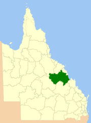 Location within Queensland | |||||||||||||||
| Population | 20,934 (2018)[1] | ||||||||||||||
| • Density | 0.356578/km2 (0.923534/sq mi) | ||||||||||||||
| Established | 2008 | ||||||||||||||
| Area | 58,708 km2 (22,667.3 sq mi)[1] | ||||||||||||||
| Mayor | Anne Baker | ||||||||||||||
| Council seat | Moranbah | ||||||||||||||
| State electorate(s) | |||||||||||||||
| Federal division(s) | Capricornia | ||||||||||||||
| Website | Isaac Region | ||||||||||||||
| |||||||||||||||
The Isaac Region is a local government area located in Central Queensland, Queensland, Australia created in March 2008 as a result of the report of the Local Government Reform Commission released in July 2007.
History[]
Yagalingu (also known as Jagalingu, Auanbura, Kokleburra, Owanburra, Kowanburra, Wagalbara, and Djagalingu) is an Australian Aboriginal language of Central Queensland. Its traditional language region was within the local government area of Isaac Region, from the headwaters of the Belyando River south to Avoca, north to Laglan, west to the Great Dividing Range, and east and south to .[2]
Prior to 2008, the Isaac Region was an entire area of three previous and distinct local government areas:
- the Shire of Belyando;
- the Shire of Broadsound;
- and the Shire of Nebo.
The report recommended that the new local government area should not be divided into wards and elect eight councillors and a mayor. The Isaac Regional Council covers an area of 58,708 square kilometres (22,667 sq mi),[1] had a population in 2018 of 20,934[1] and an operating budget of A$46.0m.
The region takes its name from the Isaac River which in turn takes its name from Queensland pioneer Frederick Isaac who accompanied the explorer Ludwig Leichhardt on his first expedition.[3]
Towns and localities[]
The Isaac Region includes the following settlements:
|
Belyando area: |
Broadsound area:
|
Nebo area:
|
* - The former town of Blair Athol, obliterated by the Blair Athol coal mine was within the region.[4]
Libraries[]
Isaac Regional Council operates public libraries in Carmila, Clermont, Dysart, Glenden, Middlemount, Moranbah, Nebo, and St Lawrence.[5]
Mayors[]
Population[]
The populations given relate to the component entities prior to 2008.
| Year | Total Region | Belyando | Broadsound | Nebo |
|---|---|---|---|---|
| 1933 | 4,971 | 2,987 | 1,590 | 394 |
| 1947 | 5,016 | 3,067 | 1,415 | 534 |
| 1954 | 5,088 | 3,104 | 1,537 | 447 |
| 1961 | 5,367 | 3,253 | 1,539 | 575 |
| 1966 | 5,101 | 2,997 | 1,625 | 479 |
| 1971 | 7,200 | 4,834 | 1,589 | 777 |
| 1976 | 11,389 | 7,210 | 3,379 | 800 |
| 1981 | 15,522 | 7,700 | 6,908 | 914 |
| 1986 | 22,133 | 11,362 | 8,419 | 2,352 |
| 1991 | 22,188 | 11,082 | 8,472 | 2,634 |
| 1996 | 20,703 | 10,755 | 7,486 | 2,462 |
| 2001 | 19,013 | 9,883 | 6,601 | 2,529 |
| 2006 | 19,820 | 10,455 | 6,843 | 2,522 |
| 2016 | 20,940 |
References[]
- ^ a b c d "3218.0 – Regional Population Growth, Australia, 2017-18: Population Estimates by Local Government Area (ASGS 2018), 2017 to 2018". Australian Bureau of Statistics. Australian Bureau of Statistics. 27 March 2019. Retrieved 25 October 2019. Estimated resident population, 30 June 2018.
- ^
 This Wikipedia article incorporates CC-BY-4.0 licensed text from: "Yagalingu". Queensland Aboriginal and Torres Strait Islander languages map. State Library of Queensland. Retrieved 30 January 2020.
- ^ "Isaac Regional Council". Queensland Places. Centre for the Government of Queensland, University of Queensland. Archived from the original on 11 April 2015. Retrieved 5 April 2015.
- ^ "Blair Athol". Queensland Places. Centre for the Government of Queensland, University of Queensland. Archived from the original on 24 April 2014. Retrieved 23 April 2014.
- ^ "Find your local library". Isaac Regional Council. Archived from the original on 31 January 2018. Retrieved 31 January 2018.
- ^ "2008 Isaac Regional Council - Mayoral Election - Election Summary". results.ecq.qld.gov.au. Archived from the original on 27 April 2018. Retrieved 4 December 2017.
- ^ "2012 Isaac Regional Council - Mayoral Election - Election Summary". results.ecq.qld.gov.au. Archived from the original on 1 April 2018. Retrieved 4 December 2017.
- ^ "2016 Isaac Regional Council - Mayoral Election - Election Summary". results.ecq.qld.gov.au. Archived from the original on 27 March 2018. Retrieved 4 December 2017.
- ^ "2020 Local Government Elections: Saturday, 28 March 2020". Electoral Commission of Queensland. 2020. Retrieved 16 June 2020.[dead link]
External links[]
Coordinates: 22°49′00″S 148°41′56″E / 22.81667°S 148.69889°E

- Populated places established in 2008
- 2008 establishments in Australia
- Isaac Region
- Local government areas of Queensland
- Central Queensland
- Central Queensland geography stubs