Shire of Mornington (Queensland)
| Mornington Shire Queensland | |||||||||||||||
|---|---|---|---|---|---|---|---|---|---|---|---|---|---|---|---|
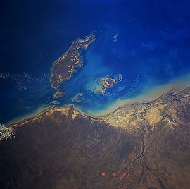 Mornington Island from space, September 1991 | |||||||||||||||
| Population | 1,218 (2018)[1] | ||||||||||||||
| • Density | 0.9760/km2 (2.5277/sq mi) | ||||||||||||||
| Established | 1978 | ||||||||||||||
| Area | 1,248 km2 (481.9 sq mi)[1] | ||||||||||||||
| Mayor | Kyle Hector Yanner | ||||||||||||||
| Council seat | Gununa | ||||||||||||||
| State electorate(s) | Traeger | ||||||||||||||
| Federal division(s) | Kennedy | ||||||||||||||
| Website | Mornington Shire | ||||||||||||||
| |||||||||||||||
The Shire of Mornington is a local government area in northwestern Queensland, Australia. The shire covers Mornington Island as well as neighbouring islands in the Wellesley Islands group in the Gulf of Carpentaria. Ninety-three percent of the employees of the Shire Council are indigenous local residents.
The Shire Council comprises 22 islands. They are inhabited by the Lardil, Yangkaal, Kaiadilt and Gangalidda peoples. The area has abundant flora and fauna, including tea trees, mangroves and sea oaks. The beaches are filled with a variety of marine life, including turtles and the endangered dugong. It is a fishing and diving locale with beaches and an emphasis on ecotourism.[2]
The administrative centre of the shire is the township of Gununa on Mornington Island. In 2001, the shire had a population of 934, of which 88.2% were Aboriginal.[3] By the 2016 census, the population of the shire had risen to 1,143, with 86.1% of residents being either Aboriginal or Torres Strait Islander.[4]
History[]
An Australian Aboriginal language, Lardil (also known as Gununa, Ladil), is spoken on Mornington Island and on the Northern Wellesley Islands, which are all within the local government boundaries of the Mornington Shire.[5]
Another Australian Aboriginal language, Yukulta (also known as Ganggalida), is spoken in the Gulf Country, which includes the local government areas of the Aboriginal Shire of Doomadgee and Shire of Mornington.[6]
The shire was formed in 1978 when the Queensland government decided to take control of the islands over from the Uniting Church of Australia. The local community objected, and asked the Australian federal government to help overturn this decision. After negotiations, it was agreed that the community would become self-governing under a so-called “Local Government” model.[7]
Amenities[]
The Mornington Shire Council does not operate any public libraries.[8]
Mayors[]
This list is incomplete; you can help by . (November 2017) |
- 2008 - 2012: Cecil Goodman [9]
- 2012 - 2020: Bradley Wilson [10][11]
- 2020 - present: Kyle Hector Yanner [12]
References[]
- ^ a b "3218.0 – Regional Population Growth, Australia, 2017-18: Population Estimates by Local Government Area (ASGS 2018), 2017 to 2018". Australian Bureau of Statistics. Australian Bureau of Statistics. 27 March 2019. Retrieved 25 October 2019. Estimated resident population, 30 June 2018.
- ^ "About the Island(s)". Mornington Shire Council.
- ^ Australian Bureau of Statistics (9 March 2006). "Mornington (S) (Local Government Area)". 2001 Census QuickStats. Retrieved 30 June 2007.
- ^ Australian Bureau of Statistics (27 June 2017). "Mornington (S)". 2016 Census QuickStats. Retrieved 5 October 2018.

- ^
 This Wikipedia article incorporates CC-BY-4.0 licensed text from: "Indigenous Languages of Queensland". State Library of Queensland. State Library of Queensland. Retrieved 30 January 2020.
- ^ This Wikipedia article incorporates CC-BY-4.0 licensed text from: "Yukulta". Queensland Aboriginal and Torres Strait Islander languages map. State Library of Queensland. Retrieved 28 January 2020.
- ^ James Cook University - Mount Isa Centre for Rural and Remote Health Archived 27 September 2006 at the Wayback Machine - Mornington Island page. Retrieved 21 December 2006.
- ^ "Mornington Shire". Public Libraries Connect. State Library of Queensland. 3 April 2014. Archived from the original on 5 February 2018. Retrieved 6 February 2018.
- ^ "2008 Mornington Shire - Mayoral Election - Election Summary". results.ecq.qld.gov.au. Retrieved 4 December 2017.
- ^ "2012 Mornington Shire - Mayoral Election - Election Summary". results.ecq.qld.gov.au. Retrieved 4 December 2017.
- ^ "2016 Mornington Shire Council - Mayoral Election - Election Summary". results.ecq.qld.gov.au. Retrieved 4 December 2017.
- ^ "2020 Local Government Elections: Saturday, 28 March 2020". Electoral Commission of Queensland. 2020. Archived from the original on 16 June 2020. Retrieved 16 June 2020.
Coordinates: 20°43′29″S 139°29′37″E / 20.72472°S 139.49361°E

- Populated places established in 1978
- 1978 establishments in Australia
- Shire of Mornington (Queensland)
- Local government areas of Queensland
- North West Queensland