Kalat County
Kalat County
شهرستان کلات | |
|---|---|
County | |
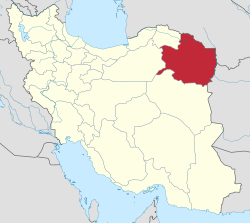
 Location of Kalat County in Razavi Khorasan province | |
 Location of Razavi Khorasan Province in Iran | |
| Coordinates: 36°54′N 59°54′E / 36.900°N 59.900°ECoordinates: 36°54′N 59°54′E / 36.900°N 59.900°E | |
| Country | |
| Province | Razavi Khorasan Province |
| Capital | Kalat |
| Bakhsh (Districts) | Central District, Zavin District |
| Population (2016)[1] | |
| • Total | 36,237 |
| Time zone | UTC+3:30 (IRST) |
| • Summer (DST) | UTC+4:30 (IRDT) |
| Kalat County at GEOnet Names Server | |
Kalat County (Persian: شهرستان کلات) is a shahrestan (county) in Razavi Khorasan Province in Iran. The capital of the county is Kalat. At the 2006 census, the county's population was 39,560, in 9,489 families.[2] The County has two districts: Central District and Zavin District. The County has two cities: Kalat and Shahr-e Zow.
Languages[]
Around half of the population of Kalat County are Tekke Turkmen, 35% Kurdish and 15% are Persian.[3]
References[]
- ^ "Census of the Islamic Republic of Iran, 1395 (2016)" (Excel). Islamic Republic of Iran.
- ^ "Census of the Islamic Republic of Iran, 1385 (2006)" (Excel). Statistical Center of Iran. Archived from the original on 2011-11-11.
- ^ کلات نادری، محمد رضا خسروی، انتشارات آستان قدس رضوی 1367 (Farsi book)
- اطلس گیتاشناسی استانهای ایران [Atlas Gitashenasi Ostanhai Iran] (Gitashenasi Province Atlas of Iran)
External links[]
| Wikimedia Commons has media related to Kalat County. |
Categories:
- Kalat County
- Counties of Razavi Khorasan Province
- Kalat County geography stubs

