Karet railway station
This article needs additional citations for verification. (October 2013) |
| Location | Jl. KH Mas Mansyur, Kebon Melati, Tanah Abang, Central Jakarta 10230 Indonesia | |||||||||||||||||||
|---|---|---|---|---|---|---|---|---|---|---|---|---|---|---|---|---|---|---|---|---|
| Coordinates | 6°12′03″S 106°48′57″E / 6.2008165°S 106.8159002°ECoordinates: 6°12′03″S 106°48′57″E / 6.2008165°S 106.8159002°E | |||||||||||||||||||
| Elevation | +11 m (36 ft) | |||||||||||||||||||
| Owned by | Kereta Api Indonesia | |||||||||||||||||||
| Operated by | Kereta Commuter Indonesia | |||||||||||||||||||
| Line(s) | ||||||||||||||||||||
| Platforms | 2 side platforms | |||||||||||||||||||
| Tracks | 2 | |||||||||||||||||||
| Construction | ||||||||||||||||||||
| Structure type | Ground | |||||||||||||||||||
| Other information | ||||||||||||||||||||
| Station code | KAT | |||||||||||||||||||
| Services | ||||||||||||||||||||
| ||||||||||||||||||||
| Location | ||||||||||||||||||||
 L12 Karet Station Location in Jakarta | ||||||||||||||||||||
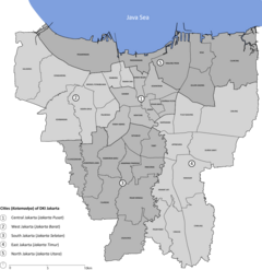
Karet Station (KAT[1]) is a railway station located in Kebon Melati, Tanah Abang, Central Jakarta. This station lies on the north bank of West Flood Canal. This station only serves Commuterline trains. This station and Sudirman station are spaced only 0.8 km between each other, making it one of the shortest stretch between any two stations in the network. It only takes one minute to travel between these two stations.[2] BNI City railway station, a station that serves Soekarno–Hatta Airport Rail Link exclusively, is wedged between these two station.
Places of Interest[]
- Karet Bivak Cemetery
- The London School of Public Relations
- LaSalle College Jakarta
- Wisma 46 BNI
- Shangri-La Hotel Jakarta
- Popular Theater Teguh Karya Building
References[]
- ^ PJKA (1982). Buku Jarak untuk Jawa dan Madura. Bandung: Balai Grafika Perusahaan Jawatan Kereta Api.
- ^ "Perjalanan KRL - Peta Rute KRL Commuterline". KRL Official Website (in Indonesian).
| Preceding station | Kereta Api Indonesia | Following station | ||
|---|---|---|---|---|
| Tanah Abang Terminus |
THB–MRI |
BNI City towards Manggarai |
Categories:
- Central Jakarta
- Railway stations in Jakarta
- Asian railway station stubs
- Indonesian building and structure stubs
- Indonesia transport stubs
