Kewaunee County, Wisconsin
Kewaunee County | |
|---|---|
U.S. county | |
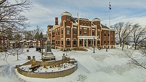 Kewaunee County Courthouse | |
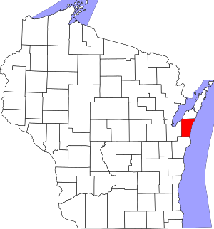 Location within the U.S. state of Wisconsin | |
 Wisconsin's location within the U.S. | |
| Coordinates: 44°35′N 87°26′W / 44.59°N 87.44°W | |
| Country | |
| State | |
| Founded | 1859 |
| Seat | Kewaunee |
| Largest city | Algoma |
| Area | |
| • Total | 1,084 sq mi (2,810 km2) |
| • Land | 343 sq mi (890 km2) |
| • Water | 742 sq mi (1,920 km2) 68%% |
| Population (2010) | |
| • Total | 20,574 |
| • Estimate (2020) | 20,386 |
| • Density | 19/sq mi (7.3/km2) |
| Time zone | UTC−6 (Central) |
| • Summer (DST) | UTC−5 (CDT) |
| Congressional district | 8th |
| Website | www |

Kewaunee County is a county located in the U.S. state of Wisconsin. As of the 2010 census, the population was 20,574.[1] Its county seat is Kewaunee.[2] The county was created in 1852 and organized in 1859.[3] Its Menominee name is Kewāneh, an archaic name for a species of duck.[4]
Kewaunee County is part of the Green Bay, WI Metropolitan Statistical Area as well as the Green Bay-Shawano, WI Combined Statistical Area.
Fishing and boating[]
In 2018, Kewaunee County ranked first in the state in the Chinook salmon harvest, with 26,557 fish caught, with nearby Door County ranking second at 14,268 fish caught.[5] Chinook salmon are sought after by tourists enjoying chartered fishing trips.[6] 2,447 in Kewaunee County
The state record rainbow trout was set in 1997 at 27 pounds, 2 ounces and 42.5 inches long. It came from the Kewaunee County portion of Lake Michigan. In 1999 the state record pink salmon was also caught in Lake Michigan out of Kewaunee County waters. It was 6 pounds, 1.9 ounces and was 24.0 inches long. In 2005, the state record white perch was taken out of the Kewaunee County portion of Green Bay. It weighed 1 pound, 5.4 ounces and was 13.5 inches long.[7]
Beginning in 1964, first coho and then chinook salmon were stocked in Lake Michigan.[8] New salmon and trout fingerling stocking in the spring and egg and milt collection from late September to early November takes place at the C.D. "Buzz" Besadny Anadromous Fish Facility. The facility is a public attraction.
In recent years there has been concern that the alewife population will not support the salmon population,[9] especially as the Chinook population has already collapsed in Lake Huron.[10] A 2016 survey of Wisconsin anglers found they would on average pay $140 for a trip to catch Chinook salmon, $90 for lake trout, and $180 for walleye.[11] Should the Chinook salmon fishery be replaced with a native lake trout fishery, the economic value would decrease by 80%.[12]
A 1995 study found the greatest abundance of spawning lake trout in Lake Michigan was on the Clay Banks Reef off of Door and Kewaunee counties.[13]
The sucker run, which was a popular fishing event in the 19th century,[14] occurs in March and April.[15] Suckers may be taken by frame dip nets,[16] and the sucker run is also sought out as viewing opportunity.[17] The smelt run also attracts fishermen.[18]
The state recognizes 11 public boat access sites.[19] There are 14 inland lakes or ponds in Kewaunee County. In 2012, there were 2,252 registered boats in the county.[20] Algoma Light and Kewaunee Pierhead Light are active navigational aids for boaters. The Daniel Lyons shipwreck near Algoma is used as a dive site, but the America near Carlton is less visited by divers due to its remote location.[21] There are 24 other known shipwrecks in county waters.[22] The Tug Ludington in Kewaunee is operated as a museum boat.
Parks and other lands open to the public[]
The county operates eight parks. The Dana Farm (childhood home of Ransom Asa Moore) was relocated to the Winter Park. Along with the Bruemmer Park and Zoo, it is located near the state-owned C.D. Buzz Besadny Fish Hatchery.[23] Two other state-owned parks are Mashek Creek Public Access[24] and the Brusky Wildlife Area.[25] There are also 27 municipal parks operated by the cities of Algoma, Kewaunee, and the Village of Luxembourg.[26]
There are four public beaches in the county, three of which are routinely monitored for water quality advisories.[27] The county[28] and the city of Algoma[29] each operate one beach. Kewaunee operates two beaches,[30] There are boardwalks along the beach in Algoma and the Kewaunee Marshland Walk.
Limestone kiln remnants of historical interest are open to the public at the Bruemmer Park and Zoo. Although lime is not presently produced in Kewaunee County, as of 2016, there were 9 active gravel pits producing sand and gravel for roadwork and construction use.[31]
279.54 acres (113.1 ha) of privately owned land is open to the public for hunting, fishing, hiking, sight-seeing and cross-country skiing under the Managed Forest Program.[32]
Species lists and coastal wetlands[]
The four state recognized coastal wetlands in the county are the Kewaunee River Wetland Complex, the Black Ash Swamp Area, the Ahnapee River Wetlands, and the Duvall Swamp.[33] A 1980 inventory of natural areas recognized Duvall Swamp, Alaska Bog, Krok Woods, Kewaunee River Marshes, Cosco Tamarack Woods, Broemmer Creek Headwaters, Alaska Lake, Three Mile Creek Tag Alder, Silver Lake, Krohn's Lake, and the Ahnapee River Swamps.[34] Historically, hypnum peat was produced in the county.[35][36]
Plants[]
In 2016, 586 plant species were listed in a checklist for the county that excluded mosses, liverworts, and hornworts.[37] In 2020, 33 species of mosses, liverworts, and hornworts[38] and 125 species of macrofungi (including lichens) were listed for the county.[39] In 1999, 8 aquatic species were found in East Alaska Lake.[40]
Snails[]
From 1996 to 2001, researchers listed 48 species of snails in Kewaunee County, ranking eighth out of the 22 counties in the study. Nearby Door and Brown counties ranked first and second with 69 and 62 species respectively. However, they only sampled 13 areas in Kewaunee County, compared to 74 areas in Door and 28 areas in Brown. Slugs were found in all three counties.[41]
Birds[]
As of 2020, 103 species of birds have been confirmed to breed in Kewaunee County.[42]
Cattle and deer[]
In 2018 statistics, a county total of 3,527 deer were killed as a total of all deer hunting seasons, down from the total harvest of 3,787 deer for 2017 statistics.[43] In 2017, Kewaunee and Door counties were reported to have equal deer-to-human ratios. Kewaunee County had the third highest cow-to-human ratio in the state, with only Lafayette and Buffalo counties having higher ratios.[44] In 2018, there were an estimated 97,000 head of cattle in the county, more than Door County which had 23,500 head of cattle.[45]
Foods, agritourism, and alcohol[]
Kewaunee County is known for its kolache.[46] Another distinctive local food is booyah.[47][48] The cooking of booyah is not exclusive to Belgians, but has also been adopted by some Czechs.[49] Cornish apple elderberry dumplings are another local dish.[50]
In 2017, six operations tapped 1,840 trees to produce maple syrup, down from 3,024 trees tapped by three operations in 1997.[51]
U-pick strawberries, apples, and pumpkins are grown.[52]
There are also two Christmas tree operations.[52] In 2017, 4,084 Christmas trees were cut, down from 4,462 in 2012.[53]
In 2014–15, there were 96 liquor licenses in the county.[54] The first modern winery in the state opened in Algoma in 1967.[55] The area was recognized as part of a larger federally designated wine grape-growing region in 2012. In 2017, there were 28 acres of vineyards, down from 34 in 2012.[56]
Arts[]
Tourism supports an arts community, including papermaking,[57] sculpture,[58] and painting.[59]
Crops[]
The most important field crops by acres harvested in 2017 were hay and haylage at 48,887 acres, corn (silage) at 37,042 acres, corn (grain) at 22,846 acres, soybeans at 15,000 acres, wheat at 9,975 acres, oats at 2,834 acres, and barley at 146 acres.[60]
Both sale prices and rental values of agricultural land are higher than the average for Wisconsin counties.[61] The most common USDA soil association in the county is the Hortonville[a]–Symco[b] association. About 51 percent of soils in this association are Hortonville and 16 percent are Symco. The remaining 33% in the association are minor soils such as Carbondale,[c] Pella,[d] and Kolberg.[e] Altogether, about 34.8% of the county has Hortonville-Symco association soils.[62] In a forested environment, Hortonville and Symco soils have an average of 7.6% and 13.2% organic matter, respectably. However, as cropland they only have tested from 2% to 3% organic matter.[63]
Geography[]
According to the U.S. Census Bureau, the county has a total area of 1,084 square miles (2,810 km2), of which 343 square miles (890 km2) is land and 742 square miles (1,920 km2) (68%) is water.[64] The northern part of the county is on the Door Peninsula between Green Bay and Lake Michigan. The northern part of the Kettle Moraine extends into Kewaunee County. There are three named peaks in the county.[65] The USGS monitors one well in the county on an hourly basis. It also takes hourly pictures of the field in front of the well.[66] It usually takes four to five hours for the groundwater level to rise after a big rain.[67]
Adjacent counties[]
- Door County – north
- Manitowoc County – south
- Brown County – west
- Benzie County, Michigan – northeast across Lake Michigan
- Manistee County, Michigan – southeast across Lake Michigan
Transportation[]
Major highways[]
 Highway 29 (Wisconsin)
 Highway 42 (Wisconsin)
 Highway 54 (Wisconsin)
 Highway 57 (Wisconsin)
Rustic road and quilt trail[]
- There is one rustic road in the county.[68] A quilt trail along roadside barns was organized in 2009.[69]
Non-motorized[]
- The Ahnapee State Trail connects Kewaunee to Sturgeon Bay. The Ice Age Trail coincides with the Kewaunee County portion of the Ahnapee State Trail, and also extends further south along the East Twin River Segment.[70] Winter snowmobile access to trails[71] is dependent on weather and trail grooming.[72]
- WIS 42 and 57 are part of the Lake Michigan Circle Tour.[73]
- Riverview ATV Park includes mountain bike trails that are off limits to ATVs. It is open from May to November.[74]
Airport[]
- The Rio Creek airport (also called Walter's Agri-center Airport) (WI28) is privately owned, but open to the public and includes a campground.[75][76]
- The nearest international airport is the Green Bay–Austin Straubel International Airport
Demographics[]
| Historical population | |||
|---|---|---|---|
| Census | Pop. | %± | |
| 1860 | 5,530 | — | |
| 1870 | 10,128 | 83.1% | |
| 1880 | 15,807 | 56.1% | |
| 1890 | 16,153 | 2.2% | |
| 1900 | 17,212 | 6.6% | |
| 1910 | 16,784 | −2.5% | |
| 1920 | 16,091 | −4.1% | |
| 1930 | 16,037 | −0.3% | |
| 1940 | 16,680 | 4.0% | |
| 1950 | 17,366 | 4.1% | |
| 1960 | 18,282 | 5.3% | |
| 1970 | 18,961 | 3.7% | |
| 1980 | 19,539 | 3.0% | |
| 1990 | 18,878 | −3.4% | |
| 2000 | 20,187 | 6.9% | |
| 2010 | 20,574 | 1.9% | |
| 2020 (est.) | 20,386 | [77] | −0.9% |
| U.S. Decennial Census[78] 1790–1960[79] 1900–1990[80] 1990–2000[81] 2010–2020[1] | |||

2000 census[]
As of the census[82] of 2000, there were 20,187 people, 7,623 households, and 5,549 families residing in the county. The population density was 59 people per square mile (23/km2). There were 8,221 housing units at an average density of 24 per square mile (9/km2). The racial makeup of the county was 98.56% White, 0.15% Black or African American, 0.27% Native American, 0.13% Asian, 0.30% from other races, and 0.57% from two or more races. 0.76% of the population were Hispanic or Latino of any race. 36.4% were of German, 23.8% Belgian, 9.7% Czech, 6.3% Polish and 5.1% American ancestry.
There were 7,623 households, out of which 33.50% had children under the age of 18 living with them, 62.40% were married couples living together, 6.60% had a female householder with no husband present, and 27.20% were non-families. 23.50% of all households were made up of individuals, and 11.80% had someone living alone who was 65 years of age or older. The average household size was 2.61 and the average family size was 3.10.
In the county, the population was spread out, with 25.80% under the age of 18, 8.00% from 18 to 24, 28.20% from 25 to 44, 22.80% from 45 to 64, and 15.20% who were 65 years of age or older. The median age was 38 years. For every 100 females, there were 100.60 males. For every 100 females age 18 and over, there were 98.80 males.
Population dynamics[]
Between April 2010 and January 2019, there were an estimated 1,745 births and 1,605 deaths in the county. The greater number of births served to increase the population by an estimated 140 people. In addition, there were an estimated 68 more people who moved in than left. Combined, this positive net migration along with the natural increase raised the county population by an estimated 208 persons during this period.[83] In 2013, a researcher predicted that in 2030 the county's population would peak then start to decline.[84]
In 2017, there were 199 births, giving a general fertility rate of 61.8 births per 1000 women aged 15–44, the 33rd lowest rate out of all 72 Wisconsin counties.[85] Additionally, there were 10 reported induced abortions performed on women of Kewaunee County residence in 2017.[86]
Marriages[]
Five-year ACS data from 2012 to 2016 show that an estimated 5.2% of women aged 45–54 in the county had never been married, tying with 19 other counties in having the 697th lowest percentage of never-married women in this age bracket out of 3,130 U.S. counties reporting data. The ACS estimate also found that 76.3% of women aged 35–44 were married, tying with five other counties in having the 360th highest number of married women in this age bracket out of 3,136 counties reporting data, and that the county was tied with seven other counties in having the 552th lowest percentage of births to unmarried women out of 3,021 counties reporting data. 22.8% of births were to unmarried women.[87]
In 2015, the county tied with Sawyer County in having the 13th fewest marriages in the state. It tied with Marquette County in having the 23th fewest divorces out of all 72 Wisconsin counties. May and October tied as the months with the most weddings, with 21 each.[88] In 2016 the county was the 19th-least populous in the state.[89]
Religion[]
In 2010 statistics, the largest religious group in Kewaunee County was the Catholics, with 10,606 adherents worshipping at St. Lawrence Catholic Church in Stangelville and six other parishes, followed by 1,622 WELS Lutherans with three congregations, 1,356 LCMS Lutherans with three congregations, 318 ELCA Lutherans with one congregation, 163 NACCC Congregationalists with one congregation, 155 United Methodists with two congregations, 119 non-denominational Christians with two congregations, 90 Converge Baptists with one congregation, 70 AoG Pentecostals with one congregation, and 27 EC-USA Episcopalians at St Agnes-by-the-Lake in Algoma. Altogether, 70.6% of the population was counted as adherents of a religious congregation.[90] In 2014, Kewaunee County had 15 religious organizations in the county.[91]
Public health[]
According to calculations based on 2010–2014 data, children born in Kewaunee County have a life expectancy of 82.0 years, the highest out of all 72 Wisconsin counties.[92] From 2000 to 2010, the county premature death rate of persons younger than 75 years old fell 38.3%, the greatest reduction out of all Wisconsin counties.[93] In 2015, 89.1% of babies born in the county had a normal birth weight, compared to 92.6% for the state. The substance abuse and preventable hospitalization rates for the county were lower than for the state as a whole.[94] Five-year ACS estimates for 2012-2016 found that Kewaunee County tied with 23 other counties in having the 675th lowest percentage of disabled residents under 65 years old out of all 3,145 US counties. 9.7% were disabled.[87]
A CDC survey of people reporting frequent mental distress (14-30 mentally unhealthy days in the last 30 days, data aggregated over 2003–2009) found that people in Kewaunee County were more likely to be distressed than those in most Wisconsin counties, but less likely to be distressed than those in the heavily urbanized southeast portion of the state.[95]
From 2014 through 2017 reported cases of Lyme disease increased from 0 cases in 2014 to 5 cases in 2017.[96]
In a study of car accident data from 1992 to 2001, the risk of incurring a severe traffic injury during a stretch of driving was found to be higher in Kewaunee County than in Door County, but Kewaunee County had less fatalities per 100 people severely injured than Door County. This was thought to be due to the shorter distance it took to get people injured in Kewaunee County to treatment, as the nearest hospital with a high level of trauma certification was St. Vincent Hospital in Green Bay.[97]
Pollution[]
PCBs from Green Bay have been deposited into the county as windborn dust[98] and off of contaminated waters.[99]
The only superfund site in the county is the former Algoma Municipal Landfill.[100]
As of 2020, the state listed the following waters in Kewaunee County as being impaired by pollution: Ahnapee River, Black Creek, Casco Creek, East Alaska Lake, East Twin River, Green Bay, Jambo Creek, Kewaunee River, Krok Creek,[101] Lake Michigan, Neshota River, Red River, School Creek, Silver Creek, and Stony Creek. Concerns varied from waterway to waterway, but included E. coli, mercury, PCBs, phosphorus, sediment levels, and high levels of suspended solids.[102]
Between 2010 and 2018, there were 76 state-documented manure spills in the county.[103] The likelihood of well water contamination differs depending on which area of the county the well is located, as some areas have thicker layers of soil than others.[104] An electronic map marks the locations of every septic system and drain field, along with situations more liable to spread fecal contamination, such as areas with a shallow water table, high permeability, or likely to have karst features.[105] A different electronic map shows the locations of private wells polluted with nitrates and other contaminants down to the section level.[106] Another factor is tile drainage, as relatively high amounts of phosphorus were documented from water coming from two tiled sites located on a Kewaunee County farm between 2005 and 2009. The quick drainage reduces the filtration of nutrients out of the water and into the soil.[107] The distribution of bacterial contamination in private wells has been mapped.[108] Some bacteria found in surface water have genes for antibiotic resistance. This is thought to be due to the bovine use of antibiotics.[109]
Radio stations[]

Communities[]
Cities[]
Villages[]
Towns[]
Census-designated places[]
- Dyckesville (partial)
Unincorporated communities[]
- Alaska
- Bay View
- Birchwood
- Bolt
- Bruemmerville
- Casco Junction
- Cherneyville
- Clyde
- Curran
- Duvall
- East Krok
- Ellisville
- Euren
- Frog Station
- Gregorville
- Kodan
- Krok
- Lincoln
- Neuren
- Norman
- Pilsen
- Rankin
- Rio Creek
- Rosiere (partial)
- Rostok
- Ryans Corner
- Slovan
- Stangelville
- Thiry Daems
- Tisch Mills (partial)
- Tonet
- Walhain
Former communities[]
History[]
In 1795, Jacques Vieau established a short-lived trading post in Kewaunee.[110]
Simon Kahquados, the last known Chief of the Wisconsin Potawatomi, was born in the county in 1851.[111] Later on he lived in Mishicot.
In 1854, the first Czechs arrived, coming north from Milwaukee.[112]
19th-century Algoma (at the time called Ahnapee) was host to a longstanding inter-ethnic economic struggle over pier pricing and access.[113]
In 1887, an octahedrite meteorite weighing nearly nine pounds was plowed up four miles west of Algoma.[114] It is displayed at the Geology Museum at UW–Madison.[115]
Kewaunee and Casco Junction were connected to Green Bay in 1891 by the Kewaunee, Green Bay and Western Railroad. It later became part of the Green Bay and Western Railroad. The western portion of this line provides freight service to Luxembourg to the present day, but not further east.
The first leg of the Ahnapee and Western Railway was built in 1892.[116]
The first Belgian Kermiss harvest festival in the nation is thought have taken place in the county.[117]
Gallery[]
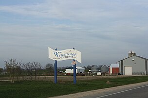
Welcome sign on WIS 54, farm in the background
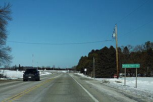
Kewaunee County sign on Highway 42, at the border with Manitowoc County
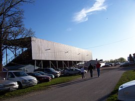
Kewaunee County fairgrounds
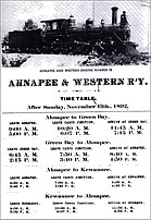
Ahnapee and Western Time Table, 1892


Politics[]
Notable people[]
For lists of notable people from Kewaunee County, see the following articles:
- Luxemburg § Notable people
- Algoma § Notable people
- Kewaunee § Notable people
- Ahnapee § Notable residents
- Carlton § Notable people
- Franklin § Notable people
See also[]
Notes[]
- ^ Hortonville soil series information
- ^ Symco soil series information
- ^ Carbondale soil series information
- ^ Pella soil series information
- ^ Kolberg soil series information
References[]
- ^ Jump up to: a b "State & County QuickFacts". United States Census Bureau. Archived from the original on June 6, 2011. Retrieved January 21, 2014.
- ^ "Find a County". National Association of Counties. Archived from the original on May 31, 2011. Retrieved June 7, 2011.
- ^ "Wisconsin: Individual County Chronologies". Wisconsin Atlas of Historical County Boundaries. The Newberry Library. 2007. Archived from the original on April 14, 2017. Retrieved August 14, 2015.
- ^ Hoffman, Mike. "Menominee Place Names in Wisconsin". The Menominee Clans Story. Retrieved October 5, 2018.
- ^ Kewaunee/Door Peninsula Again Top in Chinook Harvest by Kevin Naze, Peninsula Pulse, May 1, 2019
- ^ It’s No Fish Tale… Charter Boat Captain Is Living His Dream by Joel Waldinger, November 5, 2015, Wisconsin Life, PBS
- ^ Wisconsin Record Fish List, September 2018, Wisconsin DNR (The records are current as of September 2018.)
- ^ The Salmon Experiment: The invention of a Lake Michigan sport fishery, and what has happened since, Updated Jan 21, 2019; Posted Apr 18, 2011 By Howard Meyerson, The Grand Rapids Press
- ^ Red flags signal possible trouble for Lake Michigan salmon where chinooks are king, by Howard Meyerson, The Grand Rapids Press, Updated Jan 21, 2019; Posted Apr 17, 2011
- ^ Charter Captain Meeting March 12, 2015, see pages 56-57, Archived November 1, 2019 also see Lake Huron’s Chinook salmon fishery unlikely to recover due to ongoing food shortage by Jim Erickson, March 14, 2016
- ^ Wisconsin Sea Grant documents value of recreational fishing in Lake Michigan by Aaron R. Conklin, Wisconsin Sea Grant, July 10, 2017
- ^ Can Native Species Compete with Valuable Exotics? Measuring Willingness to Pay for Recreational Fishing in Lake Michigan by Raynor, Jennifer and Phaneuf, Daniel, Presentation for the 2018 International Institute of Fisheries Economics & Trade
- ^ Edsall, T. A., M. E. Holey, B. A. Manny and G. W. Kennedy 1995 An Evaluation of Lake Trout Reproductive Habitat on Clay Banks Reef, Northwestern Lake Michigan. Journal of Great Lakes Research 21 (Supplement 1):418-432
- ^ "Wisconsin Historical Markers: Kewaunee County Historical Society Driving Tour Maps and Descriptions". Archived from the original on March 20, 2014. Retrieved July 31, 2016.
- ^ Atlas of the Spawning and Nursery Areas of Great Lakes Fishes, Volume IV Goodyear C. D., T. Edsall D. M. Ormsby Dempsey G 0 Moss and P. E. Polanski 1982 Fish and wildlife Service FNS/0BS-82/52, p. 155, 164 of the pdf
- ^ Spearing, Netting, and Bait Harvest Regulations 2019-2020, Wisconsin DNR, page 12
- ^ Fish Watching in Wisconsin, EEK Wisconsin website, Accessed January 17, 2020
- ^ 2019 Smelt Run Brings Back Memories of ‘Good Old Days’ by Kevin Naze, Peninsula Pulse, April 26, 2019
- ^ Wisconsin DNR interactive boating map: Kewaunee County
- ^ 2012 Wisconsin Boating Program Report, Wisconsin Department of Natural Resources Bureau of Law Enforcement Pub-LE-314-2012
- ^ America Shipwreck (Canaller), National Register of Historic Places Program, National Park Service, Accessed January 18, 2020
- ^ Maritime trail markers for Kewaunee County listed by the Maritime Preservation Program of the Wisconsin Historical Society, Accessed January 18, 2020
- ^ Parks and trails visitkewauneecounty.com, Accessed January 18, 2020
- ^ Mashek Creek Public Access, Wisconsin DNR, August 17, 2017
- ^ Brusky Wildlife Area, Wisconsin DNR, January 11, 2017
- ^ Directory, visitkewauneecounty.com, accessed January 18, 2020
- ^ Wisconsin Beach Advisories on the Wisconsin Beach Health website; counties are in the dropdown menu
- ^ Red River Park, visitkewauneecounty.com, Accessed January 18, 2020
- ^ Crescent Beach and Boardwalk, travelwisconsin.com, Accessed January 18, 2020
- ^ City of Kewaunee Park Facilities, Parks Department, Accessed January 18, 2020
- ^ Pit locations spreadsheet, Wisconsin Department of Transportation, January 21, 2016
- ^ Lands enrolled in the tax program are shown on the DNR Private Forest Lands Open for Public Recreation interactive map and Managed Forest Law 2019 Acreage Summary Report by Municipality by the Wisconsin Department of Natural Resources, February 25, 2019, page 34
- ^ A Data Compilation and Assessment of Coastal Wetlands of Wisconsin’s Great Lakes, 2002
- ^ Natural area inventory: Wisconsin Great Lakes coast by W. Tans and R. Dawson, 1980, Office of Coastal Management, Wisconsin DNR, 1980, pages 13-13 (pages 16-17 of the pdf)
- ^ Minerals Yearbook, Volume 2, United States. Bureau of Mines, 1989, page 519
- ^ The Peat Resources of Wisconsin by Frederick William Huels, Bulletin of the Wisconsin Geological and Natural History Survey, Issue 45, 1915
- ^ Kewaunee County 2016, WisFlora, UW-Madison
- ^ Mycology Collections Portal. "Consortium of North American Bryophyte Herbaria". (CNABH). Retrieved January 18, 2020.
- ^ Mycology Collections Portal. "Search for Kewaunee, Wisconsin". Mycoportal. Retrieved January 18, 2020.
- ^ Lake Management Plan for East Alaska Lake, page 31, Table 3-4: Aquatic Vegetation of East Alaska Lake and Relative Abundance at the Lake and State Level by the Ecological Services Division of Robert E. Lee and Associates, Inc.
- ^ Terrestrial gastropod fauna of Northeastern Wisconsin and the Southern Upper Peninsula of Michigan, Jeffrey C. Nekola, 2003, American Malacological Bulletin 18(1-2)
- ^ "ebird.org Checklist for Kewaunee County". January 18, 2020. Retrieved January 18, 2020. and ebird.org. "Wisconsin Breeding Bird Atlas". Cornell Lab of Ornithology. Retrieved January 18, 2020.
- ^ WI DNR Harvest Trends database, accessed September 5th, 2019
- ^ Where Cows and Deer Outnumber People In Wisconsin A Badger State Approach to Rural Identity, Malia Jones, UW Applied Population Lab, November 17, 2017, Accessed December 12, 2019
- ^ All cattle and calves in Wisconsin as of January 1, 2017-2018, by the USDA National Agricultural Statistics Service
- ^ The Night(s) of 12,000 Kolache, Wisconsin Life, Wisconsin PBS, from Season 3 Episode 6, article by Zac Schultz, November 5, 2015
- ^ Booyah, a hearty Belgian soup-stew, is revered tradition in Green Bay by Molly Bergin, September 25, 2018, Milwaukee Journal Sentinel
- ^ Booyah Cookout, visitalgomawi.com, 2018
- ^ Wisconsin Folklife, Smithsonian Folklife festival, 1998, page 11
- ^ The Flavor of Wisconsin: An Informal History of Food and Eating in the Badger State by Harva Hachten and Terese Allen, Madison, Wisconsin: Wisconsin Historical Society Press, Second edition, 2009, pages 322-323
- ^ NASS Quick Stats, 1997-2017
- ^ Jump up to: a b Pick Your Own listings, visitkewauneecounty.com, Accessed January 18, 2020
- ^ USDA NASS Quick Stats database results for Christmas trees, 1997-2017
- ^ Wisconsin Epidemiological Profile on Alcohol and Other Drug Use, 2016, P-4578-16, November 2016, Wisconsin Department of Health Services
- ^ The Wisconsin Winery Association. History of Winemaking in Wisconsin
- ^ USDA NASS Quick Stats database results for grapes, 2017-2002 data
- ^ Algoma Natural Papermaker, Paper Is Art, by Zac Schultz, November 12, 2018, Wisconsin Life Wisconsin PBS
- ^ Algoma Artist Tells Stories Through Sculpture by Trevor Keller, December 23, 2019, Wisconsin Life Wisconsin PBS
- ^ Kewaunee Academy of Fine Art: On the Left Bank of the Ahnapee by Gary Jones, Peninsula Pulse, October 5, 2010
- ^ Quick Stats data from the USDA National Agricultural Statistics Service.
- ^ See the map of soils by suitability for agriculture for context. In 2016, the average rental value was $144.00 per acre, more than the Wisconsin average of $131.00 per acre and $81.00 per acre for Door County. The average sale price of agricultural land in 2016 was $6,568 per acre, more than the Wisconsin average of $5,306 per acre and $3,861 per acre for Door County. Statistics from the 2017 Wisconsin Agricultural Statistics pages 5 and 10 and (9 and 14 of the pdf), by the USDA National Agricultural Statistics Service, September 2017
- ^ Soil Survey of Kewaunee County, Wisconsin "2. Hortonville–Symco," page 7 (page 17 of the pdf), 1980, USDA Soil Conservation Service.
- ^ Kewaunee County 2020-2029 Land & Water Resource Management Plan, Table 15. 2016 Organic Matter Study Results, page 51, (page 62 of the pdf), Kewaunee County Land & Water Conservation Department, April 2019
- ^ "2010 Census Gazetteer Files". United States Census Bureau. August 22, 2012. Retrieved August 5, 2015.
- ^ PeakVisor Kewaunee County Named Mountains, Accessed January 18, 2020
- ^ National Water Information System: Web Interface, USGS Station 443535087345401 KW-25/24E/34-0183
- ^ Assessing groundwater quality in Kewaunee County, Wisconsin and Characterizing the timing and variability of enteric pathogen contamination within the dolomite aquifer in northeastern Wisconsin by Borchardt, M.A., Muldoon, M.A., Hunt, R.J., Bonness, D.E., Firnstahl, A.D., Kieke, B.A., Jr., Owens, D.W., Spencer, S.K., Stokdyk, J.P., Wisconsin Geological & Natural History Survey # WOFR2019-05, Final report to the Wisconsin Department of Natural Resources, DNR Project Number 227, August 7, 2019, Section "Recharge and Water Quality," page 45 (page 52 of the pdf)
- ^ Rustic Roads Guide, 2018, Wisconsin DOT, page 74 (page 76 of the pdf)
- ^ Barn Quilts of Door County Location Guide, by the UW-Extension and 4-H program, 2014
- ^ Ice Age National Scenic Trail Hiker Resource Map
- ^ Kewaunee County Trails Map, Kewaunee County Promotions & Recreation Office, Accessed January 18, 2020
- ^ Wisconsin Snow Report
- ^ Lake Michigan Circle Tour, Great Lakes Circle Tour website.
- ^ Riverview ATV Park, Accessed January 18, 2020, visitkewauneecounty.com
- ^ Walter's Agri-center Airport (WI28) on airport-data.com, accessed January 18, 2020
- ^ Rio Creek Airport: History, accessed January 18, 2020
- ^ "County Population Totals: 2010-2020". Retrieved June 20, 2021.
- ^ "U.S. Decennial Census". United States Census Bureau. Retrieved August 5, 2015.
- ^ "Historical Census Browser". University of Virginia Library. Retrieved August 5, 2015.
- ^ Forstall, Richard L., ed. (March 27, 1995). "Population of Counties by Decennial Census: 1900 to 1990". United States Census Bureau. Retrieved August 5, 2015.
- ^ "Census 2000 PHC-T-4. Ranking Tables for Counties: 1990 and 2000" (PDF). United States Census Bureau. April 2, 2001. Retrieved August 5, 2015.
- ^ "U.S. Census website". United States Census Bureau. Retrieved May 14, 2011.
- ^ Final Estimated Components of Population Change for Wisconsin Counties: April 2010 - January 2019, Wisconsin Demographic Services Center, October 2019
- ^ Wisconsin’s Future Population Projections for the State, Its Counties and Municipalities, 2010-2040, by David Egan-Robertson, UW-Madison Applied Population Laboratory, Prepared for the Wisconsin Department of Administration Demographic Services Center, December 2013, page 19 (page 23 of the pdf)
- ^ "Annual Wisconsin Birth and Infant Mortality Report, 2017 P-01161-19 (June 2019): Detailed Tables". Archived from the original on June 19, 2019. Retrieved June 19, 2019.
- ^ Reported Induced Abortions in Wisconsin, Office of Health Informatics, Division of Public Health, Wisconsin Department of Health Services. Section: Trend Information, 2013-2017, Table 18, pages 17-18
- ^ Jump up to: a b Social Capital Project: Social Capital Index Data accompanying the U.S. Congress, Joint Economic Committee, Social Capital Project. “The Geography of Social Capital in America.” Report prepared by the Vice Chairman’s staff, 115th Cong., 2nd Sess. (April 2018)
- ^ 2015 Wisconsin Marriages and Divorces by the State Vital Records Office, May 2016, page 7 and following (page 11 and following of the pdf)
- ^ Wisconsin Blue Book 2017–2018 Basic data on Wisconsin counties, Basic data on Wisconsin counties, page 590 (page 3 of the pdf)
- ^ County Membership Report: Door County (Wisconsin), The Association of Religion Data Archives
- ^ Social Capital Variables Spreadsheet for 2014, PennState College of Agricultural Sciences, Northeast Regional Center for Rural Development
- ^ Life Expectancy in Wisconsin by Karl Pearson and Reka Sundaram-Stukel, August 2016, Wisconsin Department of Health Services, Office of Health Informatics, page 3 (page 5 of the pdf)
- ^ Progress in Reducing Premature Deaths in Wisconsin Counties, 2000-2010 by Thomas Nonnweiler, Elizabeth A. Pollock, Barbara Rudolph, and Patrick L. Remington, Wisconsin Medical Journal, Vol. 112, October 2013, p. 212
- ^ Wisconsin Public Health Profile for Door County, 2017 compared to Wisconsin Public Health Profile for Wisconsin, 2017, Office of health informatics, Division of Public Health, Wisconsin Department of Health Services.
- ^ A look at the prevalence of mental illness in California and the U.S. by Kurt Snibbe, Orange County Register, November 11, 2017, accessed December 11, 2019.
- ^ EPHTracker, Wisconsin Department of Public Health, Accessed January 17, 2020
- ^ Geographic analysis of traffic injury in Wisconsin: impact on case fatality of distance to level I/II trauma care. by Maureen Durkin, Jane A. Mcelroy, Hui Guan, Wayne Bigelow, Tom Brazelton, Wisconsin Medical Journal 2005 Feb; 104(2):26-31.
- ^ A Case Study of Atmospheric Dry Deposition by Jim J. Lin, Department of Life Sciences, National Air University, Tapeii, 1998
- ^ Atmospheric Deposition of PCBs into Green Bay (link to abstract), Journal of Great Lakes Research Volume 19, Issue 1, 1993, Pages 109-123, authors: Clyde W. Sweet, Thomas J. Murphy, James H. Bannasch, Cynthia A. Kelsey, and John Hong
- ^ Algoma Municipal Landfill, epa.gov, accessed January 19, 2020
- ^ Although Krok Creek (along with the East Twin River) is considered an impaired stream for phosphorus levels, a report in 2018 concluded that the "overall fish community in the Upper East Twin River watershed is in good to excellent condition." Water Quality Surveys of the East Twin River (84000) and Unnamed Tributaries (3000211, 3000212, & 3000213) to the East Twin River, and Krok Creek (86700), Kewaunee County, Blue Iris Environmental, 2018
- ^ Impaired Search, Wisconsin DNR, Accessed January 17, 2020
- ^ Kewaunee County 2020-2029 Land & Water Resource Management Plan, Table 12. Kewaunee County Manure Spills, page 43, (page 54 of the pdf), Kewaunee County Land & Water Conservation Department, April 2019
- ^ Groundwater Contamination Susceptibility Map, wi.water.usgs.gov website, accessed January 18, 2020
- ^ Kewaunee County Public GIS Map, ruekert-mielke.com, accessed January 19, 2020
- ^ Groundwater Quality Viewer, UW-Stevens Point, College of Natural Resources, Groundwater Center
- ^ Phosphorus loss from tile drains: Should we be concerned by Matt Ruark, Allison Madison,, Eric Cooley, Todd Stuntebeck, and Matt Komiskey, Proc. of the 2012 Wisconsin Crop Management Conference, Vol. 51, page 3, (page 11 of the pdf)
- ^ Final Report of the Northeast Wisconsin Karst Task Force, Edited by Kevin Erb and Ron Stieglitz, page 27-28 (32-33 of the pdf), February 9, 2007
- ^ Agricultural contamination impacts antibiotic resistance gene abundances in river bed sediment temporally by Rachelle E. Beattie, Michael Walsh, Mercedes Cecilia Cruz, L. Rex McAliley, Laurel Dodgen, Wei Zheng, and Krassimira R. Hristova, FEMS Microbiology Ecology, 94, 2018, page 1
- ^ Soil Survey of Kewaunee County, Wisconsin "History and Development," page 4 (page 14 of the pdf), 1980, USDA Soil Conservation Service.
- ^ The Walloon Immigrants Of Northeast Wisconsin: An Examination Of Ethnic Retention by Tinkler, Jacqueline Lee, Chapter 2 Establishment of Walloon Settlement in Wisconsin, MA Thesis, University of Texas-Arlington, page 26 (page 33), July 22, 2013
- ^ The Czechs in Wisconsin History by Karel D. Bicha, The Wisconsin Magazine of History, 1970, page 196 (page 3 of the pdf)
- ^ Sailors as Entrepreneurs in a Great Lakes Maritime Village by Fred Neuschel, The Northern Mariner, Vol. VIII, No. 1 (January 1998), pages 65-82 (pages 1-18 of the pdf)
- ^ Algoma, Wisconsin listing from the Handbook of Iron Meteorites. Buchwald, Vagn F. 1975, University of California Press, Volume 2
- ^ Minerals home: Meteorites, Wisconsin Geological and Natural History Survey
- ^ Mailer, Stan (1989). Green Bay & Western The First 111 Years. Hundman Publishing.
- ^ Establishing an Ethnic Collection in a Small Institution, by Dorothy L. Heinrich, The Midwestern Archivist, 1977, page 43 (page 3 of the pdf)
- ^ Leip, David. "Dave Leip's Atlas of U.S. Presidential Elections". uselectionatlas.org. Retrieved November 9, 2020.
Further reading[]
- History of Kewaunee County. n.p., n.p., 1921–1922.
External links[]
| Wikimedia Commons has media related to Kewaunee County, Wisconsin. |
- Kewaunee County
- Kewaunee County map from the Wisconsin Department of Transportation
- Northeast Wisconsin Historical County Plat Maps & Atlases University of Wisconsin Digital Collections Center
- Lengthy excerpt from Pioneers of Ahnapee detailing history from the later half of the 19th century
| show Places adjacent to Kewaunee County, Wisconsin |
|---|
| show Municipalities and communities of Kewaunee County, Wisconsin, United States |
|---|

Coordinates: 44°35′N 87°26′W / 44.59°N 87.44°W
| show Authority control |
|---|
- Wisconsin counties
- Kewaunee County, Wisconsin
- Green Bay metropolitan area
- 1859 establishments in Wisconsin
- Populated places established in 1859