Manitowoc County, Wisconsin
Manitowoc County, Wisconsin | |
|---|---|
County | |
 Flag  Seal | |
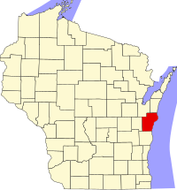 Map of Wisconsin showing Manitowoc County | |
 Wisconsin's location in the United States | |
| Country | |
| State | |
| Incorporated | 1848 |
| County seat | City of Manitowoc |
| Incorporated Municipalities | |
| Government | |
| • Type | County |
| • Body | Board of Supervisors |
| • Board President | Jim Brey |
| • County Board | 25 commissioners |
| Area | |
| • Total | 1,494 sq mi (3,870 km2) |
| • Land | 589 sq mi (1,530 km2) |
| • Water | 905 sq mi (2,340 km2) |
| Area rank | 6th largest county in Wisconsin |
| Population (2010) | |
| • Total | 81,442 |
| • Estimate (2020) | 78,757 |
| • Rank | 21st largest county in Wisconsin |
| • Density | 55/sq mi (21/km2) |
| Time zone | UTC−6 (Central) |
| • Summer (DST) | UTC−5 (Central) |
| Area codes | 920 |
| Congressional districts | 6th |
| Interstates | |
| U.S. Routes | |
| State Routes | |
| Airports | Manitowoc County Airport
|
| Waterways | Lake Michigan – Manitowoc River
|
| Public transit | Maritime Metro Transit |
| Website | co.manitowoc.wi.us |
Manitowoc County /ˈmænɪtəwɔːk/ is a county in the U.S. state of Wisconsin. As of the 2010 census, the population was 81,442.[1] Its county seat is Manitowoc.[2] The county was created in 1836 prior to Wisconsin's statehood and organized in 1848.[3]
Manitowoc County comprises the Manitowoc, WI Micropolitan Statistical Area.
Geography[]
According to the U.S. Census Bureau, the county has a total area of 1,494 square miles (3,870 km2), of which 589 square miles (1,530 km2) is land and 905 square miles (2,340 km2) (61%) is water.[4]
Major highways[]
|
|
Airport[]
Manitowoc County Airport (KMTW) serves the county and surrounding communities.
Adjacent counties[]
- Brown County – northwest
- Kewaunee County – northeast
- Sheboygan County – south
- Calumet County – west
Climate[]
| ||||||||||||||||||||||||||||||||||||||||||||||||||||||||||||||||||||||||||||
Demographics[]
| Historical population | |||
|---|---|---|---|
| Census | Pop. | %± | |
| 1840 | 235 | — | |
| 1850 | 3,702 | 1,475.3% | |
| 1860 | 22,416 | 505.5% | |
| 1870 | 33,364 | 48.8% | |
| 1880 | 37,505 | 12.4% | |
| 1890 | 37,831 | 0.9% | |
| 1900 | 42,261 | 11.7% | |
| 1910 | 44,978 | 6.4% | |
| 1920 | 51,644 | 14.8% | |
| 1930 | 58,674 | 13.6% | |
| 1940 | 61,617 | 5.0% | |
| 1950 | 67,159 | 9.0% | |
| 1960 | 75,215 | 12.0% | |
| 1970 | 82,294 | 9.4% | |
| 1980 | 82,918 | 0.8% | |
| 1990 | 80,421 | −3.0% | |
| 2000 | 82,887 | 3.1% | |
| 2010 | 81,442 | −1.7% | |
| 2020 (est.) | 78,757 | [6] | −3.3% |
| U.S. Decennial Census[7] 1790–1960[8] 1900–1990[9] 1990–2000[10] 2010–2020[1] | |||

The 2000 census[11] shows Manitowoc County as having 82,887 people, 32,721 households and 22,348 families.The population density was 140 people per square mile (54/km2). There were 34,651 housing units at an average density of 59 per square mile (23/km2). The racial makeup of the county was 95.90% White, 0.30% Black or African American, 0.43% Native American, 1.98% Asian, 0.04% Pacific Islander, 0.60% from other races, and 0.76% from two or more races. 1.62% of the population were Hispanic or Latino of any race. 53.7% were of German, 7.3% Polish, 5.3% Czech and 5.0% American ancestry. 95.2% spoke English, 1.8% Spanish, 1.3% Hmong and 1.1% German as their first language.
There were 32,721 households, out of which 31.50% had children under the age of 18 living with them, 57.10% were married couples living together, 7.50% had a female householder with no husband present, and 31.70% were non-families. 26.80% of all households were made up of individuals, and 12.10% had someone living alone who was 65 years of age or older. The average household size was 2.49 and the average family size was 3.04.
In the county, the population is spread out, with 25.5% under the age of 18, 7.60% from 18 to 24, 28.20% from 25 to 44, 23% from 45 to 64, and 15.70% who were 65 years of age or older. The median age was 38 years. For every 100 females there were 98.20 males. For every 100 females age 18 and over, there were 96.10 males.
In 2017, there were 780 births, giving a general fertility rate of 60.2 births per 1000 women aged 15–44, the 27th lowest rate out of all 72 Wisconsin counties.[12] Additionally, there were 43 reported induced abortions performed on women of Manitowoc County residence in 2017.[13]
Government[]
The county executive is Bob Ziegelbauer. He is serving his fourth term in that position after being elected in April 2006 and reelected in April 2010, April 2014, and April 2018.[14] The county is served by a 25-member county board.
Politics[]
Manitowoc County is fairly competitive in Presidential Elections until 2016 when candidate Donald Trump became the first president since Lyndon B. Johnson from 1964 to win more than 55% of the vote and adding on a further 60% during the 2020 elections. Statewide, Manitowoc has voted Republican since the 2002 gubernatorial elections although not significantly impacting the results as the tipping point area is in the state's 3rd congressional district.
Communities[]
Cities[]
- Kiel (partly in Calumet County)
- Manitowoc (county seat)
- Two Rivers
Villages[]
Towns[]
Census-designated places[]
Unincorporated communities[]
- Alverno
- Branch
- Cato
- Cato Falls
- Clarks Mills
- Clover
- Cooperstown
- Duveneck
- Fisherville
- Grimms
- Hickory Grove
- Kellners Corners
- Kingsbridge
- Larrabee
- Louis Corners
- Madsen
- Maple Grove
- Meeme
- Meggers (partial)
- Melnik
- Menchalville
- Millhome
- Newton
- Newtonburg
- North Grimms
- Northeim
- Osman
- Reifs Mills
- Rockville
- Rockwood
- Rosecrans
- Rube
- School Hill
- Shoto
- Spring Valley
- Steinthal
- Taus
- Tisch Mills (partial)
- Two Creeks
- Wells (partial)
- Zander
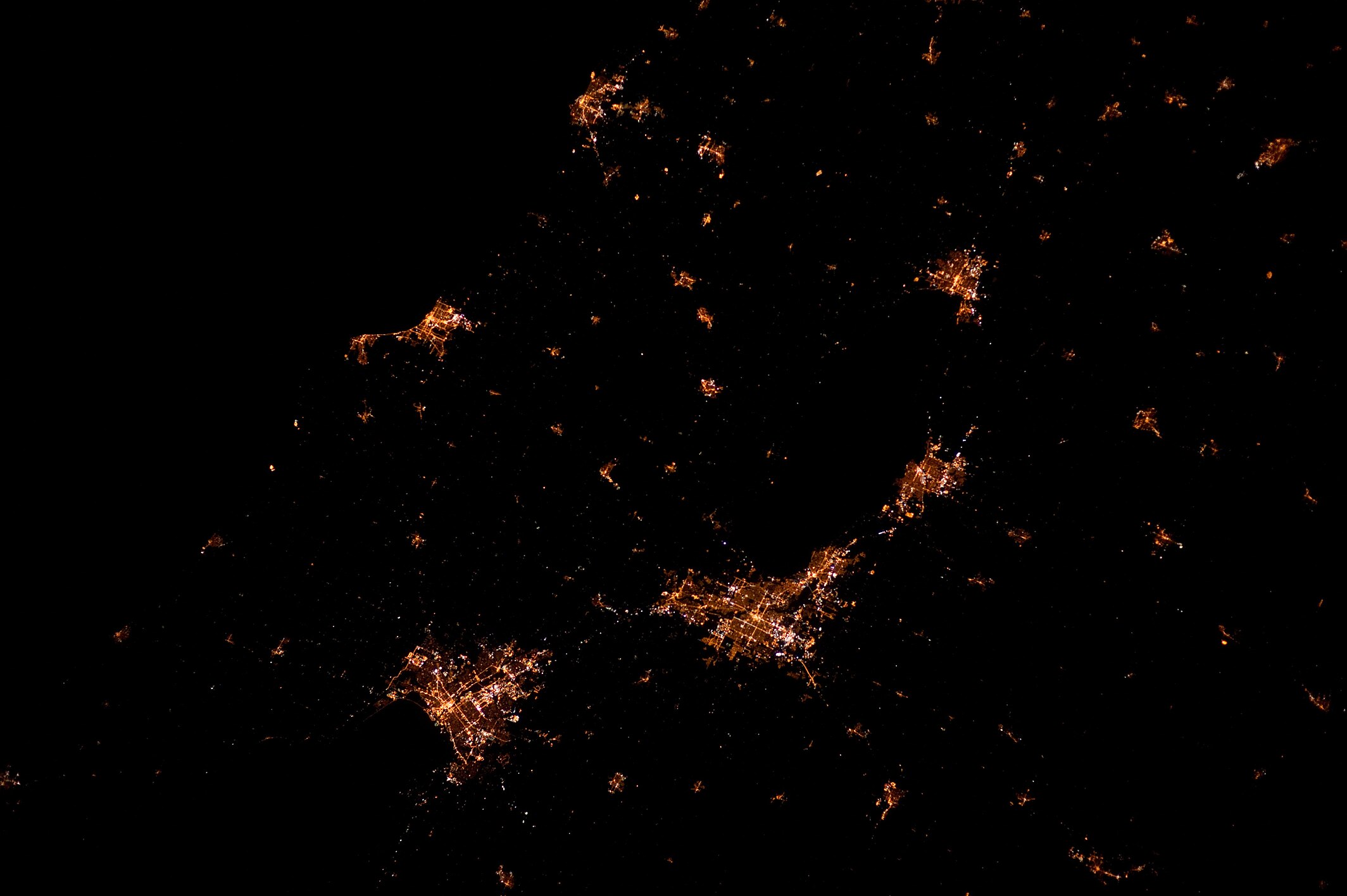
At night[]
In the media[]
The Netflix documentary series Making a Murderer (2015) explores the arrests and trials in 2007 of Manitowoc County residents Steven Avery and his nephew Brendan Dassey for the murder of Teresa Halbach, who disappeared in October 2005. The series describes an earlier wrongful conviction of Avery, for which he served 18 years, and his subsequent lawsuit against Manitowoc County. It then focuses on the procedures of the Calumet County Sheriff's Office and the Manitowoc County Sheriff's Department, which investigated the later Halbach case. The Sheriffs officers have come under intense scrutiny for their involvement in the Halbach case due to Steven Avery's $36 million lawsuit and their questionable police and investigative techniques.[16][17]
Gallery[]
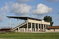
Manitowoc County Expo Grounds

Sign marking entrance to Manitowoc County in Kiel

Manitowoc County Jail


See also[]
References[]
- ^ Jump up to: a b "State & County QuickFacts". United States Census Bureau. Archived from the original on June 6, 2011. Retrieved January 22, 2014.
- ^ "Find a County". National Association of Counties. Retrieved June 7, 2011.
- ^ "Wisconsin: Individual County Chronologies". Wisconsin Atlas of Historical County Boundaries. The Newberry Library. 2007. Archived from the original on April 14, 2017. Retrieved August 15, 2015.
- ^ "2010 Census Gazetteer Files". United States Census Bureau. August 22, 2012. Retrieved August 6, 2015.
- ^ "NASA Earth Observations Data Set Index". NASA. Retrieved January 30, 2016.
- ^ "County Population Totals: 2010-2020". Retrieved June 20, 2021.
- ^ "U.S. Decennial Census". United States Census Bureau. Retrieved August 6, 2015.
- ^ "Historical Census Browser". University of Virginia Library. Retrieved August 6, 2015.
- ^ Forstall, Richard L., ed. (March 27, 1995). "Population of Counties by Decennial Census: 1900 to 1990". United States Census Bureau. Retrieved August 6, 2015.
- ^ "Census 2000 PHC-T-4. Ranking Tables for Counties: 1990 and 2000" (PDF). United States Census Bureau. April 2, 2001. Retrieved August 6, 2015.
- ^ "U.S. Census website". United States Census Bureau. Retrieved May 14, 2011.
- ^ "Annual Wisconsin Birth and Infant Mortality Report, 2017 P-01161-19 (June 2019): Detailed Tables". Archived from the original on June 19, 2019. Retrieved June 19, 2019.
- ^ Reported Induced Abortions in Wisconsin, Office of Health Informatics, Division of Public Health, Wisconsin Department of Health Services. Section: Trend Information, 2013-2017, Table 18, pages 17-18
- ^ Schafer, Alisa M. (April 3, 2018). "3 Bob Ziegelbauer re-elected as county exec; Manitowoc schools referendum passes". Herald Times Reporter. Retrieved May 26, 2018.
- ^ Leip, David. "Dave Leip's Atlas of U.S. Presidential Elections". uselectionatlas.org. Retrieved November 11, 2020.
- ^ MONICA DAVEY, "Questioning the Evidence in the ‘Making a Murderer’ Case", New York Times, January 29, 2016; accessed January 14, 2016
- ^ Hale, Mike (December 16, 2015). "Review: 'Making a Murderer,' True Crime on Netflix". The New York Times. Retrieved December 20, 2015.
Further reading[]
- Falge, Louis (ed.). History of Manitowoc County, Wisconsin. Chicago: Goodspeed Historical Association, 1912. Vol. 1, Vol. 2
- Langill, Ellen, Robin E. Butler, Rachel Young, and MaryBeth Matzek. Manitowoc County: A Beacon on the Lakeshore. Milwaukee, Wis.: Milwaukee Pub. Group, 1999.
- Plumb, Ralph Gordon. A History of Manitowoc County. Manitowoc, Wis.: Brant Print & Binding Co., 1904.
- Rapper, Joseph J. Story of a Century, 1848-1948: Manitowoc County During Wisconsin's First Hundred Years. Manitowoc, Wis.: Manitowoc County Centennial Committee, 1948.
External links[]
- Manitowoc County website
- Manitowoc County map from the Wisconsin Department of Transportation
| show Places adjacent to Manitowoc County, Wisconsin |
|---|
| show Municipalities and communities of Manitowoc County, Wisconsin, United States |
|---|


Coordinates: 44°09′N 87°33′W / 44.15°N 87.55°W

| show Authority control |
|---|
- Manitowoc County, Wisconsin
- Wisconsin counties
- 1836 establishments in Wisconsin Territory
- Populated places established in 1836