Kipling, Saskatchewan
Kipling | |
|---|---|
Town | |
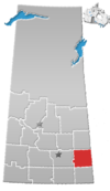
 Kipling Location of Kipling in Saskatchewan | |
| Coordinates: 50°6′5.36″N 102°37′56.64″W / 50.1014889°N 102.6324000°W | |
| Country | Canada |
| Province | Saskatchewan |
| Rural municipality | Kingsley |
| Government | |
| • Mayor | Rylan Franks[1] |
| Population | |
| • Total | 1,140 |
| Time zone | UTC−6 (Central (CST)) |
| Website | http://www.townofkipling.ca/ |
Kipling is a town in south-east Saskatchewan, Canada. In provincial politics, Kipling is in the constituency of Moosomin. The town was named after the English author Rudyard Kipling.[2]
History[]
Kipling sites which can be classed as 'heritage properties' include the former CN station, built in 1908–09, and the Kingsley rural municipality office, built in 1919. In addition, a major and highly interesting group of pioneer-era buildings can be viewed on the spacious sites belonging to the Kipling and District Historical Society Museum. The Kipling and District Museum (1903–59) is a Municipal Heritage Property on the Canadian Register of Historic Places.[3]
In 2007, Canadian blogger Kyle MacDonald successfully parlayed one red paperclip via a series of trades into a house in Kipling.[4] The town commemorates the story with the Guinness World Record certified World's Largest Paper Clip, 15 feet tall and weighing 3043 pounds.[5]
Government[]
There is a town council, whose members as of February 2017 were Mayor Pat Jackson, and aldermen Makyla Stender, Tyler Vargo, Don Johnson, Colby Sproat, Devin Draper, and James Gallagher.
As of 2017 Kipling is within the provincial constituency of Moosomin, and is represented in the Legislative Assembly of Saskatchewan by Steven Bonk of the Saskatchewan Party.
Federally, Kipling is in the riding of Souris-Moose Mountain, and is represented in the 42nd Parliament by Robert Kitchen, of the Conservative Party of Canada.
Climate[]
| hideClimate data for Kipling | |||||||||||||
|---|---|---|---|---|---|---|---|---|---|---|---|---|---|
| Month | Jan | Feb | Mar | Apr | May | Jun | Jul | Aug | Sep | Oct | Nov | Dec | Year |
| Record high °C (°F) | 6.7 (44.1) |
11 (52) |
20.6 (69.1) |
31.7 (89.1) |
36.7 (98.1) |
36.7 (98.1) |
38 (100) |
38.3 (100.9) |
35 (95) |
31 (88) |
21.7 (71.1) |
9.5 (49.1) |
38.3 (100.9) |
| Average high °C (°F) | −11 (12) |
−7.1 (19.2) |
−0.5 (31.1) |
9.5 (49.1) |
17.5 (63.5) |
22 (72) |
24.5 (76.1) |
23.4 (74.1) |
17.2 (63.0) |
9.9 (49.8) |
−1.2 (29.8) |
−8.6 (16.5) |
8 (46) |
| Daily mean °C (°F) | −16.5 (2.3) |
−12.5 (9.5) |
−6 (21) |
3.3 (37.9) |
10.9 (51.6) |
15.6 (60.1) |
18 (64) |
16.6 (61.9) |
10.7 (51.3) |
3.9 (39.0) |
−5.9 (21.4) |
−13.7 (7.3) |
2 (36) |
| Average low °C (°F) | −21.9 (−7.4) |
−17.7 (0.1) |
−11.4 (11.5) |
−2.9 (26.8) |
4.3 (39.7) |
9.2 (48.6) |
11.3 (52.3) |
9.8 (49.6) |
4.2 (39.6) |
−2 (28) |
−10.5 (13.1) |
−18.6 (−1.5) |
−3.9 (25.0) |
| Record low °C (°F) | −44.4 (−47.9) |
−41.7 (−43.1) |
−40 (−40) |
−26.7 (−16.1) |
−12.8 (9.0) |
−3.3 (26.1) |
1.7 (35.1) |
−2 (28) |
−8.9 (16.0) |
−23 (−9) |
−34.4 (−29.9) |
−43 (−45) |
−44.4 (−47.9) |
| Average precipitation mm (inches) | 20.4 (0.80) |
17.5 (0.69) |
25.3 (1.00) |
28.2 (1.11) |
53.4 (2.10) |
75.3 (2.96) |
65.4 (2.57) |
60.4 (2.38) |
46.4 (1.83) |
27.4 (1.08) |
17.8 (0.70) |
23.9 (0.94) |
461.3 (18.16) |
| Source: Environment Canada[6] | |||||||||||||
Sports[]
The Kipling/Windthorst Oil Kings of the senior men's Big 6 Hockey League play in the local arena.[7]
The Kipling Royals of the Saskota Baseball League[8] play at the ball diamonds in Kipling.
See also[]
References[]
- ^ Town of Kipling » Council
- ^ Town of Kipling » About the Town
- ^ "Kipling and District Historical Museum". Canadian Register of Historic Places. Parks Canada. Retrieved 2011-03-29.
- ^ "Town of Kipling » Red Paperclip Story".
- ^ "Worlds Largest Red Paper Clip | Tourism Saskatchewan".
- ^ Environment Canada Canadian Climate Normals 1971–2000, accessed 4 August 2010
- ^ Big 6 Hockey League
- ^ "Saskota Baseball League - Teams".
Other sources[]
- The Unforgiving Minute – A Life of Rudyard Kipling Harry Ricketts, Pimlico, 2000 ISBN 0-7126-6471-8[unreliable source?]
- What was he doing out?- The Province, Page A8, Vancouver BC Brett Popplewell, Canadian Press, August 3, 2006
External links[]
Coordinates: 50°6′5.3634″N 102°37′56.64″W / 50.101489833°N 102.6324000°W
- Towns in Saskatchewan
- Kingsley No. 124, Saskatchewan
- Division No. 5, Saskatchewan
- Saskatchewan Division No. 5 geography stubs


