Kortemark
Kortemark | |
|---|---|
 | |
 Flag  Coat of arms | |
 Kortemark Location in Belgium
show Location of Kortemark in West Flanders | |
| Coordinates: 51°02′N 03°02′E / 51.033°N 3.033°ECoordinates: 51°02′N 03°02′E / 51.033°N 3.033°E | |
| Country | Belgium |
| Community | Flemish Community |
| Region | Flemish Region |
| Province | West Flanders |
| Arrondissement | Diksmuide |
| Government | |
| • Mayor | Firmin Dupulthys (Samen Sterk) 2007-2010 Toon Vancoillie (Open VLD) 2011-2012 |
| • Governing party/ies | , CD&V, Open VLD |
| Area | |
| • Total | 55.00 km2 (21.24 sq mi) |
| Population (2018-01-01)[1] | |
| • Total | 12,584 |
| • Density | 230/km2 (590/sq mi) |
| Postal codes | 8610 |
| Area codes | 051 |
| Website | www.kortemark.be |


Kortemark, church: Sint-Bartholomeuskerk
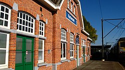
Kortemark ([ˈkɔrtəmɑrk]), also previously Cortemarck, is a municipality located in the Belgian province of West Flanders. The municipality comprises the towns of Handzame, Kortemark, Werken and Zarren. On January 1, 2006, Kortemark had a total population of 11,976. The total area is 55.00 km² which gives a population density of 218 inhabitants per km².
Notable people[]
- Gustave Sap, politician, (Kortemark, 21 January 1886 - Brussels, 19 March 1940)
References[]
- ^ "Wettelijke Bevolking per gemeente op 1 januari 2018". Statbel. Retrieved 9 March 2019.
External links[]
 Media related to Kortemark at Wikimedia Commons
| show Places adjacent to Kortemark |
|---|

| show Authority control |
|---|
This West Flanders location article is a stub. You can help Wikipedia by . |
Categories:
- Municipalities of West Flanders
- West Flanders geography stubs