Wingene
Wingene | |
|---|---|
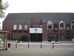 Wingene town hall | |
 Flag  Coat of arms | |
 Wingene Location in Belgium
show Location of Wingene in West Flanders | |
| Coordinates: 51°03′N 03°16′E / 51.050°N 3.267°ECoordinates: 51°03′N 03°16′E / 51.050°N 3.267°E | |
| Country | Belgium |
| Community | Flemish Community |
| Region | Flemish Region |
| Province | West Flanders |
| Arrondissement | Tielt |
| Government | |
| • Mayor | Lieven Huys (CD&V) |
| • Governing party/ies | CD&V |
| Area | |
| • Total | 68.42 km2 (26.42 sq mi) |
| Population (2018-01-01)[1] | |
| • Total | 14,243 |
| • Density | 210/km2 (540/sq mi) |
| Postal codes | 8750 |
| Area codes | 051 |
| Website | www.wingene.be |


Wingene (historically: Wynghene) is a municipality located in the Belgian province of West Flanders. The municipality comprises the towns of Wingene proper and Zwevezele. On December 1, 2019, Wingene had a total population of 14,398. The total area is 68.42 km² which gives a population density of 192 inhabitants per km².
Gallery[]
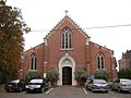
Saint George's church, Wildenburg, Wingene

Restored coach house of the former castle of Zwevezele


References[]
- ^ "Wettelijke Bevolking per gemeente op 1 januari 2018". Statbel. Retrieved 9 March 2019.
External links[]
 Media related to Wingene at Wikimedia Commons
| show Places adjacent to Wingene |
|---|

| show Authority control |
|---|
This West Flanders location article is a stub. You can help Wikipedia by . |
Categories:
- Municipalities of West Flanders
- West Flanders geography stubs