Kuala Lumpur International Airport ERL station
This article does not cite any sources. (June 2019) |
KE2 KT5 Kuala Lumpur International Airport 吉隆坡国际机场 / 吉隆坡國際機場 Lapangan Terbang Antarabangsa Kuala Lumpur கோலாலம்பூர் பன்னாட்டு வானூர்தி நிலையம் | |||||||||||||||
|---|---|---|---|---|---|---|---|---|---|---|---|---|---|---|---|
| Airport rail link station | |||||||||||||||
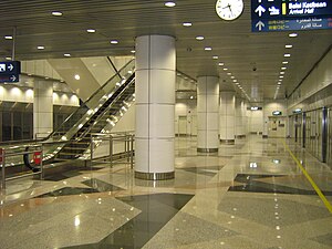 A platform at the KLIA ERL station. | |||||||||||||||
| Location | Kuala Lumpur International Airport, Sepang, Selangor, Malaysia. | ||||||||||||||
| Owned by | Express Rail Link | ||||||||||||||
| Line(s) | 6 KLIA Ekspres 7 KLIA Transit | ||||||||||||||
| Platforms | 1 island platform | ||||||||||||||
| Tracks | 2 tracks | ||||||||||||||
| History | |||||||||||||||
| Opened | 2002 | ||||||||||||||
| Services | |||||||||||||||
| |||||||||||||||
Kuala Lumpur International Airport ERL station or KLIA ERL station is a station on the Express Rail Link (ERL) which serves the Main Terminal of the Kuala Lumpur International Airport (KLIA), Malaysia. The station is on the first floor of the Main Terminal Building. It is served by both lines of the ERL, the KLIA Ekspres and KLIA Transit.
All ERL trains stop at this station and klia2 ERL station. KLIA Ekspres runs non-stop to KL Sentral, the main railway in the capital Kuala Lumpur, while KLIA Transit calls at three intermediate stations before terminating at KL Sentral.
KLIA-klia2 shuttle[]
The KLIA Ekspres and KLIA Transit services each operate on two 2 km bi-directional single tracks between the KLIA and klia2 stations. The KLIA Ekspress runs on the track connecting Platforms A of both stations and the KLIA Transit between Platforms B respectively. Passengers are advised whether a service is inbound or outbound through automated station announcements and platform displays.
These overlapping services and shared stations allow the ERL to function as a higher frequency shuttle between KLIA and klia2 unlike the terminals at KL Sentral where the services end and start at their own separate platforms on different corners of the station.
See also[]
- Kuala Lumpur International Airport
- Public transport in Kuala Lumpur
Coordinates: 2°45′18″N 101°42′18″E / 2.7550°N 101.7049°E
- Airport railway stations
- Express Rail Link
- Rapid transit stations in Kuala Lumpur
- 2002 establishments in Malaysia
- Railway stations opened in 2002
- Kuala Lumpur International Airport