La Talaudière
show This article may be expanded with text translated from the corresponding article in French. (July 2014) Click [show] for important translation instructions. |
La Talaudière | |
|---|---|
Commune | |
 | |
show Location of La Talaudière | |
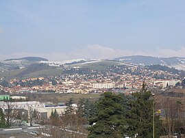
 La Talaudière | |
| Coordinates: 45°28′57″N 4°25′58″E / 45.4825°N 4.4328°ECoordinates: 45°28′57″N 4°25′58″E / 45.4825°N 4.4328°E | |
| Country | France |
| Region | Auvergne-Rhône-Alpes |
| Department | Loire |
| Arrondissement | Saint-Étienne |
| Canton | Sorbiers |
| Intercommunality | Saint-Étienne Métropole |
| Government | |
| • Mayor (2020–2026) | Ramona Gonzalez-Grail |
| Area 1 | 7.63 km2 (2.95 sq mi) |
| Population (Jan. 2018)[1] | 6,931 |
| • Density | 910/km2 (2,400/sq mi) |
| Time zone | UTC+01:00 (CET) |
| • Summer (DST) | UTC+02:00 (CEST) |
| INSEE/Postal code | 42305 /42350 |
| Elevation | 473–696 m (1,552–2,283 ft) (avg. 507 m or 1,663 ft) |
| 1 French Land Register data, which excludes lakes, ponds, glaciers > 1 km2 (0.386 sq mi or 247 acres) and river estuaries. | |


La Talaudière (French pronunciation: [la talodjɛʁ]) is a commune in the Loire department in central France.
Population[]
| Year | Pop. | ±% |
|---|---|---|
| 1872 | 2,469 | — |
| 1881 | 3,046 | +23.4% |
| 1891 | 3,246 | +6.6% |
| 1901 | 3,178 | −2.1% |
| 1911 | 3,437 | +8.1% |
| 1921 | 3,413 | −0.7% |
| 1931 | 3,410 | −0.1% |
| 1946 | 3,774 | +10.7% |
| 1954 | 4,302 | +14.0% |
| 1962 | 4,309 | +0.2% |
| 1975 | 5,655 | +31.2% |
| 1982 | 5,577 | −1.4% |
| 1990 | 5,935 | +6.4% |
| 1999 | 6,700 | +12.9% |
| 2012 | 6,496 | −3.0% |
| 2017 | 6,860 | +5.6% |
Twin towns[]
La Talaudière is twinned with:
See also[]
References[]
- ^ "Populations légales 2018". INSEE. 28 December 2020.
| Wikimedia Commons has media related to La Talaudière. |
| show Authority control |
|---|
This Loire geographical article is a stub. You can help Wikipedia by . |
Categories:
- Communes of Loire (department)
- Loire geography stubs