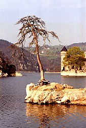
Saint-Priest-la-Roche
Saint-Priest-la-Roche | |
|---|---|
Commune | |
 | |
show Location of Saint-Priest-la-Roche | |
 Saint-Priest-la-Roche | |
| Coordinates: 45°54′49″N 4°05′40″E / 45.9136°N 4.0944°ECoordinates: 45°54′49″N 4°05′40″E / 45.9136°N 4.0944°E | |
| Country | France |
| Region | Auvergne-Rhône-Alpes |
| Department | Loire |
| Arrondissement | Roanne |
| Canton | Le Coteau |
| Intercommunality | Pays entre Loire et Rhône |
| Government | |
| • Mayor (2020–2026) | André Roche [1] |
| Area 1 | 13.5 km2 (5.2 sq mi) |
| Population (Jan. 2018)[2] | 344 |
| • Density | 25/km2 (66/sq mi) |
| Time zone | UTC+01:00 (CET) |
| • Summer (DST) | UTC+02:00 (CEST) |
| INSEE/Postal code | 42277 /42590 |
| Elevation | 290–535 m (951–1,755 ft) (avg. 434 m or 1,424 ft) |
| 1 French Land Register data, which excludes lakes, ponds, glaciers > 1 km2 (0.386 sq mi or 247 acres) and river estuaries. | |


Saint-Priest-la-Roche is a commune in the Loire department in central France.
Population[]
|
|
Amenities[]
There are two chambres d'hôtes in the village.
See also[]
References[]
- ^ "Répertoire national des élus: les maires". data.gouv.fr, Plateforme ouverte des données publiques françaises (in French). 2 December 2020.
- ^ "Populations légales 2018". INSEE. 28 December 2020.
| Wikimedia Commons has media related to Saint-Priest-la-Roche. |
This Loire geographical article is a stub. You can help Wikipedia by . |
Categories:
- Communes of Loire (department)
- Loire geography stubs