List of Interstate Highways in Pennsylvania
| Interstate Highways of the Pennsylvania State Route System | |
|---|---|
    Route markers for Interstate 83, Interstate 376, Interstate 83 Business, and Interstate 376 Business | |
 Map of Interstate Highways in Pennsylvania | |
| System information | |
| Notes | All routes are assigned State Route (SR X) numbers, usually corresponding to the signed numbers. Interstates are generally state-maintained. |
| Highway names | |
| Interstates | Interstate X (I-X) |
| Business Loops: | Interstate X Business (I-X Bus.) |
| System links | |
| |
The list of Interstate Highways in Pennsylvania encompasses 23 Interstate Highways—12 primary routes and 11 auxiliary routes—which exist entirely or partially in the U.S. state of Pennsylvania. In Pennsylvania, most of the Interstate highways are maintained by the Pennsylvania Department of Transportation (PennDOT). Some stretches are also maintained by the Pennsylvania Turnpike Commission, Delaware River Port Authority, the Delaware River Joint Toll Bridge Commission, and 2 short stretches maintained by the New York State Department of Transportation (these being the Delaware River bridge on Interstate 84 and a short stretch of the future Interstate 86 in Bradford County). Interstate highways make up three percent of all roadway lane miles in Pennsylvania and have a combined length of 1,953 mi (3,143 km) within the state. Twenty-four percent of all vehicle traffic is on the Interstate system.[1]
Primary Interstate Highways[]
| Number | Length (mi)[2] | Length (km) | Southern or western terminus | Northern or eastern terminus | Formed | Removed | Notes | |
|---|---|---|---|---|---|---|---|---|
| 167.92 | 270.24 | I-70 at West Virginia border in Donegal Township | I-70/US 522 at Maryland border near Warfordsburg | 1956 | current | Interstate 70 enters Pennsylvania at the West Virginia state line one mile (1.6 km) west of West Alexander in Washington County. The highway multiplexes with I-76 from Exit 75 to Exit 161 as the Pennsylvania Turnpike. In Breezewood, I-70 leaves I-76 and the Pennsylvania turnpike veering south toward the Maryland border. It exits the state two miles (3 km) east of Warfordsburg in Fulton County.[3][4] | ||
| 36.7 | 59.1 | I-70/I-79 in North Beaver Township | I-70/I-80S/Penna Turnpike in New Stanton | 1957 | 1964 | I-70S bypassed Pittsburgh to the South; I-70 rerouted to avoid Pittsburgh onto I-70S | ||
| 349.67 | 562.74 | I-76 at Ohio border in North Beaver Township | I-76 at New Jersey border in Philadelphia | 1964 | current | Interstate 76 enters Pennsylvania at the Ohio border northwest of Enon Valley in Lawrence County as the Pennsylvania Turnpike. The highway initially heads southeast through Pittsburgh to Somerset before turning east. At Exit 326, the highway becomes the Schuylkill Expressway. I-76 leaves the state at the New Jersey state line in Philadelphia via the Walt Whitman Bridge.[3][4] | ||
| 75.23 | 121.07 | I-81 in Union Township | I-78 at New Jersey border in Williams Township | 1956 | current | Interstate 78 begins at I-81 five miles (8 km) west of Fredericksburg in Lebanon County. It is multiplexed with U.S. Route 22 as the William Penn Highway from Exit 8 in Fredericksburg to Exit 51 in Allentown. The highway was briefly designated as I-80N from 1957 to 1958. I-78 exits Pennsylvania and enters New Jersey via the Interstate 78 Toll Bridge in Easton.[3][4] | ||
| 182.72 | 294.06 | I-79 at West Virginia border in Perry Township | Bayfront Parkway in Erie | 1956 | current | Interstate 79 enters Pennsylvania at the West Virginia state line one mile (1.6 km) south of Mount Morris in Greene County. The highway travels north to Erie, bypassing Pittsburgh. I-79 is named to Raymond P. Shafer Highway for its entire length. Between Exits 65 and 68, I-79 is part of the Yellow Belt of the Pittsburgh Belt System. The only multiplex on the route is with I-70 in Washington from Exit 34 to Exit 38. The interstate ends at PA 5/PA 290 and the Bayfront Parkway at Exit 183 in Erie.[3][4] | ||
| 311.07 | 500.62 | I-80 at Ohio border in Shenango Township | I-80 at New Jersey border in Delaware Water Gap | 1956 | current | Interstate 80 enters Pennsylvania at the Ohio state line three miles (5 km) west of West Middlesex in Mercer County. The route is known as the Z.H. Confair Memorial Highway and the Keystone Shortway. I-80 passes through no major cities while in Pennsylvania. It leaves the state and enters New Jersey via the Delaware Water Gap Toll Bridge in Stroudsburg, Monroe County.[3][4] | ||
| 349.67 | 562.74 | I-80S at Ohio border in North Beaver Township | I-80S at New Jersey border in Philadelphia | 1956 | 1964 | Renumbered as I-76 to conform to AASHTO policy against suffixed routes | ||
| 232.63 | 374.38 | I-81 at Maryland border near Greencastle | I-81 at New York border near Hallstead | 1956 | current | Interstate 81 is the longest north-south interstate in Pennsylvania. It enters the state at the Maryland state line in Franklin County and heads northeast to Scranton, bypassing Harrisburg, before turning north for New York. It is known as the American Legion Memorial Highway while in Pennsylvania. In the Harrisburg area, I-81 is also part of the Capital Beltway. The interstate leaves Pennsylvania at the New York border two miles (3 km) north of Great Bend in Susquehanna County.[3][4] | ||
| 50.8 | 81.8 | I-83 at Maryland border near Shrewsbury | I-81/US 322 in Harrisburg | 1956 | current | Interstate 83 enters Pennsylvania at the Maryland border four miles (6 km) south of Shrewsbury in York County and heads north for York and Harrisburg. The road is known as the Veterans of Foreign Wars of the United States Memorial Highway as well as the Harrisburg-York-Baltimore Expressway. While in Harrisburg it is also known as the Capital Beltway. I-83 ends at I-81 at Exit 70 in Harrisburg.[3][4] | ||
| 54.55 | 87.79 | I-81/I-380/US 6 in Dunmore | I-84 at New York border in Matamoras | 1958 | current | Interstate 84 begins at I-81 at Exit 187 in Dunmore and heads east to the New York state line over the Delaware River on a bridge maintained by New York State in Matamoras. Originally, plans were made to build the interstate to cross extreme northern Pennsylvania, but the mountains proved to be too big of a challenge. Scranton is the only major city on the route.[3][4] | ||
| 6.99 | 11.25 | I-90 in Greenfield Township | I-86 at New York border in North East Township | 1999 | current | Only seven miles of Interstate 86 is in Pennsylvania. It begins east of Erie from I-90 at Exit 37 to the New York state line south of North East. The interstate is named the Hopkins-Bowser Highway.[3][4] A portion of its future route, along New York State Route 17 enters Bradford County but is maintained by New York State. | ||
| 46.4 | 74.7 | I-90 at Ohio border in Springfield Township | I-90 at New York border in North East Township | 1956 | current | Interstate 90, known as the AMVETS Memorial Highway, enters Pennsylvania from Ohio three miles (5 km) west of Springfield and exits at the New York border two miles (3 km) east of North East. The highway crosses Erie County along the lake, bypassing the city of Erie.[3][4] | ||
| 44.25 | 71.21 | I-95 at Delaware border near Marcus Hook | I-95 at New Jersey border near Bristol | 1956 | current | Interstate 95 enters Pennsylvania from Delaware at Marcus Hook in Delaware County. I-95, known as the Vietnam Veterans Memorial Highway, passes through Delaware, Philadelphia, and Bucks counties along the Delaware River before leaving the state and entering New Jersey via the Delaware River–Turnpike Toll Bridge in Bristol.[3][4] | ||
| 85.780 | 138.050 | I-70/I-76/US 220 near Bedford | I-80/US 220 near Bellefonte | 1998 | current | Interstate 99 is an incomplete highway in central Pennsylvania. It is known as the Appalachian Thruway and is located entirely within the state. It begins at Business US 220 in Bedford, Bedford County. It continues north through Altoona and State College before ending at a non-freeway interchange with I-80 near Bellefonte. The entirety of the current route is multiplexed with US 220. It will eventually extend northward along US 220 to Williamsport, and along US 15 from there to the New York border to Interstate 86 in Painted Post, New York.[3][4] | ||
Auxiliary Interstate Highways[]
| Number | Length (mi)[5] | Length (km) | Southern or western terminus | Northern or eastern terminus | Formed | Removed | Notes | |
|---|---|---|---|---|---|---|---|---|
| 11.33 | 18.23 | I-76 in Morgantown | US 422 near Reading | 1964 | current | Interstate 176, also called the Morgantown Expressway, connects Reading to the turnpike in Morgantown. It begins at I-76 at Exit 298 in and ends in Reading at US 422.[3][4] | ||
| — | — | — | — | — | 1971 | Cancelled | ||
| — | — | — | — | 1958 | 1968 | Replaced by its parent route, I-79 | ||
| 28.85 | 46.43 | US 15/US 220 in Williamsport | I-80/PA 147 near Milton | 1984 | current | Interstate 180 is a 29-mile (47 km) road that connects Williamsport, Lycoming County, to I-80 at Exit 212B near Milton in Northumberland County. The route begins at US 15/US 220 at Exit 29.[3][4] | ||
| — | — | — | — | — | 1964 | Now part of I-176 | ||
| 29.78 | 47.93 | I-76 in King of Prussia | I-95 and I-295 in Bristol Township | 1964 | current | Interstate 276 begins at Exit 326 in King of Prussia, Montgomery County, and ends in Bristol Township at the I-95 and I-295 interchange with the Pennsylvania Turnpike.[3][4] | ||
| — | — | — | — | 1958 | 1964 | Now part of Pennsylvania Turnpike | ||
| 13.32 | 21.44 | I-376/US 22/US 30 in Pittsburgh | I-79 in Franklin Park | 1972 | current | Interstate 279, also known as the Parkway North, begins at I-376 at the Fort Pitt Bridge in Pittsburgh. It travels 13 miles (21 km) north through downtown Pittsburgh before joining I-79 at Exit 72 in Franklin Park. Other names for the road are the North Shore Expressway, East Street Valley Expressway and the Raymond E. Wilt Memorial Highway.[3][4] | ||
| 2.91 | 4.68 | I-76 near Highspire | I-83/US 322 near Harrisburg | 1972 | current | Interstate 283 begins at I-76 Exit 247 in Highspire and ends at I-83 Exit 46A in Paxtang. The highway is entirely in Dauphin County and is an eastern shore bypass of Harrisburg.[3][4] | ||
| 10.324 | 16.615 | I-95/I-276 in Bristol Township | I-295 at New Jersey border near Yardley | 2018 | current | Interstate 295 begins at the I-95/I-276/PA Turnpike interchange and travels east to the Scudder Falls Bridge to New Jersey.[3][4] | ||
| 84.70 | 136.31 | I-80/PA 760 in Shenango Township | I-76/US 22 in Monroeville | 1972 | current | Interstate 376 begins at I-80 near Sharon and follows the Beaver Valley Expressway and the James E. Ross Highway south to Pittsburgh International Airport. From there, the route continues east along the Penn-Lincoln Parkway to I-76 exit 57 in Monroeville. It is concurrent with U.S. Route 22 (the William Penn Highway) east of PA 60 and with US 30 (the Lincoln Highway) from PA 60 to Wilkinsburg.[3][4] | ||
| — | — | — | — | 1968 | 1971 | Replaced by PA Route 378 | ||
| 28.25 | 45.46 | I-80 in Tunkhannock Township | I-81/I-84/US 6 in Dunmore | 1973 | current | Interstate 380, known as the Scranton-Dunmore Expressway in Scranton, begins at I-80 at Exit 293 in , Monroe County. It ends at I-81 at Exit 187 in Scranton. The Interstate gives Scranton direct access to the Pocono Mountains.[3][4] | ||
| 132.10 | 212.59 | I-95 in Woodlyn | I-81/US 6/US 11 in Clarks Summit | 1964 | current | Interstate 476, the Blue Route, begins at I-95 Exit 7 in Chester in Delaware County. At Exit 20, the highway becomes the PA Turnpike Northeast Extension. The highway travels north around Philadelphia and through Montgomery, Bucks, Lehigh, Carbon and Luzerne counties. It passes Allentown before it ends in Clarks Summit near Scranton at I-81/US 6/US 11. It is the longest Auxiliary Interstate in Pennsylvania and the United States.[3][4] | ||
| — | — | — | — | 1966 | 1971 | Early number for I-579 | ||
| — | — | — | — | 1958 | 1964 | Now part of I-476 | ||
| — | — | — | — | 1956 | 1958 | Early number of I-476 | ||
| 19.2 | 30.9 | I-376 in Findlay Township | I-79 in Cecil Township | proposed | — | Interstate 576 will begin at the Pittsburgh International Airport and will travel in an east-west direction along the Southern Beltway route in Pittsburgh, terminating at the Mon-Fayette Expressway (Pennsylvania Route 43). Route is currently designated as Pennsylvania Route 576, but will most likely be upgraded to Interstate Highway status after the Southern Beltway is completed.[3][4] | ||
| 1.57 | 2.53 | PA 885 in Pittsburgh | I-279/US 19 Truck/PA 28 in Pittsburgh | 1962 | current | The Crosstown Boulevard is a short Interstate in Pittsburgh. It connects the Boulevard of the Allies (PA 885) to I-279 at exit 8A.[3][4] | ||
| 7.36 | 11.84 | I-81 in Hampden Township | I-83 in Lemoyne | proposed | — | Part of the Capital Beltway, currently designated as PA 581. | ||
| 2.15 | 3.46 | I-76/US 30 in Philadelphia | I-676/US 30 at New Jersey border in Philadelphia | 1964 | current | The Vine Street Expressway takes traffic out of Philadelphia into New Jersey via the Benjamin Franklin Bridge. The route begins at Exit 344 of I-76.[3][4] | ||
| — | — | I-95 near Philadelphia International Airport | I-95 in Philadelphia, PA | 1964 | 1977 | Never built | ||
| — | — | — | — | 1971 | 1972 | Short lived renumbering of I-479, now I-579 | ||
| — | — | I-295 in Burlington, NJ | I-95 in Bristol, PA | 1963 | 1981 | Never built | ||
| ||||||||
Business routes[]
| Number | Length (mi)[4] | Length (km) | Southern or western terminus | Northern or eastern terminus | Formed | Removed | Notes | |
|---|---|---|---|---|---|---|---|---|
| 6.81 | 10.96 | I-83 in York Township | I-83/PA 181 in Manchester Township | 1957 | current | Interstate 83 Business passes through the city of York, running along George Street.[3][4] It was the only Interstate business route in Pennsylvania until 2009. | ||
| 6.26 | 10.07 | I-376 in Findlay Township | I-376 in Moon Township | 2009 | current | Interstate 376 Business runs along Airport Parkway near the Pittsburgh International Airport.[3][4] | ||
| ||||||||
Gallery[]
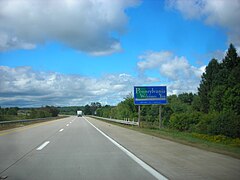
Entering Pennsylvania on I-86 westbound in Erie County

I-95 at I-276 exit
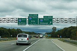
I-90 at I-79 exit

I-81 at I-78 exit

I-99 to I-80

I-176 end at US 422

I-83 and I-283

I-476 north of US 1

I-376 in Pittsburgh
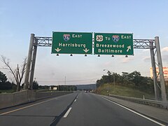
I-70 and I-76 at eastern split

I-76 approaching I-676

I-79 at I-70


See also[]
 U.S. Roads portal
 Pennsylvania portal
References[]
- ^ "KEY FACTS ABOUT PENNSYLVANIA'S INTERSTATE HIGHWAY SYSTEM" (PDF). Tripnet.org. Retrieved 2008-06-15.
- ^ "Route Log - Main Routes of the Eisenhower National System Of Interstate and Defense Highways - Table 1". Federal Highway Administration. Retrieved May 10, 2016.
- ^ a b c d e f g h i j k l m n o p q r s t u v w x y z Jeffrey J. Kitsko (2000–2008). "Pennsylvania Highways". Retrieved 2008-07-09.
- ^ a b c d e f g h i j k l m n o p q r s t u v w x y z aa "Google Maps". 2008. Retrieved 2008-07-09.
- ^ "Route Log - Auxlilary Routes of the Eisenhower National System Of Interstate and Defense Highways - Table 1". Federal Highway Administration. Retrieved May 10, 2016.
External links[]
Route map:

| ( • help)
|
- Lists of roads in Pennsylvania
- Interstate Highways in Pennsylvania