Madison Lake, Minnesota
Madison Lake | |
|---|---|
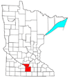
 Location of Madison Lake, Minnesota | |
| Coordinates: 44°12′14″N 93°48′48″W / 44.20389°N 93.81333°W | |
| Country | United States |
| State | Minnesota |
| County | Blue Earth |
| Government | |
| • Type | Mayor - Council |
| • Mayor | Kent Hoehn |
| Area | |
| • Total | 1.36 sq mi (3.53 km2) |
| • Land | 1.35 sq mi (3.50 km2) |
| • Water | 0.01 sq mi (0.03 km2) |
| Elevation | 1,047 ft (319 m) |
| Population | |
| • Total | 1,017 |
| • Estimate (2019)[2] | 1,174 |
| • Density | 867.70/sq mi (335.09/km2) |
| Time zone | UTC-6 (Central (CST)) |
| • Summer (DST) | UTC-5 (CDT) |
| ZIP code | 56063 |
| Area code(s) | 507 |
| FIPS code | 27-39320 |
| GNIS feature ID | 0647362[4] |
| Website | ci.madison-lake.mn.us |

Madison Lake is a small city in Blue Earth County, Minnesota, United States. The population was 1,017 at the 2010 census.[5] It is part of the Mankato–North Mankato Metropolitan Statistical Area.
History[]
A post office called Madison Lake has been in operation since 1885.[6] The town took its name from nearby Madison Lake, which was named for President James Madison.[7]
Geography[]
According to the United States Census Bureau, the city has a total area of 1.04 square miles (2.69 km2), of which 1.03 square miles (2.67 km2) is land and 0.01 square miles (0.03 km2) is water.[8]
Minnesota State Highway 60 serves as a main route in the community. U.S. Route 14 is nearby.
Demographics[]
| Historical population | |||
|---|---|---|---|
| Census | Pop. | %± | |
| 1900 | 300 | — | |
| 1910 | 335 | 11.7% | |
| 1920 | 359 | 7.2% | |
| 1930 | 365 | 1.7% | |
| 1940 | 377 | 3.3% | |
| 1950 | 357 | −5.3% | |
| 1960 | 477 | 33.6% | |
| 1970 | 587 | 23.1% | |
| 1980 | 592 | 0.9% | |
| 1990 | 643 | 8.6% | |
| 2000 | 837 | 30.2% | |
| 2010 | 1,017 | 21.5% | |
| 2019 (est.) | 1,174 | [2] | 15.4% |
| U.S. Decennial Census[9] 2018 Estimate[10] | |||
2010 census[]
As of the census[3] of 2010, there were 1,017 people, 394 households, and 271 families living in the city. The population density was 987.4 inhabitants per square mile (381.2/km2). There were 430 housing units at an average density of 417.5 per square mile (161.2/km2). The racial makeup of the city was 96.7% White, 0.5% African American, 0.6% Native American, 0.5% Asian, 0.1% Pacific Islander, 1.1% from other races, and 0.6% from two or more races. Hispanic or Latino of any race were 2.0% of the population.
There were 394 households, of which 37.8% had children under the age of 18 living with them, 51.0% were married couples living together, 11.4% had a female householder with no husband present, 6.3% had a male householder with no wife present, and 31.2% were non-families. 22.8% of all households were made up of individuals, and 7.3% had someone living alone who was 65 years of age or older. The average household size was 2.58 and the average family size was 3.01.
The median age in the city was 33.3 years. 26.2% of residents were under the age of 18; 8.2% were between the ages of 18 and 24; 32.7% were from 25 to 44; 24.4% were from 45 to 64; and 8.5% were 65 years of age or older. The gender makeup of the city was 50.0% male and 50.0% female.
2000 census[]
As of the census of 2000, there were 837 people, 319 households, and 223 families living in the city. A 2007 estimate shows the population has grown to 990. The population density was 1,794.4 people per square mile (687.6/km2). There were 370 housing units at an average density of 793.2 per square mile (304.0/km2). The racial makeup of the city was 98.21% White, 0.60% African American, 0.48% Native American, 0.36% Asian, and 0.36% from two or more races. Hispanic or Latino of any race were 2.27% of the population.
There were 319 households, out of which 38.9% had children under the age of 18 living with them, 55.5% were married couples living together, 10.0% had a female householder with no husband present, and 29.8% were non-families. 21.3% of all households were made up of individuals, and 9.4% had someone living alone who was 65 years of age or older. The average household size was 2.62 and the average family size was 3.09.
In the city, the population was spread out, with 29.5% under the age of 18, 7.8% from 18 to 24, 34.5% from 25 to 44, 19.1% from 45 to 64, and 9.1% who were 65 years of age or older. The median age was 32 years. For every 100 females, there were 100.7 males. For every 100 females age 18 and over, there were 98.7 males.
The median income for a household in the city was $84,659, and the median income for a family was $97,673. Males had a median income of $65,000 versus $44,938 for females. The per capita income for the city was $38,312. About 2.6% of families and 4.0% of the population were below the poverty line, including 3.7% of those under age 18 and 7.3% of those age 65 or over.
Politics[]
Madison Lake Watershed and Lake Association[]
The Madison Lake Watershed and Lake Association is a non-profit organization established for the purpose of protecting and preserving the natural resource of Madison Lake for future generations. MLWLA promotes the protection and improvement of the lake and surrounding watershed area through education and advocacy. Its goals include improving the water quality of the lake through an assessment of the lake's needs to determine the best approach to achieving a healthy, thriving lake and watershed ecosystem.[26]
References[]
- ^ "2019 U.S. Gazetteer Files". United States Census Bureau. Retrieved July 26, 2020.
- ^ Jump up to: a b "Population and Housing Unit Estimates". United States Census Bureau. May 24, 2020. Retrieved May 27, 2020.
- ^ Jump up to: a b "U.S. Census website". United States Census Bureau. Retrieved November 13, 2012.
- ^ "US Board on Geographic Names". United States Geological Survey. October 25, 2007. Retrieved January 31, 2008.
- ^ "2010 Census Redistricting Data (Public Law 94-171) Summary File". American FactFinder. United States Census Bureau. Retrieved April 27, 2011.[dead link]
- ^ "Blue Earth County". Jim Forte Postal History. Retrieved April 10, 2015.
- ^ Upham, Warren (1920). Minnesota Geographic Names: Their Origin and Historic Significance. Minnesota Historical Society. p. 61.
- ^ "US Gazetteer files 2010". United States Census Bureau. Archived from the original on July 2, 2012. Retrieved November 13, 2012.
- ^ United States Census Bureau. "Census of Population and Housing". Retrieved September 12, 2013.
- ^ "Population Estimates". United States Census Bureau. Retrieved July 4, 2019.
- ^ https://www.sos.state.mn.us/elections-voting/election-results/2020/2020-general-election-results/2020-precinct-results-spreadsheet/. Missing or empty
|title=(help) - ^ https://www.sos.state.mn.us/elections-voting/election-results/2016/2016-general-election-results/2016-precinct-results-spreadsheet/. Missing or empty
|title=(help) - ^ https://www.sos.state.mn.us/elections-voting/election-results/2012/2012-general-election-results/2012-precinct-results-spreadsheet/. Missing or empty
|title=(help) - ^ https://www.sos.state.mn.us/elections-voting/election-results/2008/2008-general-election-results/2008-precinct-results-spreadsheet/. Missing or empty
|title=(help) - ^ https://www.sos.state.mn.us/elections-voting/election-results/2004/2004-general-election-results/2004-precinct-results-spreadsheet/. Missing or empty
|title=(help) - ^ https://www.sos.state.mn.us/elections-voting/election-results/2000/2000-general-election-results/2000-precinct-results-spreadsheet/. Missing or empty
|title=(help) - ^ (PDF) https://www.lrl.mn.gov/archive/sessions/electionresults/1996-11-05-g-sec.pdf. Missing or empty
|title=(help) - ^ (PDF) https://www.lrl.mn.gov/archive/sessions/electionresults/1992-11-03-g-sec.pdf. Missing or empty
|title=(help) - ^ (PDF) https://www.lrl.mn.gov/archive/sessions/electionresults/1988-11-08-g-sec.pdf. Missing or empty
|title=(help) - ^ (PDF) https://www.lrl.mn.gov/archive/sessions/electionresults/1984-11-06-g-sec.pdf. Missing or empty
|title=(help) - ^ (PDF) https://www.lrl.mn.gov/archive/sessions/electionresults/1980-11-04-g-sec.pdf. Missing or empty
|title=(help) - ^ (PDF) https://www.lrl.mn.gov/archive/sessions/electionresults/1976-11-02-g-sec.pdf. Missing or empty
|title=(help) - ^ (PDF) https://www.lrl.mn.gov/archive/sessions/electionresults/1968-11-05-g-man.pdf. Missing or empty
|title=(help) - ^ (PDF) https://www.lrl.mn.gov/archive/sessions/electionresults/1964-11-03-g-man.pdf. Missing or empty
|title=(help) - ^ (PDF) https://www.lrl.mn.gov/archive/sessions/electionresults/1960-11-08-g-man.pdf. Missing or empty
|title=(help) - ^ Purpose of MLWLA Retrieved April 29, 2011.
External links[]
| show Municipalities and communities of Blue Earth County, Minnesota, United States |
|---|

Coordinates: 44°12′16″N 93°48′56″W / 44.20444°N 93.81556°W
| show Authority control |
|---|
- Cities in Blue Earth County, Minnesota
- Cities in Minnesota
- Mankato – North Mankato metropolitan area
- 1885 establishments in Minnesota