Mairie de Montreuil (Paris Métro)
Mairie de Montreuil | |||||||||||
|---|---|---|---|---|---|---|---|---|---|---|---|
| Paris Métro station | |||||||||||
 MF 67 at Mairie de Montreuil | |||||||||||
| Location | Montreuil, Seine-Saint-Denis Île-de-France France | ||||||||||
| Coordinates | 48°51′44″N 2°26′31″E / 48.862283°N 2.441847°ECoordinates: 48°51′44″N 2°26′31″E / 48.862283°N 2.441847°E | ||||||||||
| Owned by | RATP | ||||||||||
| Operated by | RATP | ||||||||||
| Line(s) | |||||||||||
| Platforms | 2 (2 side platforms) | ||||||||||
| Tracks | 2 | ||||||||||
| Other information | |||||||||||
| Station code | 25-03 | ||||||||||
| Fare zone | 1 | ||||||||||
| History | |||||||||||
| Opened | 14 October 1937 | ||||||||||
| Passengers | |||||||||||
| 4,764,601 (2020) | |||||||||||
| Services | |||||||||||
| |||||||||||
| Location | |||||||||||
 Mairie de Montreuil Location within Paris | |||||||||||
Mairie de Montreuil (French pronunciation: [mɛʁi d(ə) mɔ̃tʁœj]) is a station on line 9 of the Paris Métro. It is named after the nearby Mairie de Montreuil (Montreuil town hall).
History[]
The station opened on 14 October 1937 with the extension of the line from Porte de Montreuil and serves as the eastern terminus of line 9.
In 2019, the station was used by 8,106,589 passengers, making it the 27th busiest of the Métro network out of 302 stations.[1]
In 2020, the station was used by 4,764,601 passengers amidst the COVID-19 pandemic, making it the 18th busiest of the Métro network out of 305 stations.[2]
Passenger services[]
Access[]
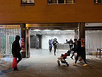
The station has 5 accesses:
- Access 1: Square Jean-Jaurès
- Access 2: avenue Walwein
- Access 3: Boulevard Rouget-de-Lisle
- Access 4: avenue Pasteur
- Access 5: Boulevard Paul-Vaillant-Couturier
Station layout[]
| Street Level | ||
| B1 | Mezzanine | |
| Line 11 platforms | Side platform, doors will open on the right | |
| Westbound | ← | |
| Eastbound | | |
| Side platform, doors will open on the right | ||
Platforms[]
The station has a standard configuration with 2 tracks surrounded by 2 side platforms.
Other connections[]
The station is also served by lines 102, 115, 121, 122, 129, and 322 of the RATP bus network, and at night, by lines N16 and N34 of the Noctilien bus network.
Gallery[]

Access 1

Access 2

Access 3

Access 4
Access 5


| Wikimedia Commons has media related to Mairie de Montreuil (Paris Metro). |
References[]
- ^ "Trafic annuel entrant par station du réseau ferré 2019". dataratp2.opendatasoft.com (in French). Retrieved 11 February 2022.
{{cite web}}: CS1 maint: url-status (link) - ^ "Trafic annuel entrant par station du réseau ferré 2020". data.ratp.fr (in French). Retrieved 11 February 2022.
{{cite web}}: CS1 maint: url-status (link)
- Roland, Gérard (2003). Stations de métro. D’Abbesses à Wagram. Éditions Bonneton.
- Paris Métro line 9
- Paris Métro stations in Montreuil, Seine-Saint-Denis
- Railway stations in France opened in 1937
- Paris Métro stubs