Meclov
Meclov | |
|---|---|
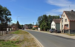 Main road in Meclov | |
 Flag  Coat of arms | |
 Meclov Location in the Czech Republic | |
| Coordinates: 49°30′29″N 12°52′40″E / 49.50806°N 12.87778°ECoordinates: 49°30′29″N 12°52′40″E / 49.50806°N 12.87778°E | |
| Country | |
| Region | Plzeň |
| District | Domažlice |
| First mentioned | 1115 |
| Area | |
| • Total | 31.98 km2 (12.35 sq mi) |
| Elevation | 396 m (1,299 ft) |
| Population (2021-01-01)[1] | |
| • Total | 1,188 |
| • Density | 37/km2 (96/sq mi) |
| Time zone | UTC+1 (CET) |
| • Summer (DST) | UTC+2 (CEST) |
| Postal codes | 345 21, 346 01 |
| Website | www |

Meclov is a municipality and village in Domažlice District in the Plzeň Region of the Czech Republic. It has about 1,200 inhabitants.
Meclov lies approximately 9 kilometres (6 mi) north-west of Domažlice, 45 km (28 mi) south-west of Plzeň, and 129 km (80 mi) south-west of Prague.
Administrative parts[]
Villages of Bozdíš, Březí, Jeníkovice, Mašovice, Mračnice, Mrchojedy, Němčice and Třebnice are administrative parts of Meclov.
References[]
| Wikimedia Commons has media related to Meclov. |
| show Authority control |
|---|
This Plzeň Region location article is a stub. You can help Wikipedia by . |
Categories:
- Villages in Domažlice District
- Plzeň Region geography stubs