Montague County, Texas
Montague County | |
|---|---|
County | |
 The Montague County Courthouse in Montague | |
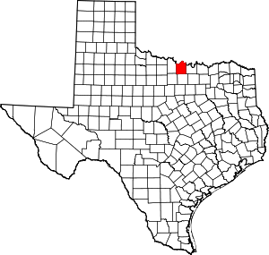 Location within the U.S. state of Texas | |
 Texas's location within the U.S. | |
| Coordinates: 33°40′N 97°44′W / 33.67°N 97.73°W | |
| Country | |
| State | |
| Founded | 1858 |
| Seat | Montague |
| Largest city | Bowie |
| Area | |
| • Total | 938 sq mi (2,430 km2) |
| • Land | 931 sq mi (2,410 km2) |
| • Water | 7.4 sq mi (19 km2) 0.8%% |
| Population (2010) | |
| • Total | 19,719 |
| • Density | 21/sq mi (8/km2) |
| Time zone | UTC−6 (Central) |
| • Summer (DST) | UTC−5 (CDT) |
| Congressional district | 13th |
| Website | www |

Montague County (/ˈmɒnteɪɡ/ MAHN-tayg)[1][2] is a county located in the U.S. state of Texas, established in 1857. As of the 2010 census, its population was 19,719.[3] The county seat is Montague.[4] The county was created in 1857 and organized the next year.[5] It is named for Daniel Montague, a surveyor and soldier in the Mexican–American War. Republican Drew Springer, Jr., a businessman from Muenster in Cooke County, represents Montague County in the Texas House of Representatives. He carried the county in the 2012 Republican runoff election.[6]
History[]
In the mid- to late 19th century, the county was the site of the trading post known as Red River Station, established near the river of the same name by Jesse Chisholm, a Cherokee merchant who also served as an important interpreter for the Republic of Texas and the United States. Together with , a Lenape guide, he had scouted and developed what became known as the Chisholm Trail north through Indian Territory, where he had more trading posts, and into Kansas.
In the post-Civil War period, ranchers suffered from low prices for their beef cattle, as overproduction had occurred during the war, when their regular markets were cut off. Learning about high prices and demand in the East, they began to have their cattle driven to railheads in Kansas for shipment to the east. Red River Station became the southern terminus for the Chisholm Trail, and the gathering place for thousands of Texas Longhorns during annual cattle drives to railheads in Kansas. Over the years, an estimated five million cattle were driven north to Kansas. The cattle were gathered by cowboys from ranches in East and West Texas; the cattle were then driven overland north to Kansas. They were shipped east, where they could command much higher prices. After railroads were constructed into Texas, the cattle drives to Kansas ended.
On September 26, 2009, an historical marker on the Chisholm Trail was unveiled at the site of the former community of Red River Station in Montague County. The 5.5-ft concrete marker is the last of 12 erected in Montague County as part of a joint project of the Texas Lakes Trail and the Montague County Historical Commission to outline the Chisholm Trail.[7]
Geography[]
According to the U.S. Census Bureau, the county has a total area of 938 sq mi (2,430 km2), of which 931 sq mi (2,410 km2) are land and 7.4 sq mi (19 km2) (0.8%) are covered by water.[8]
Adjacent counties[]
- Jefferson County, Oklahoma (north)
- Love County, Oklahoma (northeast)
- Cooke County (east)
- Wise County (south)
- Jack County (southwest)
- Clay County (west)
National protected area[]
Demographics[]
| Historical population | |||
|---|---|---|---|
| Census | Pop. | %± | |
| 1860 | 849 | — | |
| 1870 | 890 | 4.8% | |
| 1880 | 11,257 | 1,164.8% | |
| 1890 | 18,863 | 67.6% | |
| 1900 | 24,800 | 31.5% | |
| 1910 | 25,123 | 1.3% | |
| 1920 | 22,200 | −11.6% | |
| 1930 | 19,159 | −13.7% | |
| 1940 | 20,442 | 6.7% | |
| 1950 | 17,070 | −16.5% | |
| 1960 | 14,893 | −12.8% | |
| 1970 | 15,326 | 2.9% | |
| 1980 | 17,410 | 13.6% | |
| 1990 | 17,274 | −0.8% | |
| 2000 | 19,117 | 10.7% | |
| 2010 | 19,719 | 3.1% | |
| 2019 (est.) | 19,818 | [9] | 0.5% |
| U.S. Decennial Census[10] 1850–2010[11] 2010–2014[3] | |||
As of the census[12] of 2000, 19,117 people, 7,770 households, and 5,485 families were residing in the county. The population density was 20 people per sq mi (8/km2). The 9,862 housing units averaged 11 per sq mi (4/km2). The racial makeup of the county was 95.95% White, 0.18% African American, 0.74% Native American, 0.26% Asian, 1.67% from other races, and 1.21% from two or more races. About 5.41% of the population was Hispanic or Latino of any race.
Of the 7,770 households, 28.70% had children under the age of 18 living with them, 58.10% were married couples living together, 8.80% had a female householder with no husband present, and 29.40% were not families. About 27.10% of all households were made up of individuals, and 14.70% had someone living alone who was 65 years of age or older. The average household size was 2.41, and the average family size was 2.91.
In the county, the age distribution was 24.00% under 18, 6.80% from 18 to 24, 24.30% from 25 to 44, 25.10% from 45 to 64, and 19.80% who were 65 or older. The median age was 41 years. For every 100 females, there were 92.50 males. For every 100 females age 18 and over, there were 89.80 males.
The median income for a household in the county was $31,048, and for a family was $38,226. Males had a median income of $31,585 versus $19,589 for females. The per capita income for the county was $17,115. About 10.00% of families and 14.00% of the population were below the poverty line, including 17.80% of those under age 18 and 11.90% of those age 65 or over.
Education[]
These school districts serve Montague County:
- Alvord ISD (mostly in Wise County)
- Bowie ISD (small portion in Clay, Jack Counties)
- Forestburg ISD
- Gold-Burg ISD (small portion in Clay County)
- Montague ISD
- Nocona ISD
- Prairie Valley ISD
- Saint Jo ISD (small portion in Cooke County)
- Slidell ISD (partly in Wise, Denton counties; small portion in Cooke County)
In addition, a branch of North Central Texas College operates in Bowie.
Transportation[]
Major highways[]
 U.S. Highway 81
 U.S. Highway 82
 U.S. Highway 287
 State Highway 59
 State Highway 101
 State Highway 175
Farm to Market Roads[]
Communities[]
Cities[]
Census-designated places[]
- Montague
- Nocona Hills
- Sunset
Other unincorporated communities[]
Ghost town[]
Politics[]
Prior to 1996, Montague County was strongly Democratic in presidential elections. The only Republican Party candidates who managed to win the county from 1912 to 1992 were Herbert Hoover, due to anti-Catholic sentiment towards Al Smith, and Richard Nixon and Ronald Reagan in their 49-state landslides of 1972 and 1984, respectively. Since 1996, the county has swung hard to the supporting Republican Party similar to almost all White-majority rural counties in the Solid South, with its presidential candidates winning by increasing margins in each passing election. As a testament to how strongly Republican the county has swung, Donald Trump defeated Hillary Clinton by a margin over 75% in 2016, compared to an only 4.7% margin Bob Dole won the county by 20 years prior at the start of its Republican trend.
See also[]
- National Register of Historic Places listings in Montague County, Texas
- Recorded Texas Historic Landmarks in Montague County
- Buford T. Justice
References[]
- ^ "How to Pronounce: M Cities". 23 September 2014. Retrieved 20 May 2018.
- ^ "Texas Almanac Town Pronunciation Guide" (PDF).
- ^ Jump up to: a b "State & County QuickFacts". United States Census Bureau. Archived from the original on July 9, 2011. Retrieved December 22, 2013.
- ^ "Find a County". National Association of Counties. Retrieved 2011-06-07.
- ^ "Texas: Individual County Chronologies". Texas Atlas of Historical County Boundaries. The Newberry Library. 2008. Retrieved May 25, 2015.
- ^ "State Rep. Springer announces district tour July 30". Lubbock Avalanche-Journal. July 16, 2013. Retrieved July 18, 2013.
- ^ Wichita Falls Times Record News, September 27, 2009
- ^ "2010 Census Gazetteer Files". United States Census Bureau. August 22, 2012. Retrieved May 4, 2015.
- ^ "Population and Housing Unit Estimates". United States Census Bureau. May 24, 2020. Retrieved May 27, 2020.
- ^ "U.S. Decennial Census". United States Census Bureau. Retrieved May 4, 2015.
- ^ "Texas Almanac: Population History of Counties from 1850–2010" (PDF). Texas Almanac. Retrieved May 4, 2015.
- ^ "U.S. Census website". United States Census Bureau. Retrieved 2011-05-14.
- ^ Leip, David. "Dave Leip's Atlas of U.S. Presidential Elections". uselectionatlas.org. Retrieved 20 May 2018.
External links[]
- Montague County government's website
- Montague County in Handbook of Texas Online at the University of Texas
- Historic Montague County materials, hosted by the Portal to Texas History.
- Montague County QuickFacts from the US Census Bureau
| show Places adjacent to Montague County, Texas |
|---|
| show Municipalities and communities of Montague County, Texas, United States |
|---|


Coordinates: 33°40′N 97°44′W / 33.67°N 97.73°W
| show Authority control |
|---|
- Texas counties
- Montague County, Texas
- 1858 establishments in Texas
- Populated places established in 1858