Mount Tabor, Armstrong County, Pennsylvania
Mount Tabor, Pennsylvania | |
|---|---|
Unincorporated community | |
 Mount Tabor | |
| Coordinates: 40°59′15″N 79°13′03″W / 40.98750°N 79.21750°WCoordinates: 40°59′15″N 79°13′03″W / 40.98750°N 79.21750°W | |
| Country | United States |
| State | Pennsylvania |
| County | Armstrong |
| Township | Redbank |
| Elevation | 1,621 ft (494 m) |
| Time zone | UTC-5 (Eastern (EST)) |
| • Summer (DST) | UTC-4 (EDT) |
| Area code(s) | 814 |
| GNIS feature ID | 1204231[1] |

Mount Tabor is an unincorporated community in Redbank Township, Armstrong County, Pennsylvania, United States.[1] Mount Tabor Cemetery is located nearby at 40°59′11″N 79°13′02″W / 40.98639°N 79.21722°W. The community, once knowns as Dry Ridge, is situated 1.7 miles (2.7 km) east of New Salem at the intersection of Pete Schicks Road with Dry Ridge Road. Dry Ridge school was located nearby at 40°58′38″N 79°13′11″W / 40.97722°N 79.21972°W
History[]
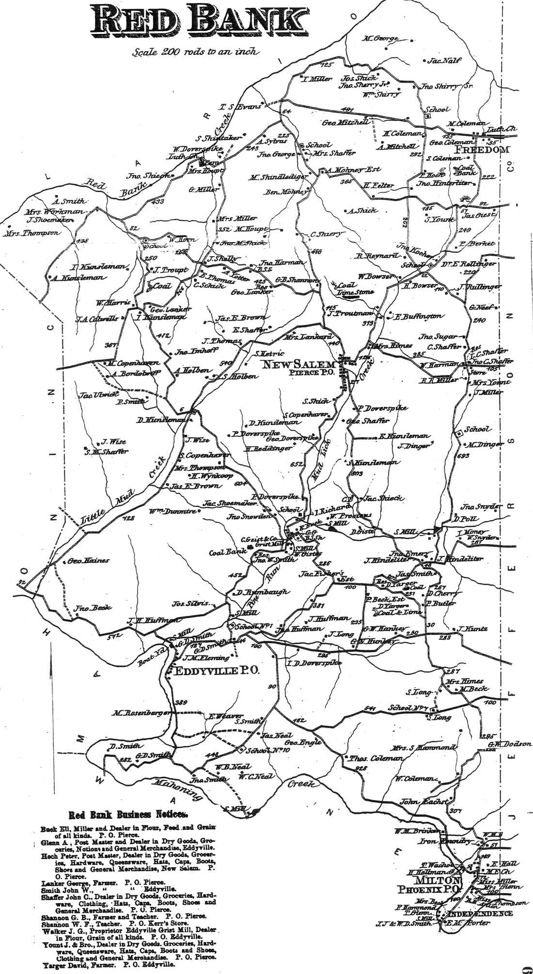
A post office called Mount Tabor was established in 1883 and closed that same year.[2] The 1876 Atlas of Armstrong County, Pennsylvania shows a store at the location of Mount Tabor.[3] The residents at that time were John C Shaffer, L. C. Shaffer, C. Shaffer, W. Harmon, and R. R. Miller.[3]
References[]
- ^ a b "Mount Tabor". Geographic Names Information System. United States Geological Survey.
- ^ "Post Offices". Jim Forte Postal History. Retrieved 6 November 2018.
- ^ a b "Atlas of Armstrong County Pennsylvania, page 66". Pomeroy, Whitman & Co. 1876. Retrieved 9 November 2018.
Municipalities and communities of Armstrong County, Pennsylvania, United States | ||
|---|---|---|
| City |  | |
| Boroughs | ||
| Townships | ||
| CDPs | ||
| Unincorporated communities |
| |
| ||
This Armstrong County, Pennsylvania state location article is a stub. You can help Wikipedia by . |
- Unincorporated communities in Armstrong County, Pennsylvania
- Unincorporated communities in Pennsylvania
- Western Pennsylvania geography stubs