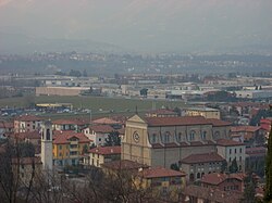
Mozzo
Mozzo | |
|---|---|
| Comune di Mozzo | |
 Mozzo | |
show Location of Mozzo | |
 Mozzo Location of Mozzo in Italy | |
| Coordinates: 45°42′N 9°36′E / 45.700°N 9.600°ECoordinates: 45°42′N 9°36′E / 45.700°N 9.600°E | |
| Country | Italy |
| Region | Lombardy |
| Province | Province of Bergamo (BG) |
| Frazioni | Borghetto, Ca' del Lupo, Colombera, Crocette, Dorotina, Merena, Mozzo di Sopra, Pascoletto |
| Area | |
| • Total | 3.6 km2 (1.4 sq mi) |
| Elevation | 252 m (827 ft) |
| Population (Dec. 2004)[2] | |
| • Total | 7,202 |
| • Density | 2,000/km2 (5,200/sq mi) |
| Demonym(s) | Mozzesi |
| Time zone | UTC+1 (CET) |
| • Summer (DST) | UTC+2 (CEST) |
| Postal code | 24030 |
| Dialing code | 035 |
| Website | Official website |


Mozzo (Bergamasque: Móss) is a comune (municipality) in the Province of Bergamo in the Italian region of Lombardy, located about 45 kilometres (28 mi) northeast of Milan and about 5 kilometres (3 mi) west of Bergamo.
The municipality of Mozzo contains the frazioni (subdivisions, mainly villages and hamlets) Borghetto, Ca' del Lupo, Colombera, Crocette, Dorotina, Merena, Mozzo di Sopra, and Pascoletto.
Mozzo borders the following municipalities: Bergamo, Curno, Ponte San Pietro, Valbrembo. Part of Mozzo's territory is part of Parco dei Colli di Bergamo.
Demographic evolution[]
As of 31 December 2004, it had a population of 7,202 and an area of 3.6 square kilometres (1.4 sq mi).[3]

Economy[]
Mozzo was the birthplace for the multinational chemical company Sigma. In 1958, it produced surfactants used in the textile industry.[4]
References[]
- ^ "Superficie di Comuni Province e Regioni italiane al 9 ottobre 2011". Istat. Retrieved 16 March 2019.
- ^ "Popolazione Residente al 1° Gennaio 2018". Istat. Retrieved 16 March 2019.
- ^ All demographics and other statistics: Italian statistical institute Istat.
- ^ "Part of 3V Group - 3V Sigma". www.3vsigma.com. n.d. Retrieved 2020-05-22.
External links[]
| show Authority control |
|---|
This article on a location in the Province of Bergamo is a stub. You can help Wikipedia by . |
- Cities and towns in Lombardy
- Municipalities of the Province of Bergamo
- Province of Bergamo geography stubs