National Register of Historic Places listings in Dunklin County, Missouri

Location of Dunklin County in Missouri
This is a list of the National Register of Historic Places listings in Dunklin County, Missouri.
This is intended to be a complete list of the properties and districts on the National Register of Historic Places in Dunklin County, Missouri, United States. Latitude and longitude coordinates are provided for many National Register properties and districts; these locations may be seen together in a map.[1]
There are 8 properties and districts listed on the National Register in the county.
This National Park Service list is complete through NPS recent listings posted February 18, 2022.[2]
Current listings[]
| [3] | Name on the Register | Image | Date listed[4] | Location | City or town | Description |
|---|---|---|---|---|---|---|
| 1 | Charles and Bettie Birthright House |  |
October 30, 2009 (#09000857) |
109 S. Main St. 36°27′02″N 89°58′02″W / 36.450597°N 89.967253°W | Clarkton | |
| 2 | Campbell Commercial Historic District |  |
October 8, 1991 (#91001482) |
Roughly bounded by Magnolia St., Martin Ave., Locust St. and the St. Louis & Southwest RR tracks 36°29′35″N 90°04′30″W / 36.493056°N 90.075°W | Campbell | |
| 3 | Ely and Walker Shirt Factory No. 5 |  |
March 12, 2008 (#07001319) |
221 S. Main St. 36°14′07″N 90°03′26″W / 36.235278°N 90.057222°W | Kennett | |
| 4 | February 17, 1978 (#78001644) |
Address Restricted | Kennett | |||
| 5 | Kennett City Hall and Masonic Lodge | September 17, 1981 (#81000333) |
122 College St. 36°14′11″N 90°04′08″W / 36.236389°N 90.068889°W | Kennett | ||
| 6 |  |
January 11, 1974 (#74001072) |
Both sides of Missouri Route 164, 3 miles (4.8 km) north of Hornersville[5] 36°04′46″N 90°05′43″W / 36.079444°N 90.095389°W | Hornersville | ||
| 7 | December 16, 1998 (#98001499) |
Address Restricted | Kennett | |||
| 8 | Given Owens House | 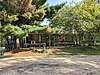 |
March 29, 1983 (#83000987) |
Off Route 53 36°30′30″N 90°06′25″W / 36.508333°N 90.106944°W | Campbell |

See also[]
- List of National Historic Landmarks in Missouri
- National Register of Historic Places listings in Missouri
References[]
| Wikimedia Commons has media related to National Register of Historic Places in Dunklin County, Missouri. |
- ^ The latitude and longitude information provided in this table was derived originally from the National Register Information System, which has been found to be fairly accurate for about 99% of listings. Some locations in this table may have been corrected to current GPS standards.
- ^ National Park Service, United States Department of the Interior, "National Register of Historic Places: Weekly List Actions", retrieved February 18, 2022.
- ^ Numbers represent an alphabetical ordering by significant words. Various colorings, defined here, differentiate National Historic Landmarks and historic districts from other NRHP buildings, structures, sites or objects.
- ^ The eight-digit number below each date is the number assigned to each location in the National Register Information System database, which can be viewed by clicking the number.
- ^ O'Brien, Michael J. Mississippian Community Organization: The Powers Phase in Southeastern Missouri. New York, Boston, Dordrecht, London, and Moscow: Kluwer Academic/Pluwer, 2001, 47.
U.S. National Register of Historic Places | |
|---|---|
| Topics |
|
| Lists by state |
|
| Lists by insular areas | |
| Lists by associated state | |
| Other areas |
|
| Related | |
| |

Municipalities and communities of Dunklin County, Missouri, United States | ||
|---|---|---|
County seat: Kennett | ||
| Cities |
|  |
| Village | ||
| Townships | ||
| CDPs | ||
| Other communities | ||
| Ghost towns | ||
| Footnotes | ‡This populated place also has portions in an adjacent county or counties | |
| ||
Categories:
- Dunklin County, Missouri
- Lists of National Register of Historic Places in Missouri by county
- National Register of Historic Places in Dunklin County, Missouri