Nord-Rana
Nord-Rana herred
Mo herred | |
|---|---|
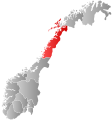
 Nordland within Norway | |
 Nord-Rana within Nordland | |
| Coordinates: 66°20′46″N 14°07′48″E / 66.34611°N 14.13000°ECoordinates: 66°20′46″N 14°07′48″E / 66.34611°N 14.13000°E | |
| Country | Norway |
| County | Nordland |
| District | Helgeland |
| Established | 1839 |
| Disestablished | 1 Jan 1964 |
| Administrative centre | Ytteren |
| Area | |
| • Total | 3,980 km2 (1,540 sq mi) |
| *Area at municipal dissolution. | |
| Population (1964) | |
| • Total | 11,636 |
| • Density | 2.9/km2 (7.6/sq mi) |
| Demonym(s) | Moværing Ranværing[1] |
| Time zone | UTC+01:00 (CET) |
| • Summer (DST) | UTC+02:00 (CEST) |
| ISO 3166 code | NO-1833 |
| Preceded by | Ranen in 1839 |
| Succeeded by | Rana in 1964 |
Nord-Rana (historically: Mo herred) is a former municipality in Nordland county, Norway. The 3,980-square-kilometre (1,540 sq mi) municipality existed from 1839 until its dissolution in 1964. From 1839 until 1844, it was named Nord-Ranen, from 1844 until 1923, it was called Mo, and then from 1923 until 1964 it was named Nord-Rana. The former municipality was located at the innermost part of the Ranfjorden. It encompassed the eastern 90% of what is now Rana Municipality. The administrative centre was the village of Ytteren, just north of the town of Mo i Rana.[2][3]

History[]
Rana Municipality was established on 1 January 1838 under the old formannskapsdistrikt law. Shortly afterwards, in 1839, the municipality was divided into Nord-Ranen and Sør-Ranen.[2] In 1844, Nord-Ranen was renamed Mo. On 1 January 1923, the village of Mo was designated as a ladested and so it was separated from the rest of the municipality to become a municipality of its own. The new town of Mo (population: 1,305) kept the name Mo and the rest of the old municipality became known as Nord-Rana (bringing back the old name for the area).
During the 1960s, there were many municipal mergers across Norway due to the work of the Schei Committee. On 1 January 1964, the municipality of Nord-Rana (population: 11,636) was merged with the town of Mo i Rana (population: 9,616), the part of the municipality of Sør-Rana located north of the Ranfjorden (population: 697), and the Sjona area of Nesna Municipality (population: 543) to create the large, new Rana Municipality.[4]
Government[]
All municipalities in Norway, including Nord-Rana, are responsible for primary education (through 10th grade), outpatient health services, senior citizen services, unemployment and other social services, zoning, economic development, and municipal roads. The municipality is governed by a municipal council of elected representatives, which in turn elects a mayor.[5]
Municipal council[]
The municipal council (Herredsstyre) of Nord-Rana was made up of 35 representatives that were elected to four year terms. The party breakdown of the final municipal council was as follows:
| Party Name (in Norwegian) | Number of representatives | |
|---|---|---|
| Labour Party (Arbeiderpartiet) | 24 | |
| Conservative Party (Høyre) | 2 | |
| Communist Party (Kommunistiske Parti) | 4 | |
| Christian Democratic Party (Kristelig Folkeparti) | 2 | |
| Centre Party (Senterpartiet) | 3 | |
| Total number of members: | 35 | |
| Party Name (in Norwegian) | Number of representatives | |
|---|---|---|
| Labour Party (Arbeiderpartiet) | 22 | |
| Communist Party (Kommunistiske Parti) | 6 | |
| Joint List(s) of Non-Socialist Parties (Borgerlige Felleslister) | 7 | |
| Total number of members: | 35 | |
| Party Name (in Norwegian) | Number of representatives | |
|---|---|---|
| Labour Party (Arbeiderpartiet) | 14 | |
| Communist Party (Kommunistiske Parti) | 5 | |
| Joint List(s) of Non-Socialist Parties (Borgerlige Felleslister) | 5 | |
| Total number of members: | 24 | |
| Party Name (in Norwegian) | Number of representatives | |
|---|---|---|
| Labour Party (Arbeiderpartiet) | 12 | |
| Communist Party (Kommunistiske Parti) | 7 | |
| Joint List(s) of Non-Socialist Parties (Borgerlige Felleslister) | 5 | |
| Total number of members: | 24 | |
| Party Name (in Norwegian) | Number of representatives | |
|---|---|---|
| Labour Party (Arbeiderpartiet) | 15 | |
| Communist Party (Kommunistiske Parti) | 6 | |
| Local List(s) (Lokale lister) | 3 | |
| Total number of members: | 24 | |
| Party Name (in Norwegian) | Number of representatives | |
|---|---|---|
| Labour Party (Arbeiderpartiet) | 17 | |
| Farmers' Party (Bondepartiet) | 5 | |
| Liberal Party (Venstre) | 1 | |
| Local List(s) (Lokale lister) | 1 | |
| Total number of members: | 24 | |
See also[]
References[]
- ^ "Navn på steder og personer: Innbyggjarnamn" (in Norwegian). Språkrådet.
- ^ a b Thorsnæs, Geir, ed. (2016-09-18). "Nord-Rana". Store norske leksikon (in Norwegian). Kunnskapsforlaget. Retrieved 2018-09-16.
- ^ Helland, Amund (1908). "Mo herred". Norges land og folk: Nordlands amt (in Norwegian). XVIII. Kristiania, Norway: H. Aschehoug & Company. p. 446. Retrieved 2018-09-16.
- ^ Jukvam, Dag (1999). "Historisk oversikt over endringer i kommune- og fylkesinndelingen" (PDF) (in Norwegian). Statistisk sentralbyrå.
- ^ Hansen, Tore, ed. (2016-05-12). "kommunestyre". Store norske leksikon (in Norwegian). Kunnskapsforlaget. Retrieved 2020-02-02.
- ^ "Kommunevalgene og Ordførervalgene 1959" (PDF) (in Norwegian). Oslo: Statistisk sentralbyrå. 1960. Retrieved 2020-03-18.
- ^ "Kommunevalgene og Ordførervalgene 1955" (PDF) (in Norwegian). Oslo: Statistisk sentralbyrå. 1957. Retrieved 2020-03-18.
- ^ "Kommunevalgene og Ordførervalgene 1951" (PDF) (in Norwegian). Oslo: Statistisk sentralbyrå. 1952. Retrieved 2020-03-18.
- ^ "Kommunevalgene og Ordførervalgene 1947" (PDF) (in Norwegian). Oslo: Statistisk sentralbyrå. 1948. Retrieved 2020-03-18.
- ^ "Kommunevalgene og Ordførervalgene 1945" (PDF) (in Norwegian). Oslo: Statistisk sentralbyrå. 1947. Retrieved 2020-03-18.
- ^ "Kommunevalgene og Ordførervalgene 1937" (PDF) (in Norwegian). Oslo: Statistisk sentralbyrå. 1938. Retrieved 2020-03-18.
- Rana, Norway
- Former municipalities of Norway
- 1839 establishments in Norway
- 1964 disestablishments in Norway


