Hattfjelldal
Hattfjelldal kommune
Aarborten tjïelte | |
|---|---|
 View of Hattfjell ("hat mountain") | |
 Coat of arms 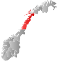 Nordland within Norway | |
 Hattfjelldal within Nordland | |
| Coordinates: 65°32′51″N 14°08′04″E / 65.54750°N 14.13444°ECoordinates: 65°32′51″N 14°08′04″E / 65.54750°N 14.13444°E | |
| Country | Norway |
| County | Nordland |
| District | Helgeland |
| Established | 1862 |
| Administrative centre | Hattfjelldal |
| Government | |
| • Mayor (2015) | Harald Lie (Sp) |
| Area | |
| • Total | 2,684.32 km2 (1,036.42 sq mi) |
| • Land | 2,411.13 km2 (930.94 sq mi) |
| • Water | 273.19 km2 (105.48 sq mi) 10.2% |
| Area rank | 20 in Norway |
| Population (2020) | |
| • Total | 1,297 |
| • Rank | 313 in Norway |
| • Density | 0.5/km2 (1/sq mi) |
| • Change (10 years) | −10.2% |
| Demonym(s) | hattfjelldaling[1] |
| Time zone | UTC+01:00 (CET) |
| • Summer (DST) | UTC+02:00 (CEST) |
| ISO 3166 code | NO-1826 |
| Official language form | Neutral[2] |
| Website | hattfjelldal |

Hattfjelldal (Southern Sami: Aarborte) is a municipality in Nordland county, Norway. It is part of the Helgeland traditional region. The administrative centre of the municipality is the village of Hattfjelldal. Other villages include , Svenskvollen, and Varntresk. Hattfjelldal Airfield is located in the village of Hattfjelldal.
The 2,684-square-kilometre (1,036 sq mi) municipality is the 20th largest by area out of the 356 municipalities in Norway. Hattfjelldal is the 313th most populous municipality in Norway with a population of 1,297. The municipality's population density is 0.5 inhabitants per square kilometre (1.3/sq mi) and its population has decreased by 10.2% over the previous 10-year period.[3][4]
Hattfjelldal is one of the last strongholds for the seriously endangered Southern Sami language. It was also one of the municipalities in Norway involved in the Terra Securities scandal.
General information[]
The municipality of Hattfjelldal was established in 1862 when it was separated from the large municipality of Vefsn. The initial population of Hattfjelldal was 961. During the 1960s, there were many municipal mergers across Norway due to the work of the Schei Committee. On 1 January 1964, the part of Hattfjelldal on the north side of the lake Røssvatnet (population: 168) was transferred to the neighboring Hemnes Municipality.[5]
Name[]
The municipality (originally a parish) is named after the old Hattfjelldalen farm (referred to as "Hatfieldalen" in 1723) where the first church was built. The name describes the valley (-dalen) below the mountain . Hattfjellet takes its name from the hat-like shape.[6]
Coat of arms[]
The coat of arms was granted on 24 October 1986. The arms show the Hattfjellet mountain, with its typical shape. The mountain is a canting element since the name of the municipality means "hat mountain valley".[7]
Churches[]
The Church of Norway has one parish (sokn) within the municipality of Hattfjelldal. It is part of the Indre Helgeland prosti (deanery) in the Diocese of Sør-Hålogaland.
| Parish (sokn) | Church Name | Location of the Church | Year Built |
|---|---|---|---|
| Hattfjelldal | Hattfjelldal Church | Hattfjelldal | 1868 |
| Susendal Church | Svenskvollen | 2001 | |
| Varntresk Church | Varntresk | 1986 |
Geography[]

Hattfjelldal lies along the Swedish border in the southeastern part of Nordland county. The lake Røssvatnet (Southern Sami: Reevhtse) lies on the border between Hattfjelldal and Hemnes, and it serves as a reservoir. It has been the site of human occupation since the Stone Age. Its area of 219 square kilometres (85 sq mi) makes it the second largest lake in Norway by surface area.
Other lakes in the region include Daningen, Elsvatnet, Famnvatnet, Jengelvatnet, Kjerringvatnet, Krutvatnet, Ranseren, Simskardvatnet, and Unkervatnet. The large river Vefsna runs through the municipality.
Børgefjell National Park is partly located in the southern part of Hattfjelldal, as is Jetnamsklumpen, a prominent mountain. There is several nature reserves, such as Varnvassdalen with a varied topography and old growth forest of pine, birch and some spruce.[8]
Government[]
All municipalities in Norway, including Hattfjelldal, are responsible for primary education (through 10th grade), outpatient health services, senior citizen services, unemployment and other social services, zoning, economic development, and municipal roads. The municipality is governed by a municipal council of elected representatives, which in turn elect a mayor.[9] The municipality falls under the Alstahaug District Court and the Hålogaland Court of Appeal.
Municipal council[]
The municipal council (Kommunestyre) of Hattfjelldal is made up of 11 representatives that are elected to four year terms. The party breakdown of the council is as follows:
| Party Name (in Norwegian) | Number of representatives | |
|---|---|---|
| Labour Party (Arbeiderpartiet) | 5 | |
| Centre Party (Senterpartiet) | 5 | |
| Hattfjelldal Local List (Hattfjelldal Bygdeliste) | 1 | |
| Total number of members: | 11 | |
Notable people[]
- Anders K. Orvin (1889–1980) a Norwegian geologist and explorer
- Anna Jacobsen (1924–2004), champion of Southern Sami language and culture
- Karl Ingebrigtsen (born 1935) a Norwegian politician
References[]
- ^ "Navn på steder og personer: Innbyggjarnamn" (in Norwegian). Språkrådet.
- ^ "Forskrift om målvedtak i kommunar og fylkeskommunar" (in Norwegian). Lovdata.no.
- ^ Statistisk sentralbyrå (2020). "Table: 06913: Population 1 January and population changes during the calendar year (M)" (in Norwegian).
- ^ Statistisk sentralbyrå (2020). "09280: Area of land and fresh water (km²) (M)" (in Norwegian).
- ^ Jukvam, Dag (1999). "Historisk oversikt over endringer i kommune- og fylkesinndelingen" (PDF) (in Norwegian). Statistisk sentralbyrå.
- ^ Rygh, Oluf (1905). Norske gaardnavne: Nordlands amt (in Norwegian) (16 ed.). Kristiania, Norge: W. C. Fabritius & sønners bogtrykkeri. p. 86.
- ^ "Civic heraldry of Norway - Norske Kommunevåpen". Heraldry of the World. Retrieved 2019-02-24.
- ^ "Varnvassdalen naturreservat" (in Norwegian). Archived from the original on 2007-09-29. Retrieved 2008-11-23.
- ^ Hansen, Tore, ed. (2016-05-12). "kommunestyre". Store norske leksikon (in Norwegian). Kunnskapsforlaget. Retrieved 2019-01-01.
- ^ "Tall for Norge: Kommunestyrevalg 2019 - Nordland". Valg Direktoratet. Retrieved 2019-10-27.
- ^ Jump up to: a b c d "Table: 04813: Members of the local councils, by party/electoral list at the Municipal Council election (M)" (in Norwegian). Statistics Norway.
- ^ "Tall for Norge: Kommunestyrevalg 2011 - Nordland". Valg Direktoratet. Retrieved 2019-10-27.
- ^ "Kommunestyrevalget 1995" (PDF) (in Norwegian). Oslo-Kongsvinger: Statistisk sentralbyrå. 1996. Retrieved 2020-04-02.
- ^ "Kommunestyrevalget 1991" (PDF) (in Norwegian). Oslo-Kongsvinger: Statistisk sentralbyrå. 1993. Retrieved 2020-04-02.
- ^ "Kommunestyrevalget 1987" (PDF) (in Norwegian). Oslo-Kongsvinger: Statistisk sentralbyrå. 1988. Retrieved 2020-04-02.
- ^ "Kommunestyrevalget 1983" (PDF) (in Norwegian). Oslo-Kongsvinger: Statistisk sentralbyrå. 1984. Retrieved 2020-04-02.
- ^ "Kommunestyrevalget 1979" (PDF) (in Norwegian). Oslo: Statistisk sentralbyrå. 1979. Retrieved 2020-04-02.
- ^ "Kommunevalgene 1975" (PDF) (in Norwegian). Oslo: Statistisk sentralbyrå. 1977. Retrieved 2020-04-02.
- ^ "Kommunevalgene 1972" (PDF) (in Norwegian). Oslo: Statistisk sentralbyrå. 1973. Retrieved 2020-04-02.
- ^ "Kommunevalgene 1967" (PDF) (in Norwegian). Oslo: Statistisk sentralbyrå. 1967. Retrieved 2020-04-02.
- ^ "Kommunevalgene 1963" (PDF) (in Norwegian). Oslo: Statistisk sentralbyrå. 1964. Retrieved 2020-04-02.
- ^ "Kommunevalgene og Ordførervalgene 1959" (PDF) (in Norwegian). Oslo: Statistisk sentralbyrå. 1960. Retrieved 2020-04-02.
- ^ "Kommunevalgene og Ordførervalgene 1955" (PDF) (in Norwegian). Oslo: Statistisk sentralbyrå. 1957. Retrieved 2020-04-02.
- ^ "Kommunevalgene og Ordførervalgene 1951" (PDF) (in Norwegian). Oslo: Statistisk sentralbyrå. 1952. Retrieved 2020-04-02.
- ^ "Kommunevalgene og Ordførervalgene 1947" (PDF) (in Norwegian). Oslo: Statistisk sentralbyrå. 1948. Retrieved 2020-04-02.
- ^ "Kommunevalgene og Ordførervalgene 1945" (PDF) (in Norwegian). Oslo: Statistisk sentralbyrå. 1947. Retrieved 2020-04-02.
- ^ "Kommunevalgene og Ordførervalgene 1937" (PDF) (in Norwegian). Oslo: Statistisk sentralbyrå. 1938. Retrieved 2020-04-02.
External links[]
- Municipal fact sheet from Statistics Norway (in Norwegian)
| Wikimedia Commons has media related to Hattfjelldal. |
 Nordland travel guide from Wikivoyage
| hide | |||||||
|---|---|---|---|---|---|---|---|
| |||||||
 | Towns and cities |
|  | ||||
| Municipalities | |||||||
| show Authority control |
|---|
- Hattfjelldal
- Municipalities of Nordland
- Valleys of Nordland
- 1862 establishments in Norway