North Lake Parish, New Brunswick
North Lake | |
|---|---|
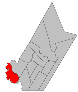 Location within York County, New Brunswick. | |
| Coordinates: 45°49′39″N 67°43′48″W / 45.8275°N 67.73°W | |
| Country | |
| Province | |
| County | York |
| Erected | 1879 |
| Area | |
| • Land | 440.03 km2 (169.90 sq mi) |
| Population (2016)[1] | |
| • Total | 233 |
| • Density | 0.5/km2 (1/sq mi) |
| • Change 2011-2016 | |
| • Dwellings | 387 |
| Time zone | UTC-4 (AST) |
| • Summer (DST) | UTC-3 (ADT) |

North Lake is a civil parish in York County, New Brunswick, Canada.[2]
For governance purposes it forms the local service district of the parish of North Lake,[3] which is a member of the Western Valley Regional Service Commission (WVRSC).[4]
Origin of name[]
The parish takes its name from the eponymous lake.[5]
History[]
North Lake was erected in 1879 from Canterbury Parish.[6]
Boundaries[]
North Lake Parish is bounded:[2][7][8]
- on the north by the Carleton County line;
- on the east by a line running up Eel River, including First Eel Lake, Second Eel Lake, and Third Eel Lake, then east-southeasterly across land to La Coote Lake, then down La Coote Lake and Big La Coote Stream to the northern end of Palfrey Lake;
- on the southeast by a line running southwesterly from the southeastern corner of a grant to Abraham Lint west of Allandale Road near the Saint John River to a point west of Sandy Point on Spednic Lake, paralleling the southeastern lines of other parishes south of the Saint John River;
- on the west by the international border, running up Spednic Lake, Grand Lake, the North Lake Thoroughfare, North Lake, and Monument Brook to the Carleton County line.
Communities[]
Communities at least partly within the parish.[7][8][9]
|
|
Bodies of water[]
Bodies of water[a] at least partly within the parish.[7][8][9] italics indicate a name no longer in official use
|
|
Islands[]
Islands at least partly within the parish.[7][8][9]
- Frog Island
- Pine Island
Other notable places[]
Parks, historic sites, and other noteworthy places at least partly within the parish.[7][8][9][10]
- First Eel Lake Protected Natural Area
- Hay Brook Protected Natural Area
- Maxwell Protected Natural Area
- Monument Brook Protected Natural Area
- North Lake Protected Natural Area
- Spednic Lake Protected Natural Area
- Tamarack Brook Protected Natural Area
Demographics[]
Population[]
|
Language[]Mother tongue (2016)[1]
|
See also[]
Notes[]
- ^ Not including brooks, ponds or coves.
References[]
- ^ a b c d "Census Profile, 2016 Census North Lake, Parish [Census subdivision], New Brunswick". Statistics Canada. Retrieved October 7, 2019.
- ^ a b "Chapter T-3 Territorial Division Act". Government of New Brunswick. Retrieved 13 November 2020.
- ^ "New Brunswick Regulation 84-168 under the Municipalities Act (O.C. 84-582)". Government of New Brunswick. Retrieved 25 July 2020.
- ^ "Communities in each of the 12 Regional Service Commissions (RSC) / Les communautés dans chacune des 12 Commissions de services régionaux (CSR)" (PDF), Government of New Brunswick, July 2017, retrieved 1 February 2021
- ^ Ganong, William F. (1896). A Monograph of the Place-Nomenclature of the Province of New Brunswick. Royal Society of Canada. p. 258. Retrieved 17 March 2021.
- ^ "42 Vic. c. 42 An Act to erect part of the Parish of Canterbury, in the County of York, into a separate Parish.". Acts of the General Assembly of Her Majesty's Province of New Brunswick. Passed in the Month of April 1879. Fredericton: Government of New Brunswick. 1879. pp. 84–85. Available as a free ebook from Google Books.
- ^ a b c d e "No. 123". Provincial Archives of New Brunswick. Department of Natural Resources and Energy Development. Retrieved 25 June 2021. Remainder of parish on maps 134, 135, and 145 at same site.
- ^ a b c d e "365" (PDF). Transportation and Infrastructure. Government of New Brunswick. Retrieved 25 June 2021. Remainder of parish on mapbooks 384, 385, 403–405, 421–423, and 438 at same site.
- ^ a b c d "Search the Canadian Geographical Names Database (CGNDB)". Government of Canada. Retrieved 3 July 2021.
- ^ "Explore New Brunswick's Protected Natural Areas". GeoNB. Retrieved 3 July 2021.
- ^ Statistics Canada: 1996, 2001, 2006, 2011 census
- ^ 2011 Statistics Canada Census Profile: North Lake Parish, New Brunswick
Places adjacent to North Lake Parish, New Brunswick | |
|---|---|
| Subdivisions |
|
|---|---|
| Cities | |
| Counties | |
| |
Coordinates: 45°49′39″N 67°43′48″W / 45.82750°N 67.73000°W
- Parishes of York County, New Brunswick
- Local service districts of York County, New Brunswick