Orange, California
Orange, California | |
|---|---|
City | |
     Clockwise: Downtown Orange; Memorial Hall; Plaza Park; Chapman University; Old Towne, Orange Historic District. | |
 Flag  Seal | |
| Motto(s): A Slice of Old Town Charm | |
 Location of Orange within Orange County, California | |
 Orange Location within Greater Los Angeles | |
| Coordinates: 33°48′11″N 117°49′57″W / 33.80306°N 117.83250°WCoordinates: 33°48′11″N 117°49′57″W / 33.80306°N 117.83250°W | |
| Country | United States |
| State | California |
| County | Orange |
| Founded | 1869 |
| Incorporated | April 6, 1888[1] |
| Government | |
| • Type | Council–Manager |
| • City council[2] | Mark A. Murphy, Mayor Kim Nichols Chip Monaco Arianna Barrios Jon Dumitru Kathy Tavoularis Ana Gutierrez |
| • City treasurer | Richard Rohm[2] |
| • City clerk | Pamela Coleman |
| • City Manager | Rick Otto[3] |
| Area | |
| • Total | 25.81 sq mi (66.86 km2) |
| • Land | 25.66 sq mi (66.47 km2) |
| • Water | 0.15 sq mi (0.39 km2) 1.75% |
| Elevation | 190 ft (58 m) |
| Population | |
| • Total | 136,416 |
| • Estimate (2019)[7] | 138,669 |
| • Rank | 6th in Orange County 42nd in California 198th in the United States |
| • Density | 5,403.25/sq mi (2,086.17/km2) |
| Time zone | UTC−08:00 (Pacific) |
| • Summer (DST) | UTC−07:00 (PDT) |
| ZIP Codes | 92856–92869 |
| Area codes | 657/714 |
| FIPS code | 06-53980 |
| GNIS feature IDs | 1652765, 2411325 |
| Website | cityoforange.org |


Orange is a city located in Orange County, California. It is approximately 3 miles (4.8 kilometers) north of the county seat, Santa Ana. Orange is unusual in this region because many of the homes in its Old Town District were built before 1920. While many other cities in the region demolished such houses in the 1960s, Orange decided to preserve them. The small city of Villa Park is surrounded by the city of Orange. The population was 138,669 as of 2019.[7]
History[]
This section needs additional citations for verification. (July 2013) |
Members of the Tongva and Juaneño/Luiseño ethnic group long inhabited this area. After the 1769 expedition of Gaspar de Portolá, an expedition out of San Blas, Nayarit, Mexico, led by Father Junípero Serra, named the area Vallejo de Santa Ana (Valley of Saint Anne). On November 1, 1776, Mission San Juan Capistrano became the area's first permanent European settlement in Alta California, New Spain.[citation needed]
In 1801, the Spanish Empire granted 62,500 acres (253 km2) to José Antonio Yorba, which he named Rancho San Antonio. Yorba's great rancho included the lands where the cities of Olive, Orange, El Modena, Villa Park, Santa Ana, Tustin, Costa Mesa and Newport Beach stand today. Smaller ranchos evolved from this large rancho, including the Rancho Santiago de Santa Ana.
Don Juan Pablo Grijalva, a retired known Spanish soldier and the area's first landowner, was granted permission in 1809 by the Spanish colonial government to establish a rancho in "the place of the Arroyo de Santiago."
After the Mexican–American War, Alta California was ceded to the United States by México with the signing of the Treaty of Guadalupe Hidalgo in 1848, and though many Californios lost titles to their lands in the aftermath, Grijalva's descendants retained ownership through marriages to Anglo-Americans.
Since at least 1864, Los Angeles attorneys Alfred Chapman and Andrew Glassell, together and separately, held about 5,400 acres (22 km2) along both sides of the Santiago Creek (Glassell also had a 4,000-acre (16 km2) parcel where Costa Mesa is today). Water was the key factor for the location of their townsite (bordered by Almond Avenue on the south, Lemon Street on the west, Glassell Street on the east, & Maple Avenue on the north). Glassell needed a spot he could irrigate, bringing water down from the Santa Ana Canyon and the quality of the soil may have influenced his choice. Originally the community was named Richland, but in 1873 Richland got a new name. In the book, Orange, The City 'Round The Plaza by local historian Phil Brigandi, it states, "In 1873 the town had grown large enough to require a post office, so an application was sent to Washington. It was refused, however, as there was (and is) already a Richland, California in Sacramento County. Undaunted, the Richlanders proposed a new name – Orange."
The small town was incorporated on April 6, 1888, under the general laws of the state of California. Orange was the only city in Orange County to be planned and built around a plaza, earned it the nickname Plaza City.[8] Orange was the first developed town site to be served by the California Southern Railroad when the nation's second transcontinental rail line reached Orange County.[9]
The town experienced its first growth spurt during the last decade of the 19th century (as did many of the surrounding communities), thanks to ever-increasing demands for California-grown citrus fruits, a period some refer to as the "Orange Era." Southern California's real estate "boom" of 1886–1888, fueled by railroad rate wars, also contributed to a marked increase in population. Like most cities in Orange County, agriculture formed the backbone of the local economy, and growth thereafter was slow and steady until the 1950s, when a second real estate boom spurred development. Inspired by the development of a region-wide freeway system which connected Los Angeles' urban center with outlying areas like Orange, large tracts of housing were developed from the 1950s to the early 1970s, and this continues today, albeit at a much slower pace, at the eastern edge of the city.
During the COVID-19 Pandemic, the City of Orange approved the closure of North and South Glassell Street to open the Orange Plaza Paseo, where businesses located on each street could open socially distant outdoor seating and patios. On December 8, 2020, the city council voted unanimously to continue to keep the street closed until state or local restrictions end, or by council direction.[10]
Geography[]
The city has a total area of 25.2 square miles (65 km2), 24.8 square miles (64 km2) of which is land and 0.4 square miles (1.0 km2) of which is water. The total area is 1.75% water.
Climate[]
| Orange, California | ||||||||||||||||||||||||||||||||||||||||||||||||||||||||||||
|---|---|---|---|---|---|---|---|---|---|---|---|---|---|---|---|---|---|---|---|---|---|---|---|---|---|---|---|---|---|---|---|---|---|---|---|---|---|---|---|---|---|---|---|---|---|---|---|---|---|---|---|---|---|---|---|---|---|---|---|---|
| Climate chart (explanation) | ||||||||||||||||||||||||||||||||||||||||||||||||||||||||||||
| ||||||||||||||||||||||||||||||||||||||||||||||||||||||||||||
| ||||||||||||||||||||||||||||||||||||||||||||||||||||||||||||
Southern California is well known for year-round pleasant weather:
– On average, the warmest month is August.[11]
– The highest recorded temperature was 113 °F (45 °C) in June 2016.
– On average, the coolest month is December.
– The lowest recorded temperature was 25 °F (−4 °C) in December 1990.
– The maximum average precipitation occurs in January.[12]
The period of April through November is warm and dry with average high temperatures of 74 to 84 °F (23 to 29 °C) and lows of 52 to 64 °F (11 to 18 °C). The period of November through March is somewhat rainy, as shown in the table to right.[13]
The Orange County area is also subject to the phenomena typical of a microclimate. As such, the temperatures can vary as much as 18 °F (10 °C) between inland areas and the coast, with a temperature gradient of over 1 °F per mile (0.3 °C/km) from the coast inland. California also has a weather phenomenon called "June Gloom" or "May Gray," which sometimes brings overcast or foggy skies in the morning on the coast, but usually gives way to sunny skies by noon, during late spring and early summer.
The Orange County area averages 15 in (380 mm) of precipitation annually, which mainly occurs during the winter and spring (November thru April) with generally light rain showers, but sometimes as heavy rainfall and thunderstorms. Coastal Torrance receives slightly less rainfall, while the mountains receive slightly more. Snowfall is extremely rare in the city basin, but the mountains in the surrounding areas receive snowfall every winter .
| hideClimate data for Orange, California | |||||||||||||
|---|---|---|---|---|---|---|---|---|---|---|---|---|---|
| Month | Jan | Feb | Mar | Apr | May | Jun | Jul | Aug | Sep | Oct | Nov | Dec | Year |
| Record high °F (°C) | 91 (33) |
91 (33) |
97 (36) |
108 (42) |
110 (43) |
113 (45) |
112 (44) |
105 (41) |
112 (44) |
105 (41) |
97 (36) |
93 (34) |
113 (45) |
| Average high °F (°C) | 68 (20) |
69 (21) |
70 (21) |
74 (23) |
75 (24) |
80 (27) |
85 (29) |
86 (30) |
85 (29) |
80 (27) |
74 (23) |
69 (21) |
76 (24) |
| Average low °F (°C) | 44 (7) |
46 (8) |
47 (8) |
50 (10) |
54 (12) |
58 (14) |
61 (16) |
62 (17) |
60 (16) |
55 (13) |
48 (9) |
43 (6) |
52 (11) |
| Record low °F (°C) | 28 (−2) |
29 (−2) |
31 (−1) |
34 (1) |
38 (3) |
42 (6) |
45 (7) |
48 (9) |
44 (7) |
35 (2) |
32 (0) |
25 (−4) |
25 (−4) |
| Average precipitation inches (mm) | 3.18 (81) |
3.08 (78) |
2.72 (69) |
0.73 (19) |
0.25 (6.4) |
0.11 (2.8) |
0.02 (0.51) |
0.12 (3.0) |
0.32 (8.1) |
0.38 (9.7) |
1.15 (29) |
1.78 (45) |
13.84 (352) |
| Source: [14] | |||||||||||||
Cityscape[]
Old Towne, Orange Historic District, a one square-mile around the original plaza, contains many of the original structures built in the period after the city's incorporation. It is a vibrant commercial district, containing Orange County's oldest operating bank and the oldest operating soda fountain. The Historic District was listed on the National Register of Historic Places in 1997,[15] and is the largest National Register District in California. The Old Towne Preservation Association is a non-profit organization dedicated to maintaining the district.
Orange is unique among the region and the state in that it has the second largest concentration of historic buildings.[16] A list of all of the buildings and sites in Orange appears in the National Register of Historic Places.[15][17][18] The Civic Center was designed by Welton Becket in 1963.[19]
Though Orange is now a fully developed city, there are still several unincorporated portions of land that have not yet been annexed, including El Modena and North El Modena, Orange Park Acres, Olive, and North Tustin.
Architectural styles in Old Towne Orange[]
- Bungalow[20]
- Craftsman Bungalow[21]
- Arts and Crafts Movement[22]
- Hip roof cottage[23]
- Mediterranean Revival architecture[24]
- Prairie Style architecture[25]
- Spanish Colonial Revival architecture[26]
- Victorian architecture[27]
Demographics[]
| Historical population | |||
|---|---|---|---|
| Census | Pop. | %± | |
| 1880 | 679 | — | |
| 1890 | 866 | 27.5% | |
| 1900 | 1,216 | 40.4% | |
| 1910 | 2,920 | 140.1% | |
| 1920 | 4,884 | 67.3% | |
| 1930 | 8,066 | 65.2% | |
| 1940 | 7,901 | −2.0% | |
| 1950 | 10,027 | 26.9% | |
| 1960 | 26,444 | 163.7% | |
| 1970 | 77,365 | 192.6% | |
| 1980 | 91,450 | 18.2% | |
| 1990 | 110,658 | 21.0% | |
| 2000 | 128,821 | 16.4% | |
| 2010 | 136,416 | 5.9% | |
| 2019 (est.) | 138,669 | [7] | 1.7% |
| U.S. Decennial Census[28] | |||
2010[]
The 2010 United States Census[29] reported that Orange had a population of 136,416. The population density was 5,404.7 people per square mile (2,086.8/km2). The racial makeup of Orange was 91,522 (67.1%) White (46.8% Non-Hispanic White),[6] 2,227 (1.6%) African American, 993 (0.7%) Native American, 15,350 (11.3%) Asian, 352 (0.3%) Pacific Islander, 20,567 (15.1%) from other races, and 5,405 (4.0%) from two or more races. Hispanic or Latino of any race were 52,014 persons (38.1%).
The Census reported that 130,163 people (95.4% of the population) lived in households, 2,587 (1.9%) lived in non-institutionalized group quarters, and 3,666 (2.7%) were institutionalized.
There were 43,367 households, out of which 16,303 (37.6%) had children under the age of 18 living in them, 23,572 (54.4%) were opposite-sex married couples living together, 5,260 (12.1%) had a female householder with no husband present, 2,424 (5.6%) had a male householder with no wife present. There were 2,442 (5.6%) unmarried opposite-sex partnerships, and 373 (0.9%) same-sex married couples or partnerships. 8,480 households (19.6%) were made up of individuals, and 3,115 (7.2%) had someone living alone who was 65 years of age or older. The average household size was 3.00. There were 31,256 families (72.1% of all households); the average family size was 3.42.
The population was spread out, with 32,096 people (23.5%) under the age of 18, 16,420 people (12.0%) aged 18 to 24, 39,574 people (29.0%) aged 25 to 44, 33,698 people (24.7%) aged 45 to 64, and 14,628 people (10.7%) who were 65 years of age or older. The median age was 34.8 years. For every 100 females, there were 101.5 males. For every 100 females age 18 and over, there were 99.7 males.
There were 45,111 housing units at an average density of 1,787.3 per square mile (690.1/km2), of which 26,319 (60.7%) were owner-occupied, and 17,048 (39.3%) were occupied by renters. The homeowner vacancy rate was 1.1%; the rental vacancy rate was 5.1%. 77,179 people (56.6% of the population) lived in owner-occupied housing units and 52,984 people (38.8%) lived in rental housing units.
During 2009–2013, Orange had a median household income of $78,838, with 11.8% of the population living below the federal poverty line.[6]
2000[]

As of the census[30] of 2000, there were 128,821 people, 40,930 households, and 30,165 families residing in the city. The population density was 5,506.4 inhabitants per square mile (2,126.5/km2). There were 41,904 housing units at an average density of 1,791.2 per square mile (691.7/km2).
The racial makeup of the city was 70.60% White, 1.59% African American, 0.78% Native American, 9.22% Asian, 0.23% Pacific Islander, 13.84% from other races, and 3.74% from two or more races. 32.21% of the population were Hispanic or Latino of any race.
There were 40,930 households, out of which 37.1% had children under the age of 18 living with them, 57.1% were married couples living together, 11.6% had a female householder with no husband present, and 26.3% were non-families. 19.5% of all households were made up of individuals, and 6.6% had someone living alone who was 65 years of age or older. The average household size was 3.02 and the average family size was 3.43.
The population was spread out, with 26.7% under the age of 18, 9.9% from 18 to 24, 33.3% from 25 to 44, 20.5% from 45 to 64, and 9.6% who were 65 years of age or older. The median age was 33 years. For every 100 females, there were 100.8 males. For every 100 females age 18 and over, there were 98.7 males.
The median income for a household in the city was $58,994, and the median income for a family was $64,573 (these figures had risen to $75,024 and $85,730 respectively as of a 2007 estimate[31]). Males had a median income of $42,144 versus $34,159 for females. The per capita income for the city was $24,294. 10.0% of the population and 6.8% of families were below the poverty line. Out of the total population, 12.5% of those under the age of 18 and 7.5% of those 65 and older were living below the poverty line.
Government and politics[]
| Year | Democratic | Republican | Third Parties |
|---|---|---|---|
| 2020[32] | 52.45% 34,851 | 45.19% 30,025 | 2.36% 1,567 |
| 2016[33] | 47.67% 25,982 | 44.98% 24,519 | 7.35% 4,006 |
| 2012[34] | 42.76% 22,065 | 54.49% 28,113 | 2.75% 1,418 |
| 2008[35] | 44.33% 23,317 | 53.24% 28,001 | 2.43% 1,278 |
| 2004[36] | 35.47% 17,549 | 63.39% 31,361 | 1.14% 566 |
| 2000[37] | 36.41% 16,615 | 59.54% 27,169 | 4.04% 1,844 |
| 1996[38] | 34.07% 14,032 | 55.23% 22,751 | 10.70% 4,408 |
| 1992[39] | 28.38% 13,232 | 47.37% 22,081 | 24.25% 11,305 |
| 1988[40] | 27.78% 11,716 | 71.02% 29,946 | 1.20% 506 |
| 1984[41] | 21.94% 8,529 | 77.05% 29,957 | 1.02% 395 |
| 1980[42] | 20.44% 7,341 | 71.04% 25,518 | 8.52% 3,062 |
In the California State Senate, Orange is split between the 34th Senate District, represented by Democrat Tom Umberg, and the 37th Senate District, represented by Democrat Dave Min.[43] In the California State Assembly, it is split between the 68th Assembly District, represented by Republican Steven Choi, and the 69th Assembly District, represented by Democrat Tom Daly.[44]
In the United States House of Representatives, Orange is split between California's 45th congressional district, represented by Democrat Katie Porter, and California's 46th congressional district, represented by Democrat Lou Correa.[45]
After the 2018 elections, the City Council consists of Mayor Mark A. Murphy, and Councilmembers Mike Alvarez, Kim Nichols, and Chip Monaco.
Orange, like much of Orange County, is known for its affluence and political conservatism – a 2005 academic study listed Orange among three Orange County cities as being among America's 25 "most conservative," making it one of two counties in the country containing more than one such city (Maricopa County, Arizona also has three cities on the list).[46]
Orange remains a somewhat conservative city in recent years; however, in 2016, Hillary Clinton defeated Donald Trump by 1,463 votes (2.7%), and the city weighed in as 3% more Republican than the average of Orange County, and nearly 14% more Republican than the state of California did as a whole. In 2020, Joe Biden carried the city by an even wider margin, winning 52.5% of the vote to Donald Trump's 45.2%.
According to the California Secretary of State, as of February 10, 2019, Orange has 69,828 registered voters. Of those, 25,744 (36.87%) are registered Republicans, 22,162 (31.74%) are registered Democrats, and 18,759 (26.86%) have no political party preference/are independents.[47]
Crime[]
From data, Orange is safer than 35% of U.S. cities, and Orange's violent crime rate is lower than the national average of 4 violent crimes per 1,000 residents at about 1 per 1,000 residents. Property crime rate is higher, at almost 16 property crimes per 1,000 residents, still lower than the national and state averages by at least 6. There 94 crimes per square mile in Orange, higher than the state average of 83, and at least 70 crimes higher than the national average of about 28.[48]
Statistically, year after year crime has continually decreased by 10%.[49]
On March 31, 2021, four people were killed and two more were injured in a mass shooting at an office complex along Lincoln Avenue in north Orange.[50]
Economy[]
Largest employers[]
According to the city's 2011 Comprehensive Annual Financial Report,[51] the top employers in the city are:
| # | Employer | # of employees |
|---|---|---|
| 1 | University of California, Irvine Medical Center | 4,000 |
| 2 | Sisters of St. Joseph Hospital | 3,853 |
| 3 | Children's Hospital of Orange County | 2,400 |
| 4 | Orange County Transportation Authority | 990 |
| 5 | Chapman University | 800 |
| 6 | National Oilwell Varco | 800 |
| 7 | City of Orange | 797 |
| 8 | Kerr Dental | 610 |
| 9 | Sisters of St. Joseph's Health System | 500 |
| 10 | AECOM | 500 |
| 11 | California Choice | 490 |
| 12 | Santiago Canyon College | 490 |
People and culture[]
Points of interest[]
Orange is home to parks, lakes, the Orange County Zoo, Chapman University, and a wildlife sanctuary.
The Outlets at Orange (originally "The City") a large, outdoor shopping and entertainment center, is located at the southwestern edge of the city. Anchors include Neiman Marcus Last Call Old Navy, Hollister, Ann Taylor Factory Store, and Saks Fifth Avenue OFF 5th as well as AMC Theatres, Dave & Buster's, Vans Skatepark and Lucky Strike Bowling Center.
The plaza has a wide variety of antique shops, clothing boutiques, and several restaurants. It also includes a Starbucks, Wells Fargo bank, a Masonic lodge, and is within walking distance of Chapman University and the reconstructed public library. Films such as That Thing You Do! starring Tom Hanks, Accepted starring Justin Long, and Big Momma's House, Ghost Whisperer, Black Sheep were all filmed in the historical Old Towne Orange.
The Woman's Club of Orange[52] organized February 1915, is located near the plaza in the Old Towne District. Their clubhouse, built in 1923–1924, is entered in the National Register of Historic Places.[53] Their annual Flower Show, celebrating its 72nd year in April is a major city event.
Since 1973, during Labor Day Weekend, the plaza hosts to the Orange International Street Fair. The fair is famous among the region, and is families from around Orange County attend each year. The profits from the event go to non-profit charities that help people in the community.
The Village at Orange (originally "Orange Mall", then the "Mall of Orange") in northern Orange on Tustin Avenue near Lincoln, is anchored by Walmart and (formerly, closed 2021) Sears.
The "Villa Park Orchards Association" packing house, located along the former Atchison, Topeka and Santa Fe Railway (now BNSF Railway) mainline, is the sole remaining fruit packing operation in Orange County.
The Lewis Ainsworth House is the city's only restored house museum.
Transportation[]
Automobile[]
Like most cities in Southern California, the primary means of transportation is by automobile. Orange is situated near many state freeways, as well as Interstate 5, also known as the Santa Ana Freeway. The junction of I-5 with two state highways (SR 57, the "Orange Freeway" and SR 22, the "Garden Grove Freeway"), commonly called the "Orange Crush", is one of the busiest interchanges in Orange County, and is located on the southwestern edge of the city. The Costa Mesa Freeway (SR 55) also passes through Orange, meeting the eastern terminus of SR 22 in the southern part of the city. The eastern areas of Orange are served by the Eastern and Foothill Toll Roads (SR 261 and SR 241), two of California's first toll highways, which connect the city with the cities of Irvine and Rancho Santa Margarita.
Rail[]

The town's first rail service, the Santa Ana, Orange & Tustin Street Railway, was a 4.04-mile (6.5-km) long horsecar line that ran between Santa Ana and Orange, beginning in 1886. One year later, the Santa Ana & Orange Motor Road Company purchased the line, using a steam "dummy" car and a single gasoline motorcar as its means of conveyance. In 1906, Henry E. Huntington acquired the company under the auspices of the Los Angeles Inter-Urban Railway and electrified the line.
Passenger service over the new line operated by Huntington's Pacific Electric Railway began on June 8, 1914, originating at the PE's depot on Lemon Street. The route provided freight service to the local citrus growers, in direct competition with the Atchison, Topeka and Santa Fe Railway. Pacific Electric sold out in 1961 to the Southern Pacific Railroad, who ultimately abandoned the line in 1964.
The Santa Fe, under its affiliate the Southern California Railway, laid its first tracks through Orange in 1886, and established its first depot the following year. The route would become part of the railroad's famous "Surf Line", and by 1925, 16 daily passenger trains (the Santa Fe's San Diegan) made stops in Orange. During peak growing seasons, as many as 48 carloads of citrus fruits, olives, and walnuts were shipped daily from the Orange depot as well.
Orange's former Santa Fe depot, in Mediterranean Revival style, still stands adjacent to the current Orange Station, which uses the platform area. It was dedicated on May 1, 1938, and was closed with the discontinuation of passenger service in 1971, though commuter service resumed at the adjacent platform in 1993. The building was granted historic landmark status by the city on November 15, 1990. In July 2004, the facility was home to a Cask 'n Cleaver restaurant and was remodeled and reopened in 2011 as a Ruby's Diner.
Rail connections to Los Angeles, the Inland Empire, and Northern San Diego County are provided by the Metrolink regional commuter rail network. The Orange Metrolink station's platform is situated adjacent to the former Santa Fe depot in the downtown Historic District, which is also home to an Orange County Transportation Authority (OCTA) bus station, is the second busiest station of the entire Metrolink train system due to its position serving as a transfer station for the Orange County and the IEOC Metrolink lines. The former Santa Fe mainline links the cities of Los Angeles, Riverside, and San Diego via a junction north of the station.
Airports[]
John Wayne Airport (SNA) in nearby Santa Ana, provides daily scheduled airline service for the area.
Education[]
All public schools (excluding Santiago Canyon College) in the region are managed by the Orange Unified School District, which serves approximately 28,000 students across the cities of Orange, Anaheim, Garden Grove, Santa Ana, Villa Park, and some unincorporated parts of Orange County. 19 of the district's 42 schools are recognized as California Distinguished Schools. Three of its four high schools are consistently listed among Newsweek's 1,000 Best Public High Schools in America. Some elementary and middle schools within the district also continue to achieve above average standardized test scores and national distinctions, while others are state designated Underperforming Schools under the No Child Left Behind Act's sanctions. Generally, its highest performing schools are in the Anaheim Hills area, where all schools have been named California Distinguished Schools and constantly rank among the best schools in the county, whereas schools in the City of Orange tend to have lower standardized test scores.
The following is a list of schools:
High Schools[]
- Orange High School
- Villa Park High School
- El Modena High School
- Canyon High School
Middle Schools[]
- Cerro Villa Middle School
- El Rancho Charter School
- Portola Middle School
- Santiago Charter Middle School
- Yorba Middle School
Elementary Schools[]
- Anaheim Hills Elementary School
- California Elementary School
- Crescent Elementary
- Cambridge Elementary School
- Canyon Rim Elementary School
- Chapman Hills Elementary School
- Crescent (formerly Peralta) Intermediate School
- Crescent Primary School
- Esplanade Elementary School
- Fairhaven Elementary School
- Fletcher Elementary School
- Handy Elementary School
- Imperial Elementary School
- Jordan Elementary School
- La Veta Elementary School
- Lampson Elementary School
- Linda Vista Elementary School
- McPherson Magnet School
- Nohl Canyon Elementary School
- Olive Elementary School
- Palmyra Elementary School
- Panorama Elementary School
- Prospect Elementary School
- Running Springs Elementary School
- Serrano Elementary School
- Sycamore Elementary School
- Taft Elementary School
- Villa Park Elementary School
- West Orange Elementary School
Universities and Colleges[]
- Chapman University
- Santiago Canyon College
Other Schools[]
- International School of Los Angeles (LILA) has its Orange County campus in Orange.[54] The Orange campus had 75 students in 2001.[55] In September 2005 the campus moved to Santa Ana.[56] In July 2015 it moved back to Orange, on the grounds of Covenant Christian School.[57]
- Eldorado Emerson Private School — preschool and K-12
- McPherson Magnet School
- Lutheran High School of Orange County
- Richland Continuation High School
- Parkside Education Center
- Canyon Hills School
Sports[]
This article needs additional citations for verification. (May 2012) |
In 1978 and 1979, the California Sunshine was a professional soccer team that played regular season games in Orange.
The city roots for major league teams: the Los Angeles Angels of Anaheim of baseball and the Anaheim Ducks of ice hockey, right along the city borders across the Santa Ana River in Anaheim.
In the city proper: the SoCal A's of the Southern California Collegiate Baseball Association play in Athletic (or Richland) Field.
Emergency Services[]
Law enforcement is provided by the Orange Police Department, which covers a jurisdictional area of roughly 27 square miles. OPD polices through three divisions; the Field Services Division, which consists of Patrol, Traffic Bureau, Communications Center, Crime Analysis, Bike Unit and H.E.A.R.T (Homeless Education and Resource Team);[58] the Investigative Services Division, which consists of Crimes Against Person, Property and Economic Crimes, Gang Unit and the Special Investigations Unit;[59] and finally the Support Services Division, which consists of Fiscal Affairs, Information Technology, Timekeeping, Personnel and Training, Crime Prevention/Analysis Unit, Volunteer Program, CERT, Facility and Fleet Services.[60] The department also operates a SWAT team for more serious incidents.
Fire protection is provided by the Orange City Fire Department which has eight stations across the city, which house seven fire engines, one fire truck, one quintuple combination pumper, and four rescue ambulances.[61] The Department is a member of the Metro Cities Fire Authority which provides emergency communications for multiple departments in and around Orange County.[62] The Department employs three battalion chiefs, which each manage a team of three shifts of 35 firefighters, each cross trained as an EMT (Emergency Medical Technician).[63]
Gallery[]

View of the early rural farm community in the town of Orange. A train can be seen on the left.

The Palmyra Hotel and Chapman Avenue in 1890

City of Orange's exhibit for the 1931 Valencia Orange Show, depicting Montezuma in an Aztec temple

A view of the fountain currently located at the center of the Orange Plaza, dedicated on December 1, 1937. The original fountain had been erected on this spot in 1886. A plaque at the fountain's base proclaims "Whoever passes here, let him remember the brave men of the Orange community who have in all times gone to the defense of their country."

Orange Daily News bldg., built in 1909

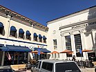
Starbucks Coffee in the Wells Fargo Bank building at the Orange Circle.

Orange City Hall, c. 1921. This building was razed in 1964 and stood on the site of the current Orange Civic Center.
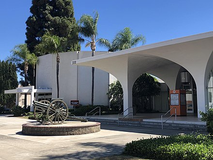
Civic Center (1964), architect Welton Becket.


Notable people[]


- Mikey Day, comedian, writer and cast member on Saturday Night Live, born in Orange[64][65]
- Don Aase, born in Orange, MLB player[66]
- Héctor Ambriz, MLB player for the Houston Astros and the Cleveland Indians[67]
- Garrett Atkins, MLB player for the Baltimore Orioles and Colorado Rockies.[68]
- Shane Bieber, MLB player who plays for the Cleveland Indians
- Erica Blasberg (1984–2010), LPGA golfer, born in Orange
- Bert Blyleven, MLB player who played in the California Angels and once owned a cafe in nearby Villa Park.
- Jeff Buckley (1966–1997), singer-songwriter and guitarist[69]
- Bud Daley, MLB player for the Cleveland Indians, Kansas City Athletics, and New York Yankees[70]
- Deakin, member of Animal Collective, born in Orange.
- Rob Deer, MLB player for the San Francisco Giants, Milwaukee Brewers, Detroit Tigers, Boston Red Sox, and San Diego Padres.[71]
- Zach Ertz, tight end for the Philadelphia Eagles, born in Orange[72]
- Placida Gardner Chesley, WWI worker, bacteriologist[73]
- Charles Gipson, former MLB player for the Baltimore Orioles, New York Yankees, Tampa Bay Devil Rays and Houston Astros[74]
- Casey Janssen, MLB player, born in Orange.[75]
- Steve Johnson, professional tennis player, two-time NCAA champion[76]
- Dean Koontz, novelist, once resided in Orange Hills[77] and set many of his novels, such as The Bad Place, in the area.
- Rusty Kuntz, baseball World Series champion player (1984) and coach (2015).
- Justin Lehr, MLB player for the Cincinnati Reds, Oakland Athletics, and Milwaukee Brewers, born in Orange.[78]
- Alexander Lévy (born 1990), professional golfer[79][80]
- Hunter Mahan, PGA Tour golfer, born in Orange.[81]
- Scott McAdams, former mayor of Sitka, Alaska and Democratic nominee for U.S. Senate in Alaska in 2010, born in Orange[82]
- Mike Pompeo (born 1963), US Secretary of State and past CIA Director[83][84]
- Ginger Zee, meteorologist, ABC News and Good Morning America, born in Orange.[85]
Sister cities[]
Orange has five sister cities, as designated by Sister Cities International:
 Novo Kosino, Moscow, Russia
 Orange, New South Wales, Australia
 Orange, Vaucluse, France
 Santiago de Querétaro, Mexico
 Timaru, New Zealand
Orange used to have two community partnerships with Utrecht, the Netherlands; and Santiago, Chile.
See also[]
- List of museums in Orange County, California
- List of Tree Cities USA
- Old Towne, Orange Historic District
References[]
- ^ "California Cities by Incorporation Date". California Association of Local Agency Formation Commissions. Archived from the original (Word) on November 3, 2014. Retrieved August 25, 2014.
- ^ Jump up to: a b "City Council". cityoforange.org. Retrieved July 5, 2021.
- ^ "City Manager". City of Orange. Archived from the original on October 7, 2015. Retrieved October 7, 2015.
- ^ "2019 U.S. Gazetteer Files". United States Census Bureau. Retrieved July 1, 2020.
- ^ "Orange". Geographic Names Information System. United States Geological Survey. Retrieved January 5, 2015.
- ^ Jump up to: a b c "Orange (city) QuickFacts". United States Census Bureau. Archived from the original on July 24, 2012. Retrieved March 24, 2015.
- ^ Jump up to: a b c "Population and Housing Unit Estimates". Retrieved May 21, 2020.
- ^ "The Plaza – History". City of Orange CA. Archived from the original on June 26, 2009. Retrieved May 3, 2009.
- ^ According to company records[citation needed]
- ^ Hicks, Angelina; Joukhadar, Joy (December 22, 2020). "Orange City Council Extends Glassell Street Closure in Orange Plaza Paseo". Voice of OC. Retrieved February 23, 2021.
- ^ iso=US&form=PRWLAS&q=335%20E%20Maple%20Ave%2C%20Orange%2C%20CA%2092866&el=g7Ozp8CoFMezIlEtUYVYMw%3D%3D: MSN Weather Retrieved September 9, 2017
- ^ Orange, CA: Weather Facts Retrieved May 7, 2009
- ^ "National and Local Weather Forecast, Hurricane, Radar and Report". The Weather Channel.
- ^ "Zipcode 92856". www.plantmaps.com. Retrieved April 27, 2021.
- ^ Jump up to: a b "CALIFORNIA – Orange County, part2". National Register of Historic Places. Retrieved May 10, 2009.
- ^ According to State Historic Resource Surveys.
- ^ "CALIFORNIA – Orange County, part1". National Register of Historic Places. Retrieved May 10, 2009.[dead link]
- ^ "CALIFORNIA – Orange County, part3". National Register of Historic Places. Retrieved May 10, 2009.
- ^ "Welton Becket", Los Angeles Conservancy
- ^ "Bungalow Style 1910–1929". Archived from the original on July 16, 2005. Retrieved May 22, 2005.
- ^ "Craftsman Bungalow Style 1904–1921". Archived from the original on February 24, 2005. Retrieved May 22, 2005.
- ^ "Craftsman Style 1909–1918". Archived from the original on February 24, 2005. Retrieved May 22, 2005.
- ^ "Classical Revival and Hip Roof Cottage Styles 1904 – 1911". Archived from the original on February 24, 2005. Retrieved May 22, 2005.
- ^ "Mediterranean Style 1920 – 1935". Archived from the original on February 24, 2005. Retrieved May 22, 2005.
- ^ "Prairie Style 1916 – 1921". Archived from the original on February 24, 2005. Retrieved May 22, 2005.
- ^ "Spanish Colonial Style 1913 – 1931". Archived from the original on February 24, 2005. Retrieved May 22, 2005.
- ^ "Victorian Style 1886 – 1910". Archived from the original on February 24, 2005. Retrieved May 22, 2005.
- ^ "Census of Population and Housing". Census.gov. Retrieved June 4, 2015.
- ^ "2010 Census Interactive Population Search: CA – Orange city". U.S. Census Bureau. Archived from the original on November 18, 2014. Retrieved July 12, 2014.
- ^ "Orange, CA Population - Census 2010 and 2000 Interactive Map, Demographics, Statistics, Quick Facts - CensusViewer". www.censusviewer.com. Retrieved December 20, 2019.
- ^ "U.S. Census website". United States Census Bureau. Retrieved April 29, 2019.
- ^ "Precinct results" (PDF). www.ocvote.com. 2020. Retrieved November 27, 2020.
- ^ "Election data" (PDF). www.ocvote.com. Retrieved August 10, 2020.
- ^ "Election data" (PDF). www.ocvote.com. Retrieved August 10, 2020.
- ^ "Election data" (PDF). www.ocvote.com. Retrieved August 10, 2020.
- ^ "Election data" (PDF). www.ocvote.com. Retrieved August 10, 2020.
- ^ "Election data" (PDF). www.ocvote.com. Retrieved August 10, 2020.
- ^ California. Secretary of State (March 30, 1968). "Statement of vote". Sacramento, Calif. : The Secretary – via Internet Archive.
- ^ California. Secretary of State (March 30, 1968). "Statement of vote". Sacramento, Calif. : The Secretary – via Internet Archive.
- ^ Statement of the Vote. Sacramento, Calif. : The Secretary. 1968.
- ^ Statement of the Vote. Sacramento, Calif. : The Secretary. 1968.
- ^ Statement of the Vote. Sacramento, Calif. : The Secretary. 1968.
- ^ "Communities of Interest — City". California Citizens Redistricting Commission. Archived from the original on October 23, 2015. Retrieved November 30, 2014.
- ^ "Communities of Interest — City". California Citizens Redistricting Commission. Archived from the original on October 23, 2015. Retrieved November 30, 2014.
- ^ "Communities of Interest – City". California Citizens Redistricting Commission. Archived from the original on September 30, 2013. Retrieved September 27, 2014.
- ^ "Study ranks America's most liberal and conservative cities". Govpro.com. August 16, 2005. Archived from the original on July 22, 2012. Retrieved July 22, 2010.
- ^ "CA Secretary of State – Report of Registration – February 10, 2019" (PDF). ca.gov. Retrieved June 26, 2019.
- ^ "Orange, CA Crime Rates and Statistics - NeighborhoodScout". www.neighborhoodscout.com. Retrieved March 16, 2021.
- ^ "Orange, CA Crime Rates & Map". www.areavibes.com. Retrieved March 16, 2021.
- ^ Vives, Ruben; Fry, Hannah; Do, Anh; Ormseth, Matthew (April 1, 2021). "4 killed, including child, in mass shooting at Orange office complex". Los Angeles Times.
- ^ "City of Orange CAFR". Archived from the original on December 5, 2012. Retrieved August 15, 2012.
- ^ "冬のボディ磨き". wcorange.org. Archived from the original on August 10, 2018. Retrieved February 16, 2019.
- ^ # 97000617
- ^ "Contact us." International School of Los Angeles. Retrieved on December 6, 2017. "Orange County Campus 1838 N. Shaffer Street Orange, CA 92865"
- ^ "Orange" (Archive). International School of Los Angeles. Retrieved on June 29, 2015. "186 N. Prospect Orange, CA 92869"
- ^ "Orange County Archived July 1, 2015, at the Wayback Machine." International School of Los Angeles. Retrieved on June 29, 2015.
- ^ "Orange County Archived July 1, 2015, at the Wayback Machine." International School of Los Angeles. Retrieved on December 6, 2017. "ORANGE COUNTY CAMPUS 1838 N. Shaffer Street Orange, CA 92865"
- ^ "Field Services Division | Orange, CA". www.cityoforange.org. Retrieved May 11, 2021.
- ^ "Investigative Services Division | Orange, CA". www.cityoforange.org. Retrieved May 11, 2021.
- ^ "Support Services Division | Orange, CA". www.cityoforange.org. Retrieved May 11, 2021.
- ^ "Locate a Station | Orange, CA". www.cityoforange.org. Retrieved May 12, 2021.
- ^ "Home". web.archive.org. February 19, 2015. Retrieved May 11, 2021.
- ^ "Emergency Operations | Orange, CA". www.cityoforange.org. Retrieved May 12, 2021.
- ^ "Mikey Day", Simple English Wikipedia, the free encyclopedia, April 8, 2019, retrieved January 28, 2021
- ^ "Mikey Day: Saturday Night Live Repertory Player - NBC.com". NBC. Retrieved January 28, 2021.
- ^ Reichler, Joseph L., ed. (1979) [1969]. The Baseball Encyclopedia (4th ed.). New York: Macmillan Publishing. ISBN 978-0-02-578970-8.
- ^ "Hector Ambriz Stats". Baseball Almanac. Retrieved December 3, 2012.
- ^ "Garrett Atkins Stats". Baseball Almanac. Retrieved December 3, 2012.
- ^ "Biography".
- ^ "Bud Daley Stats". Baseball Almanac. Retrieved December 3, 2012.
- ^ "Rob Deer Stats". Baseball Almanac. Retrieved December 3, 2012.
- ^ "Zach Ertz Stats – Stanford". ESPN. Retrieved January 9, 2015.
- ^ "Two Graduates of Local High School to Go in Red Cross" Santa Ana Register (April 10, 1918): 7. via Newspapers.com

- ^ "Charles Gipson Stats". Baseball Almanac. Retrieved December 3, 2012.
- ^ "Casey Janssen Stats". Baseball Almanac. Retrieved November 26, 2012.
- ^ "10 Things You May Not Know About Steve Johnson". August 17, 2011.
- ^ Madsen, Chris (June 10, 2017). "Master of Suspense: Dean Koontz". Havened.com. Retrieved April 25, 2019.
- ^ "Justin Lehr Stats". Baseball Almanac. Retrieved December 3, 2012.
- ^ "Fore! » Kaplan's Korner on Jews and Sports". archive.ph. July 9, 2014. Retrieved March 24, 2021.
- ^ "Levy c'est grand". Orange County Register. July 2, 2014. Retrieved March 24, 2021.
- ^ "Hunter Mahan". PGA Tour. Archived from the original on October 19, 2012. Retrieved December 3, 2012.
- ^ State of Alaska – Official Election Pamphlet – November 2, 2010 (PDF) (Region I ed.). Juneau: State of Alaska Division of Elections. 2010. p. 17. Archived from the original (PDF) on December 3, 2010. Retrieved October 15, 2010.
- ^ "Santa Ana Cadet Wins Top West Point Honor". Los Angeles Times. May 31, 1986. Retrieved March 24, 2021.
- ^ Lee, Teresa. "Pompeo visits mother's childhood home". Wellington Daily News - Wellington, KS. Retrieved March 24, 2021.
- ^ Levine, Daniel S. (July 4, 2016). "Ginger Zee: 5 Fast Facts You Need to Know". Heavy.com. Retrieved April 25, 2019.
Zee, who was born Ginger Renne Zuidgeest in Orange, California ...
External links[]
| Wikimedia Commons has media related to Orange, California. |
| Wikivoyage has a travel guide for Orange (California). |
| show Municipalities and communities of Orange County, California, United States |
|---|

| show Greater Los Angeles Area |
|---|

| show Southern California megaregion as defined by RPA |
|---|

| show Authority control |
|---|
- Orange, California
- 1888 establishments in California
- Cities in Orange County, California
- Incorporated cities and towns in California
- Populated places established in 1869
- Populated places on the Santa Ana River