Osceola County, Michigan
Osceola County | |
|---|---|
U.S. county | |
 Osceola County Courthouse | |
 Seal | |
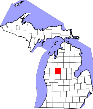 Location within the U.S. state of Michigan | |
 Michigan's location within the U.S. | |
| Coordinates: 43°59′N 85°20′W / 43.98°N 85.33°W | |
| Country | |
| State | |
| Founded | 1 April 1840 (created) 1869 (organized)[1] |
| Named for | Osceola |
| Seat | Reed City |
| Largest city | Reed City |
| Area | |
| • Total | 573 sq mi (1,480 km2) |
| • Land | 566.39 sq mi (1,466.9 km2) |
| • Water | 6.7 sq mi (17 km2) 1.2%% |
| Population | |
| • Estimate (2019) | 23,460 |
| • Density | 41.4/sq mi (16.0/km2) |
| Time zone | UTC−5 (Eastern) |
| • Summer (DST) | UTC−4 (EDT) |
| Congressional district | 4th |
| Website | www |

Osceola County is a county in the U.S. state of Michigan. At the 2010 United States Census, the population was 23,528.[2] The county seat is Reed City.[3]
History[]

When established by the Michigan Legislature on April 1, 1840, it was named Unwattin County,[4] after Chief Unwattin of the local Ottawa people.[5] As a representative of the Ottawa nation, he participated in negotiations for the Treaty of Washington (1836) that granted a vast expanse of Michigan to the US Federal Government.[4] The name was changed March 8, 1843, to Osceola, after the Seminole chief who achieved renown in Florida.[1]
The county was initially attached for administrative purposes to Ottawa County. In 1855, it was attached to Mason County; in 1857, to Newaygo County; and in 1859, to Mecosta County.[4]
As the population increased, separate county government was organized in 1869, with Hersey designated as the county seat. Reed City became the official county seat in 1927.[1] The county was developed initially for harvesting and processing lumber, and many European Americans came to work in lumbering and the mills.
Geography[]
The low rolling hills[6] of Osceola County were completely wooded prior to settlement; at present about half of the area has been cleared and converted to agricultural or urban use. There are numerous small lakes and ponds scattered across the county; the largest is Rose Lake, northeast of LeRoy.[7] The highest point on the terrain (1722 feet/525 meters ASL) is Grove Hill, in Sherman Township.[8] According to the United States Census Bureau, the county has a total area of 573 square miles (1,480 km2), of which 566 square miles (1,470 km2) is land and 6.7 square miles (17 km2) (6.7%) is water.[9] The county is drained by the Muskegon River and branches of the Manistee River. Osceola County is part of Northern Michigan.
Adjacent counties[]
- Wexford County − northwest
- Missaukee County − northeast
- Clare County − east
- Isabella County − southeast
- Mecosta County − south
- Newaygo County − southwest
- Lake County − west
Major highways[]
 US 10
US 10 US 131
 Bus. US 10
 M-61
M-61 M-66
M-66 M-115
M-115
Demographics[]
| Historical population | |||
|---|---|---|---|
| Census | Pop. | %± | |
| 1860 | 27 | — | |
| 1870 | 2,093 | 7,651.9% | |
| 1880 | 10,777 | 414.9% | |
| 1890 | 14,630 | 35.8% | |
| 1900 | 17,859 | 22.1% | |
| 1910 | 17,889 | 0.2% | |
| 1920 | 15,221 | −14.9% | |
| 1930 | 12,806 | −15.9% | |
| 1940 | 13,309 | 3.9% | |
| 1950 | 13,797 | 3.7% | |
| 1960 | 13,595 | −1.5% | |
| 1970 | 14,838 | 9.1% | |
| 1980 | 18,928 | 27.6% | |
| 1990 | 20,146 | 6.4% | |
| 2000 | 23,197 | 15.1% | |
| 2010 | 23,528 | 1.4% | |
| 2019 (est.) | 23,460 | [10] | −0.3% |
| US Decennial Census[11] 1790-1960[12] 1900-1990[13] 1990-2000[14] 2010-2018[2] | |||
2000 census[]
At the 2000 United States Census,[15] there were 23,197 people, 8,861 households and 6,415 families in the county. The population density was 41 per square mile (16/km2). There were 12,853 housing units at an average density of 23 per square mile (9/km2). The racial makeup of the county was 97.51% White, 0.35% Black or African American, 0.50% Native American, 0.22% Asian, 0.02% Pacific Islander, 0.20% from other races, and 1.21% from two or more races. 0.99% of the population were Hispanic or Latino of any race. 26.0% were of German, 11.9% English, 11.0% American, 8.8% Irish, 6.5% Dutch and 5.2% Polish ancestry. 96.8% spoke English, 1.1% German and 1.0% Spanish as their first language.
There were 8,861 households, of which 32.90% had children under the age of 18 living with them, 58.10% were married couples living together, 9.70% had a female householder with no husband present, and 27.60% were non-families. 22.60% of all households were made up of individuals, and 9.80% had someone living alone who was 65 years of age or older. The average household size was 2.58 and the average family size was 3.01.
27.10% of the population were under the age of 18, 8.00% from 18 to 24, 26.50% from 25 to 44, 24.20% from 45 to 64, and 14.20% who were 65 years of age or older. The median age was 38 years. For every 100 females there were 97.70 males. For every 100 females age 18 and over, there were 94.70 males.
The median household income was $34,102 and the median family income was $39,205. Males had a median income of $29,837 compared with $22,278 for females. The per capita income for the county was $15,632. About 9.50% of families and 12.70% of the population were below the poverty line, including 15.90% of those under age 18 and 10.30% of those age 65 or over.
Government[]
The county government operates the jail, maintains rural roads, operates the major local courts, keeps files of deeds and mortgages, maintains vital records, administers public health regulations, and participates with the state in the provision of welfare and other social services. The county board of commissioners controls the budget but has only limited authority to make laws or ordinances. In Michigan, most local government functions — police and fire, building and zoning, tax assessment, street maintenance, etc. — are the responsibility of individual cities and townships.
Communities[]

Cities[]
Villages[]
Unincorporated communities[]
- Ashton
- Dighton
- Highland
- Ina
- Orono
- Park Lake
- Pisgah Heights
- Sears
Townships[]
See also[]
- List of Michigan State Historic Sites in Osceola County, Michigan
- National Register of Historic Places listings in Osceola County, Michigan
References[]
- ^ Jump up to: a b c "Bibliography on Osceola County". Clarke Historical Library, Central Michigan University. Retrieved January 29, 2013.
- ^ Jump up to: a b "State & County QuickFacts". US Census Bureau. Archived from the original on June 6, 2011. Retrieved August 29, 2013.
- ^ "Find a County". National Association of Counties. Retrieved June 7, 2011.
- ^ Jump up to: a b c d Newberry Library. "Michigan: Individual County Chronologies". Atlas of County Historical Boundaries. Retrieved November 4, 2016.
- ^ "Michigan Historical Collections". The Commission. 6 October 2018 – via Google Books.
- ^ Ripley, George; Dana, Charles A., eds. (1879). . The American Cyclopædia.
- ^ Osceola County MI (Google Maps, accessed 7 October 2020)
- ^ "Grove Hill, Highest Point in Osceola County MI". Waymarking.com. 20 July 2010. Retrieved 7 October 2020.
- ^ "2010 Census Gazetteer Files". US Census Bureau. August 22, 2012. Archived from the original on November 13, 2013. Retrieved September 27, 2014.
- ^ "US Census Bureau QuickFacts: Osceola County MI". Retrieved 7 October 2020.
- ^ "US Decennial Census". US Census Bureau. Retrieved September 27, 2014.
- ^ "Historical Census Browser". University of Virginia Library. Retrieved September 27, 2014.
- ^ "Population of Counties by Decennial Census: 1900 to 1990". US Census Bureau. Retrieved September 27, 2014.
- ^ "Census 2000 PHC-T-4. Ranking Tables for Counties: 1990 and 2000" (PDF). US Census Bureau. Retrieved September 27, 2014.
- ^ "US Census website". US Census Bureau. Retrieved January 31, 2008.
- ^ Leip, David. "Atlas of US Presidential Elections". uselectionatlas.org.
External links[]
- Official website
- "Bibliography on Osceola County". Clarke Historical Library, Central Michigan University. Retrieved January 29, 2013.
| show Places adjacent to Osceola County, Michigan |
|---|
| show Municipalities and communities of Osceola County, Michigan, United States |
|---|

| show |
|---|

Coordinates: 43°59′N 85°20′W / 43.98°N 85.33°W
| show Authority control |
|---|
- Michigan counties
- Osceola County, Michigan
- 1869 establishments in Michigan
- Populated places established in 1869