Outline of Peru


The following outline is provided as an overview of and topical guide to Peru:
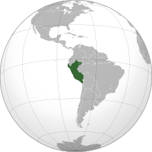
Peru – country located in western South America, on the Pacific Coast, north of Chile. Peruvian territory was home to several ancient cultures. Ranging from the Norte Chico civilization in the 32nd century BC, the oldest civilization in the Americas and one of the five cradles of civilization, to the Inca Empire, the largest state in pre-Columbian America, the territory now including Peru has one of the longest histories of civilization of any country, tracing its heritage back to the 4th millennia BCE. The Spanish Empire conquered the region in the 16th century and established a Viceroyalty, which included most of its South American colonies. After achieving independence in 1821, Peru has undergone periods of political unrest and fiscal crisis as well as periods of stability and economic upswing.
General reference[]

- Pronunciation: /pəˈruː/ (
 listen)
 - Common English country name: Peru
- Official English country name: The Republic of Peru
- Common endonym(s): Perú, Piruw
- Official endonym(s): República del Perú, Piruw Hapan llaqta, Piruw Suyu
- Adjectival(s): Peruvian
- Demonym(s): Peruvians
- Etymology: Name of Peru
- International rankings of Peru
- ISO country codes: PE, PER, 604
- ISO region codes: See ISO 3166-2:PE
- Internet country code top-level domain: .pe
Geography of Peru[]

- Peru is: a megadiverse country
- Location:
- Southern Hemisphere
- Western Hemisphere
- Americas
- Latin America
- South America
- Latin America
- Americas
- Time in Peru
- Time zone: UTC-05
- Extreme points of Peru
- Land boundaries: 7,461 km
 Brazil 2,995 km
 Colombia 1,800 km
 Ecuador 1,420 km
 Bolivia 1,075 km
 Chile 171 km
- Coastline: South Pacific Ocean 2,414 km
- Population of Peru: 28,750,770 (June 30, 2007) - 40th most populous country
- Area of Peru: 1,285,220 km2 (496,230 sq mi) - 20th largest country
- Atlas of Peru
Environment of Peru[]

- Climate of Peru
- Environmental issues in Peru
- Renewable energy in Peru
- Geology of Peru
- Natural regions of Peru
- Protected areas of Peru
- Biosphere reserves in Peru
- National parks of Peru
- Wildlife of Peru
- Flora of Peru
- Fauna of Peru
- Birds of Peru
- Mammals of Peru
Natural geographic features of Peru[]
- Glaciers of Peru
- Islands of Peru
- Lakes of Peru
- Mountains of Peru
- Peru–Chile Trench
- Rivers of Peru
- World Heritage Sites in Peru
Regions of Peru[]
Administrative divisions of Peru[]
Administrative divisions of Peru
- Regions of Peru
- Provinces of Peru
- Former regions of Peru
- Municipalities of Peru
Regions of Peru[]
Regions of Peru Peru is divided into 25 regions and the province of Lima.


|
Provinces of Peru[]
Districts of Peru[]
Municipalities of Peru[]
- Capital of Peru: Lima
- Cities of Peru
Demography of Peru[]
Neighbours of Peru[]
Peru is bordered by:
- Bolivia
- Brazil
- Chile
- Colombia
- Ecuador
Government and politics of Peru[]
- Politics of Peru
Branches of the government of Peru[]
Executive branch of the government of Peru[]
- Head of state and head of government: President of Peru, Martín Vizcarra
- Vice Presidents of Peru: Mercedes Aráoz
- Cabinet: Council of Ministers of Peru
- Ministries of Peru
- Prime Minister of Peru, Fernando Zavala
- Ministry of Agriculture of Peru
- Ministry of Economy and Finance of Peru
- Ministry of Defense of Peru
- Ministry of Education of Peru
- Ministry of Energy and Mines of Peru
- Ministry of Environment of Peru
- Ministry of Foreign Commerce and Tourism of Peru
- Ministry of Foreign Relations of Peru
- Ministry of Health of Peru
- Ministry of the Interior of Peru
- Ministry of Justice of Peru
- Ministry of Production of Peru
- Ministry of Transportation and Communication of Perú
- Ministry of Women and Social Development of Peru
Legislative branch of the government of Peru[]
Judicial branch of the government of Peru[]
- Judicial system of Peru
- Constitutional Court of Peru - interprets the constitution on matters of individual rights
- Supreme Court of Peru - located in the Palace of Justice
- Superior Courts of Justice of Peru preside over the Judicial Districts of Peru
- Courts of First Instance of Peru hold jurisdiction over each province
- Courts of Peace of Peru each have jurisdiction over a single district
- Courts of First Instance of Peru hold jurisdiction over each province
- Superior Courts of Justice of Peru preside over the Judicial Districts of Peru
Foreign relations of Peru[]
- Foreign relations of Peru
- Diplomatic missions in Peru
- Diplomatic missions of Peru
- Chile–Peru relations
International organization membership[]
The Republic of Peru is a member of:[1]
Law and order in Peru[]
- Capital punishment in Peru
- Constitution of Peru
- Crime in Peru
- Domestic violence in Peru
- Human rights in Peru
- Abortion in Peru
- LGBT rights in Peru
- Freedom of religion in Peru
- Law enforcement in Peru
- Nationality law of Peru
Military of Peru[]
- Military of Peru
- Command
- Commander-in-chief:
- Forces
- Army of Peru
- Navy of Peru
- Air Force of Peru
- Military history of Peru
- Military ranks of Peru
- Command
Local government in Peru[]
History of Peru[]
By period[]
- Ancient civilizations of Peru
- Cultural periods of Peru
- Inca Empire
- Spanish conquest of Peru
- Neo-Inca State
- Viceroyalty of Peru
- Peruvian War of Independence
- Guano era in Peru
- War of the Pacific
- Colombia-Peru War
- Ecuadorian–Peruvian War
- Internal conflict in Peru
By subject[]
- Agricultural history of Peru
- Demographic history of Peru
- Economic history of Peru
- Homosexuality in ancient Peru
- Military history of Peru
By type of event[]
Culture of Peru[]
- Architecture of Peru
- Inca architecture
- Peruvian colonial architecture
- Peruvian Viceroyal architecture
- Cuisine of Peru
- Languages of Peru
- Media in Peru
- Metrication in Peru
- National symbols of Peru
- Coat of arms of Peru
- Flag of Peru
- National anthem of Peru
- Cockade of Peru (unofficial national symbol)
- People of Peru
- Indigenous peoples in Peru
- Prostitution in Peru
- Public holidays in Peru
- Scouting and Guiding in Peru
- Television in Peru
- World Heritage Sites in Peru
Art in Peru[]
- Art in Peru
- Cinema of Peru
- Literature of Peru
- Music of Peru
- Television in Peru
Religion in Peru[]
- Christianity in Peru
- Roman Catholicism in Peru
- Roman Catholic dioceses in Peru
- Roman Catholicism in Peru
- Hinduism in Peru
- Islam in Peru
Sports in Peru[]
Sports in Peru
- Football in Peru
- Chile and Peru football rivalry
- Football clubs in Peru
- Football stadiums in Peru
- Peru national football team
- Peru at the Olympics
- Tennis in Peru
- Rugby union in Peru
- Surfing in Peru
Economy and infrastructure of Peru[]
- Economic rank, by nominal GDP (2007): 54th (fifty-fourth)
- Agriculture in Peru
- Banking in Peru
- National Bank of Peru
- Central Reserve Bank of Peru
- Communications in Peru
- Internet in Peru
- Media in Peru
- List of postal codes in Peru
- Telephone numbers in Peru
- Companies of Peru
- Currency of Peru: Nuevo Sol
- ISO 4217: PEN
- Economic history of Peru
- Energy in Peru
- Electric power in Peru
- Mining in Peru
- Peru Stock Exchange
- Tourism in Peru
- Transport in Peru
- Water resources management in Peru
- Irrigation in Peru
- Water supply and sanitation in Peru
Education in Peru[]
See also[]
| Spanish language edition of Wikipedia, the free encyclopedia |
| Quechua language edition of Wikipedia, the free encyclopedia |
| Aymara language edition of Wikipedia, the free encyclopedia |
Peru
- Index of Peru-related articles
- Iperu, tourist information and assistance
- List of international rankings
- List of Peru-related topics
- Member state of the United Nations
- Outline of geography
- Outline of South America
References[]
- ^ "Peru". The World Factbook. United States Central Intelligence Agency. July 13, 2009. Retrieved July 23, 2009.
External links[]
 Definitions from Wiktionary
 Media from Wikimedia Commons
 News from Wikinews
 Quotations from Wikiquote
 Texts from Wikisource
 Textbooks from Wikibooks
 Resources from Wikiversity
- Government
- (in Spanish) Web portal of the Peruvian Government
- (in Spanish) Directory of Peruvian Government websites
- General reference
- BBC country profile of Peru
- Peru. The World Factbook. Central Intelligence Agency.
- Encyclopædia Britannica entry on Peru
- Peru web directory Archived 2008-10-15 at the Wayback Machine
- Other
 Peru travel guide from Wikivoyage
- Outline of Peru at Curlie
- Outlines of countries
- Peru
- Peru-related lists