Palo, Leyte
This article needs additional citations for verification. (June 2013) |
Palo | |
|---|---|
| Municipality of Palo | |
 Palo Cathedral | |
 Seal | |
 Map of Leyte with Palo highlighted | |
show OpenStreetMap | |
 Palo Location within the Philippines | |
| Coordinates: 11°09′30″N 124°59′30″E / 11.1583°N 124.9917°ECoordinates: 11°09′30″N 124°59′30″E / 11.1583°N 124.9917°E | |
| Country | Philippines |
| Region | Eastern Visayas |
| Province | Leyte |
| District | 1st district |
| Founded | 1768 |
| Barangays | 33 (see Barangays) |
| Government | |
| • Type | Sangguniang Bayan |
| • Mayor | Frances Ann B. Petilla |
| • Vice Mayor | Ronnan Christian M. Reposar |
| • Representative | Ferdinand Martin G. Romualdez |
| • Councilors | show
List |
| • Electorate | 42,949 voters (2019) |
| Area | |
| • Total | 221.27 km2 (85.43 sq mi) |
| Elevation | 14 m (46 ft) |
| Highest elevation | 388 m (1,273 ft) |
| Lowest elevation | 0 m (0 ft) |
| Population (2020 census) [3] | |
| • Total | 76,213 |
| • Density | 340/km2 (890/sq mi) |
| • Households | 15,584 |
| Economy | |
| • Income class | 3rd municipal income class |
| • Poverty incidence | 22.43% (2015)[4] |
| • Revenue | ₱157,879,521.15 (2016) |
| Service provider | |
| • Electricity | Leyte 2 Electric Cooperative (LEYECO 2) |
| Time zone | UTC+8 (PST) |
| ZIP code | 6501 |
| PSGC | |
| IDD : area code | +63 (0)53 |
| Climate type | tropical rainforest climate |
| Native languages | Waray Tagalog |
| Website | www |


Palo, officially the Municipality of Palo (Waray: Bungto han Palo; Tagalog: Bayan ng Palo), is a 3rd class municipality in the province of Leyte, Philippines. According to the 2020 census, it has a population of 76,213 people. [3]
The municipality is the seat of most government departments, bureaus and regional offices of Region VIII, although some are situated at the neighboring city of Tacloban. The town is also home to the offices of the ecclesiastical government of the Archdiocese of Palo; the archbishop's residence; as well as the secondary, tertiary and theology seminaries of the archdiocese.
Geography[]
The municipality is located in the north-eastern part of the province of Leyte, 8 miles from the capital city of Tacloban.
Barangays[]
Palo is politically subdivided into 33 barangays. [5]
- Anahaway
- Arado
- Baras
- Barayong
- Cabarasan Daku
- Cabarasan Guti
- Campetic
- Candahug
- Cangumbang
- Canhidoc
- Capirawan
- Castilla
- Cogon
- San Joaquin
- Gacao
- Guindapunan
- Libertad
- Naga-naga
- Pawing
- Buri (Poblacion barangay)
- Cavite East (Pob. barangay)
- Cavite West (Poblacion)
- Luntad (Poblacion)
- Santa Cruz (Poblacion)
- Salvacion
- San Agustin
- San Antonio
- San Isidro
- San Jose
- St. Michael (Poblacion)
- Tacuranga
- Teraza
- San Fernando
Climate[]
| hideClimate data for Palo, Leyte | |||||||||||||
|---|---|---|---|---|---|---|---|---|---|---|---|---|---|
| Month | Jan | Feb | Mar | Apr | May | Jun | Jul | Aug | Sep | Oct | Nov | Dec | Year |
| Average high °C (°F) | 28 (82) |
28 (82) |
29 (84) |
30 (86) |
30 (86) |
30 (86) |
29 (84) |
30 (86) |
30 (86) |
29 (84) |
29 (84) |
28 (82) |
29 (84) |
| Average low °C (°F) | 22 (72) |
22 (72) |
22 (72) |
23 (73) |
24 (75) |
24 (75) |
24 (75) |
24 (75) |
24 (75) |
24 (75) |
23 (73) |
23 (73) |
23 (74) |
| Average precipitation mm (inches) | 90 (3.5) |
67 (2.6) |
82 (3.2) |
70 (2.8) |
97 (3.8) |
145 (5.7) |
142 (5.6) |
127 (5.0) |
132 (5.2) |
152 (6.0) |
169 (6.7) |
144 (5.7) |
1,417 (55.8) |
| Average rainy days | 17.0 | 13.5 | 16.0 | 16.5 | 20.6 | 24.3 | 26.0 | 25.4 | 25.2 | 26.4 | 23.0 | 21.0 | 254.9 |
| Source: Meteoblue [6] | |||||||||||||
History[]
The first settlers of Palo were Panganuron, Kadampog, Manlangit, Kamagung, Kawaring, Kabalhin, Kumagang Maglain, Bilyo and Dilyo. They lived peacefully in a common home resembling the shape of a bridge in what is now Barrio Bunga (present-day San Joaquin) which spanned an area on both sides of the river bearing the same name. In the course of years, these people increased in number. However, tribal feud arose and the people dispersed as a result. Many died and of those who survived some went to settle in Payapay, others in Canpetik, with the bulk going to Kutay. Those who settled in Kutay were the people who later on built the town of Palo.
Origin of the name[]
According to existing records those who went to Kutay after the tribal war in Bunga were all equipped with palo, a sort of club for fighting or self-protection. Being the settlement of a tribe with palos, this is likely the reason why the community was known as "Palo".
However, the late Justice Norberto Romualdez, in an issue of Noli Me Tangere, a Tacloban-based newspaper of that time, asserted on June 9, 1909, that this town was named Palo because of its many carpenters sporting hammers (mazo or palo).
Menawhile, superstitious folk and people inclined to believe in the supernatural ascribe the origin of Palo's name to the fact that in pre-Spanish days the town was often visited by typhoons every eight (walo) days. They called that phenomenon walo-walo, hence walo-palo (eight-hammer).
Barangay and pueblo[]
The settlers in Kutay moved to Bangon river and there started the first barrio, Barangay de Palo, in 1521. Barangay de Palo then became Pueblo de Palo in the year 1768. Its first elected gobernadorcillo was Capitan Balasabas. The first Curate was R. P. Fray Matias Rosel, O.S.A., an Augustinian friar from Andalucia, Spain.
The Missions
In October 1596, the Jesuits, Fr. Cristobal Jimenez, S.J. and Fr. Francisco Encinas, S.J. who headed out from Dulag to Palo through traversing the eastern coasts and were accompanied by the leading principales, Don Alonso Ambuyao and four others. They found only two small houses which were used as living quarters of the two servants of the encomenderos. A few boys attended the mission schools in Dulag, welcomed the two priests and taught them the dialect. These missionaries opened the first school in Palo and taught the children to play the flute. Later when Fr. Encinas was called to Carigara, Fr. Jimenez carried on alone until Bro. Miguel Gomez arrived to help him.
When Fr. Jimenez had learned enough of the local language to be understood he began his rounds of his mission only to find all doors closed to him, with the exception of very few. The people probably suspected him of being a tax collector. For a long time the natives avoided him and resisted all his attempts at friendship. Nothing he did or offered to do for them seemed to breakdown their distrust him and he was distressed and worried at their antipathy.
In his rounds of the villages, he noticed that there were many sick of which the greater the number succumbed to diseases for lack of medical attention. This observation gave him an idea. At that time, medical service was very expensive and available only to families of means for they alone could afford to pay work animals, slaves , or the equivalent of the patient's ransom. if he were captured...
Palo is well known as the site of Gen. Douglas MacArthur's return to the Philippines together with Philippine and American military forces after a period of exile in 1944.[7][8] Hill 522, a hill located near the town center, was the site of fierce fighting between Allied and Japanese forces during the Second World War. The metropolitan cathedral of the archdiocese, located right across Palo's municipal hall, was used as a hospital for wounded Filipino and American forces. A memorial now stands at the beach site where MacArthur and his troops landed, locally known as MacArthur Park. The first Gabaldon Building is also situated in Barangay San Joaquin, Palo, Leyte. It was inaugurated by President Sergio Osmeña.
Palo was also once the capital of Leyte. The town's Purissima Bridge was the first steel bridge built in the province.
In 1957, sitio Campitic was converted into a barrio,[9] while barrio Baras-Candahug was divided into two: Baras and Candahug.[10] Barrio Malirong was renamed as Libertad.[11]
Typhoon Haiyan[]
On November 8, 2013, Palo was severely struck by Typhoon Haiyan (Yolanda), which destroyed a large portion of Eastern Visayas and killed a number of residents in the town.[12] On January 17, 2015, Pope Francis visited the town as part of his papal visit to the Philippines to meet with the surviving victims of the typhoon. He also blessed the Pope Francis Center for the Poor and met with priests, seminarians, other religious figures, and surviving victims of the typhoon at the Palo Cathedral before leaving Leyte.[13]
Demographics[]
|
| |||||||||||||||||||||||||||||||||||||||||||||
| Source: Philippine Statistics Authority [14] [15] [16][17] | ||||||||||||||||||||||||||||||||||||||||||||||
In the 2020 census, the population of Palo, Leyte, was 76,213 people, [3] with a density of 340 inhabitants per square kilometre or 880 inhabitants per square mile.
Literacy rate in Palo is 99.5%.
The town's native language is Waray-Waray, the major language and lingua franca in the Eastern Visayas region.
Religion[]
Palo is the seat of the ecclesiastical province, the Archdiocese, where the Roman Catholic Archbishop resides in Bukid Tabor. One can find the Metropolitan Cathedral in Palo. Also, the seedbed of vocations to the priesthood is found at the Sacred Heart Seminary and the St. John the Evangelist School of Theology. Two Paloan nuns were also Superior Generals in their respective congregations. To date, there are 158 ordained priests and 106 nuns from the town alone.
Economy[]
| Poverty Incidence of Palo | |
| Source: Philippine Statistics Authority[18][19][20][21][22][23] | |
Palo is the seat of the 6.8-hectare Leyte Information and Communications Technology (ICT) Park and the 22-hectare Leyte Mikyu Economic Zone.[24] The Leyte ICT Park hosts two BPOs while the Leyte Mikyu Ecozone is undergoing development.
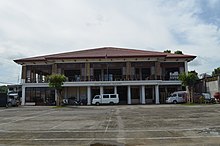
The town's historic Municipal Building was the former Seat of the Provincial Government of Leyte.
Agriculture is the dominant industry. The area produced and ferments the local coconut wine "tuba".[25][26]
Tourist attractions[]

- MacArthur Landing Memorial National Park
- Guinhangdan Hill, a destination of Holy Week pilgrims. The hill is now a forest reserve.
- Japanese Shrine in Barangay Caloogan
- Red Beach - The landmark that has brought Palo to the annals of world history is the Red Beach, in barangay Candahug, where Gen. Douglas MacArthur first landed to liberate the Philippines from the Japanese occupation on October 20, 1944.[7]
- WW2 Memorial for the Filipino Soldiers
- Palo Metropolitan Cathedral
- Palo Binangalan coral reefs
- Palo Mangrove Reservation (open season for duck hunting whole year round)
- Palo Municipal Library and Heritage Museum
- Korean Park
Educational institutions[]
Private[]
- Saint Paul School of Professional Studies
- Sacred Heart Seminary
- St. John The Evangelist School of Theology
- Palo Angelicum
- St. Mary's Academy Of Palo, Inc.
- St Agustine College of Practical Nursing
- Bethel International School
- Zion Bible College
- AMA Computer College
- ELA English Language Academy
- Alpha-Omega Learning Center
Public[]
- UP Manila School of Health Sciences
- Philippine Science High School - Eastern Visayas Campus
- Palo National High School
- Palo Central School (Regular)
- Palo Central School (SPED)
- San Joaquin Central School
- San Joaquin National High School
- Libertad Elementary School
- Anahaway National High School
- Kauswagan National High School
- Luntad Elementary School
- Naga-Naga Elementary School
- Arado Elementary School
- Pawing Elementary School
- Guindapunan Elementary School
- Baras Elementary School
- Canhidoc Elementary School
- Palo National High School- Pawing Annex
- San Antonio Elementary School
- Cogon Elementary School
- Salvacion Elementary School
- San Fernando Elementary School
- Candahug Elementary School
- Caloogan Elementary School
Notable people[]
- Francisco Alvarado - Waray-language poet and playwright[27]
- Iluminado Lucente - Waray-language playwright
- Vicente I. de Veyra - Waray-language anthologist and poet
- Carmen Pedrosa - journalist and author
- Leopoldo Petilla - current governor of Leyte
- Ely Capacio - basketball player and coach
- Glenn Capacio - basketball player and coach
References[]
- ^ Municipality of Palo | (DILG)
- ^ "2015 Census of Population, Report No. 3 – Population, Land Area, and Population Density" (PDF). Philippine Statistics Authority. Quezon City, Philippines. August 2016. ISSN 0117-1453. Archived (PDF) from the original on May 25, 2021. Retrieved July 16, 2021.
- ^ Jump up to: a b c Census of Population (2020). "Region VIII (Eastern Visayas)". Total Population by Province, City, Municipality and Barangay. PSA. Retrieved 8 July 2021.
- ^ https://psa.gov.ph/sites/default/files/City%20and%20Municipal-level%20Small%20Area%20Poverty%20Estimates_%202009%2C%202012%20and%202015_0.xlsx; publication date: 10 July 2019; publisher: Philippine Statistics Authority.
- ^ "Province: Leyte". PSGC Interactive. Quezon City, Philippines: Philippine Statistics Authority. Retrieved 12 November 2016.
- ^ "Palo: Average Temperatures and Rainfall". Meteoblue. Retrieved 29 February 2020.
- ^ Jump up to: a b "Leyte Landing". Official Gazette of the Republic of the Philippines. Retrieved 25 January 2015.
- ^ Misagal, Monch Mikko E. (16 October 2014). "Did MacArthur land on Leyte before Oct. 20, 1944?". Manila Bulletin. Retrieved 25 January 2015.
- ^ "R.A. No. 1722: An Act Converting the Sitio of Campitic in the Municipality of Palo, Province of Leyte, into a Barrio to Be Known As the Barrio of Campitic". LawPH.com. Retrieved 2011-04-12.
- ^ "R.A. No. 1723: An Act Creating the Barrios of Baras and Candahug in the Municipality of Palo, Province of Leyte". LawPH.com. Retrieved 2011-04-12.
- ^ "R.A. No. 1740: An Act Changing the Name of the Barrio of Malirong, Municipality of Palo, Province of Leyte, to Libertad". LawPH.com. Retrieved 2011-04-12.
- ^ "Five years later: How 'Yolanda'-hit areas look now". The Philippine Star. November 8, 2018.
- ^ "Pope Francis arrives in Leyte to console Yolanda victims". Rappler. 17 January 2015. Retrieved 17 January 2015.
- ^ Census of Population (2015). "Region VIII (Eastern Visayas)". Total Population by Province, City, Municipality and Barangay. PSA. Retrieved 20 June 2016.
- ^ Census of Population and Housing (2010). "Region VIII (Eastern Visayas)". Total Population by Province, City, Municipality and Barangay. NSO. Retrieved 29 June 2016.
- ^ Censuses of Population (1903–2007). "Region VIII (Eastern Visayas)". Table 1. Population Enumerated in Various Censuses by Province/Highly Urbanized City: 1903 to 2007. NSO.
- ^ "Province of Leyte". Municipality Population Data. Local Water Utilities Administration Research Division. Retrieved 17 December 2016.
- ^ "Poverty incidence (PI):". Philippine Statistics Authority. Retrieved 28 December 2020.
- ^ https://psa.gov.ph/sites/default/files/NSCB_LocalPovertyPhilippines_0.pdf; publication date: 29 November 2005; publisher: Philippine Statistics Authority.
- ^ https://psa.gov.ph/sites/default/files/2003%20SAE%20of%20poverty%20%28Full%20Report%29_1.pdf; publication date: 23 March 2009; publisher: Philippine Statistics Authority.
- ^ https://psa.gov.ph/sites/default/files/2006%20and%202009%20City%20and%20Municipal%20Level%20Poverty%20Estimates_0_1.pdf; publication date: 3 August 2012; publisher: Philippine Statistics Authority.
- ^ https://psa.gov.ph/sites/default/files/2012%20Municipal%20and%20City%20Level%20Poverty%20Estima7tes%20Publication%20%281%29.pdf; publication date: 31 May 2016; publisher: Philippine Statistics Authority.
- ^ https://psa.gov.ph/sites/default/files/City%20and%20Municipal-level%20Small%20Area%20Poverty%20Estimates_%202009%2C%202012%20and%202015_0.xlsx; publication date: 10 July 2019; publisher: Philippine Statistics Authority.
- ^ http://peza.gov.ph Archived 28 March 2013 at the Wayback Machine
- ^ "DOST Eyes Palo, Leyte as Country's Coco Wine Capital". Interaksyon.com. Philippines News Agency. 1 July 2013. Retrieved 25 January 2015.
- ^ "Boosting Philippines' Coconut Wine Industry". Tempo. 20 July 2013. Archived from the original on 25 January 2015. Retrieved 25 January 2015.
- ^ Sugbo, Victor, ed. (1995). Tinipigan: An Anthology of Waray Literature. Manila, Philippines: National Commission for Culture and the Arts. p. 270. OCLC 645852700. Retrieved 27 September 2019.
External links[]
| Wikimedia Commons has media related to Palo, Leyte. |
| Wikivoyage has a travel guide for Palo, Leyte. |
- Palo Profile at PhilAtlas.com
- Philippine Standard Geographic Code
- Philippine Census Information
- Local Governance Performance Management System
| show Places adjacent to Palo, Leyte |
|---|
| Authority control |
|
|---|
- Municipalities of Leyte (province)
- 1768 establishments in the Spanish Empire