Villaba
Villaba | |
|---|---|
| Municipality of Villaba | |
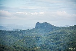 Mt. Buga-buga in Abijao, Villaba | |
 Map of Leyte with Villaba highlighted | |
OpenStreetMap  | |
 Villaba Location within the Philippines | |
| Coordinates: 11°13′N 124°24′E / 11.22°N 124.4°ECoordinates: 11°13′N 124°24′E / 11.22°N 124.4°E | |
| Country | Philippines |
| Region | Eastern Visayas |
| Province | Leyte |
| District | 3rd district |
| Barangays | 35 (see Barangays) |
| Government | |
| • Type | Sangguniang Bayan |
| • Mayor | Jorge V. Veloso |
| • Vice Mayor | Dennis L. Sy |
| • Representative | Vicente Sofronio E. Veloso III |
| • Councilors | List |
| • Electorate | 31,458 voters (2019) |
| Area | |
| • Total | 150.31 km2 (58.04 sq mi) |
| Elevation | 29 m (95 ft) |
| Highest elevation | 442 m (1,450 ft) |
| Lowest elevation | 0 m (0 ft) |
| Population (2020 census) [3] | |
| • Total | 42,859 |
| • Density | 290/km2 (740/sq mi) |
| • Households | 10,463 |
| Economy | |
| • Income class | 3rd municipal income class |
| • Poverty incidence | 33.94% (2015)[4] |
| • Revenue | ₱188,084,334.80 (2020) |
| • Assets | ₱351,165,044.94 (2020) |
| • Expenditure | ₱300,143,785.41 (2020) |
| • Liabilities | ₱74,819,645.40 (2020) |
| Service provider | |
| • Electricity | Leyte 5 Electric Cooperative (LEYECO 5) |
| Time zone | UTC+8 (PST) |
| ZIP code | 6537 |
| PSGC | |
| IDD : area code | +63 (0)53 |
| Native languages | Cebuano Tagalog |

Villaba (IPA: [vɪ'ʎabɐ]), officially the Municipality of Villaba (Cebuano: Lungsod sa Villaba; Waray: Bungto han Villaba; Tagalog: Bayan ng Villaba), is a 3rd class municipality in the province of Leyte, Philippines. According to the 2020 census, it has a population of 42,859 people. [3]
Geography[]
Barangays[]
Villaba is politically subdivided into 35 barangays. [5]
- Abijao
- Balite
- Bugabuga
- Cabungahan
- A.Tumamak
- Cagnocot
- Cahigan
- Calbugos
- Camporog
- Capinyahan
- Casili-on
- Catagbacan
- Fatima (Poblacion)
- Hibulangan
- Hinabuyan
- Iligay
- Jalas
- Jordan
- Libagong
- New Balanac
- Payao
- Poblacion Norte
- Poblacion Sur
- Sambulawan
- San Francisco
- Silad
- Sulpa
- Tabunok
- Tagbubunga
- Tinghub
- Bangkal
- Canquiason
- San Vicente
- Santa Cruz
- Suba
Climate[]
| Climate data for Villaba, Leyte | |||||||||||||
|---|---|---|---|---|---|---|---|---|---|---|---|---|---|
| Month | Jan | Feb | Mar | Apr | May | Jun | Jul | Aug | Sep | Oct | Nov | Dec | Year |
| Average high °C (°F) | 28 (82) |
29 (84) |
29 (84) |
31 (88) |
31 (88) |
30 (86) |
30 (86) |
30 (86) |
30 (86) |
29 (84) |
29 (84) |
29 (84) |
30 (85) |
| Average low °C (°F) | 22 (72) |
22 (72) |
22 (72) |
23 (73) |
24 (75) |
25 (77) |
25 (77) |
25 (77) |
25 (77) |
24 (75) |
24 (75) |
23 (73) |
24 (75) |
| Average precipitation mm (inches) | 73 (2.9) |
56 (2.2) |
75 (3.0) |
71 (2.8) |
114 (4.5) |
174 (6.9) |
172 (6.8) |
163 (6.4) |
167 (6.6) |
161 (6.3) |
158 (6.2) |
125 (4.9) |
1,509 (59.5) |
| Average rainy days | 15.2 | 12.5 | 16.2 | 17.3 | 23.9 | 27.3 | 28.4 | 26.9 | 26.9 | 27.1 | 23.8 | 19.3 | 264.8 |
| Source: Meteoblue [6] | |||||||||||||
History[]
Villaba was discovered by Boholano traders. These traders landed on the western coast and found fertile plants. Since then, they built their houses along the river and forest and eventually progressed. Along the river, grow in abundance luxuriant trees called “Hindang”. Hence the settlers called the river “Hamindangon”.[7]
Demographics[]
|
| ||||||||||||||||||||||||||||||||||||||||||||||||
| Source: Philippine Statistics Authority [8] [9] [10][11] | |||||||||||||||||||||||||||||||||||||||||||||||||
In the 2020 census, the population of Villaba was 42,859 people, [3] with a density of 290 inhabitants per square kilometre or 750 inhabitants per square mile.
Economy[]
| Poverty Incidence of Villaba | |
| Source: Philippine Statistics Authority[12][13][14][15][16][17] | |
References[]
- ^ Municipality of Villaba | (DILG)
- ^ "2015 Census of Population, Report No. 3 – Population, Land Area, and Population Density" (PDF). Philippine Statistics Authority. Quezon City, Philippines. August 2016. ISSN 0117-1453. Archived (PDF) from the original on May 25, 2021. Retrieved July 16, 2021.
- ^ a b c Census of Population (2020). "Region VIII (Eastern Visayas)". Total Population by Province, City, Municipality and Barangay. PSA. Retrieved 8 July 2021.
- ^ https://psa.gov.ph/sites/default/files/City%20and%20Municipal-level%20Small%20Area%20Poverty%20Estimates_%202009%2C%202012%20and%202015_0.xlsx; publication date: 10 July 2019; publisher: Philippine Statistics Authority.
- ^ "Province: Leyte". PSGC Interactive. Quezon City, Philippines: Philippine Statistics Authority. Retrieved 12 November 2016.
- ^ "Villaba: Average Temperatures and Rainfall". Meteoblue. Retrieved 29 February 2020.
- ^ . Tourism In The Philippines http://www.tourisminthephilippines.com/city/Tacloban/buga-buga-hills/about-villaba-town.html. Retrieved November 13, 2018. Missing or empty
|title=(help) - ^ Census of Population (2015). "Region VIII (Eastern Visayas)". Total Population by Province, City, Municipality and Barangay. PSA. Retrieved 20 June 2016.
- ^ Census of Population and Housing (2010). "Region VIII (Eastern Visayas)". Total Population by Province, City, Municipality and Barangay. NSO. Retrieved 29 June 2016.
- ^ Censuses of Population (1903–2007). "Region VIII (Eastern Visayas)". Table 1. Population Enumerated in Various Censuses by Province/Highly Urbanized City: 1903 to 2007. NSO.
- ^ "Province of Leyte". Municipality Population Data. Local Water Utilities Administration Research Division. Retrieved 17 December 2016.
- ^ "Poverty incidence (PI):". Philippine Statistics Authority. Retrieved 28 December 2020.
- ^ https://psa.gov.ph/sites/default/files/NSCB_LocalPovertyPhilippines_0.pdf; publication date: 29 November 2005; publisher: Philippine Statistics Authority.
- ^ https://psa.gov.ph/sites/default/files/2003%20SAE%20of%20poverty%20%28Full%20Report%29_1.pdf; publication date: 23 March 2009; publisher: Philippine Statistics Authority.
- ^ https://psa.gov.ph/sites/default/files/2006%20and%202009%20City%20and%20Municipal%20Level%20Poverty%20Estimates_0_1.pdf; publication date: 3 August 2012; publisher: Philippine Statistics Authority.
- ^ https://psa.gov.ph/sites/default/files/2012%20Municipal%20and%20City%20Level%20Poverty%20Estima7tes%20Publication%20%281%29.pdf; publication date: 31 May 2016; publisher: Philippine Statistics Authority.
- ^ https://psa.gov.ph/sites/default/files/City%20and%20Municipal-level%20Small%20Area%20Poverty%20Estimates_%202009%2C%202012%20and%202015_0.xlsx; publication date: 10 July 2019; publisher: Philippine Statistics Authority.
External links[]
- Villaba Profile at PhilAtlas.com
- Philippine Standard Geographic Code
- Philippine Census Information
- Local Governance Performance Management System
Places adjacent to Villaba | ||||||||||||||||
|---|---|---|---|---|---|---|---|---|---|---|---|---|---|---|---|---|
| ||||||||||||||||
Tacloban (capital) | |
| Municipalities |
|
| Component city | |
| Independent component city |
|
| Highly urbanized city |
|
This article about a location in Eastern Visayas region is a stub. You can help Wikipedia by . |
- Municipalities of Leyte (province)
- Eastern Visayas geography stubs